Alpenglow Expeditions
Rock Climbing business nearby (~17 mi away) — hasn't claimed their Roamze page yet
Mid-range climb among nine routes at East Face, Nevada.
Closure in the area
There's a closure order in Lake Tahoe Basin Management Unit. It doesn't name Left Crack Variation, so check the source for the area it covers.
Harmful Algal Blooms
Agency closure covering Lake Tahoe Basin Management Unit · USFS · Lake Tahoe Basin Management Unit
Desolation Wilderness Food and Refuse Storage (Bear Canister) Restriction
Agency alert covering Lake Tahoe Basin Management Unit · Order 19-25-06 · USFS · Lake Tahoe Basin Management Unit
Meyers Landfill Area Closure
Agency alert covering Lake Tahoe Basin Management Unit · Order 19-25-01 · USFS · Lake Tahoe Basin Management Unit
Campfire Restrictions
Agency alert covering Lake Tahoe Basin Management Unit · Order 19-24-04 · USFS · Lake Tahoe Basin Management Unit
Camping/Overnight Stay Restriction
Agency alert covering Lake Tahoe Basin Management Unit · Order 19-24-05 · USFS · Lake Tahoe Basin Management Unit
As of · Source: USFS · Lake Tahoe Basin Management Unit. Agencies don't list every closure — check before you go.
Best months: May–October. Best months have typical highs of 55–85 °F, lows of 30 °F or warmer (32 °F where the station doesn't record snow), at most one snowy day and no more than 12 wet days.
Jan
41° / 25°
8 wet
Feb
41° / 25°
7 wet
Mar
46° / 28°
6 wet
Apr
51° / 30°
4 wet
May
59° / 37°
4 wet
Jun
69° / 42°
2 wet
Jul
77° / 50°
1 wet
Aug
76° / 50°
1 wet
Sep
71° / 45°
2 wet
Oct
60° / 38°
3 wet
Nov
48° / 30°
5 wet
Dec
40° / 25°
7 wet
Typical high / low (°F) and days with rain or snow, 1991–2020. Measured at Glenbrook, NV, 4.3 mi away at 6,350 ft. The station sits about 600 ft lower than this place, so expect it a little cooler here. This station doesn't record snowfall. Source: NOAA NCEI U.S. Climate Normals 1991–2020.
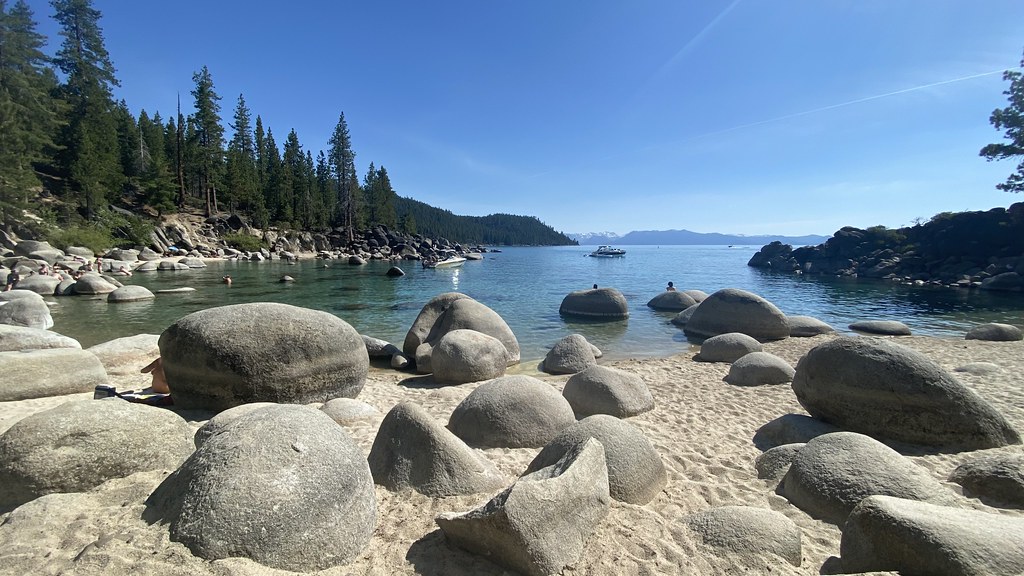
One of nine routes catalogued at East Face, this climb sits in the middle of the crag's range, which spans from 5.6 to 5.11b.
 Photo: Famartin, CC BY-SA 4.0 (via Wikimedia Commons)
Dinosaur Rock
~12 min drive
Dinosaur Rock in Nevada has 18 climbing routes across 10 grades, offering mixed, sport, and trad styles.
 Photo: Nouhailler, CC BY-SA 2.0 (via Flickr)
Prison Hill
~18 min drive
Prison Hill in Nevada has 14 climbing routes across 12 grades, offering bouldering, sport, and trad.
 Photo: jfdervin, CC BY-SA 2.0 (via Flickr)
Washoe Boulders
~21 min drive
Washoe Boulders in Nevada has 14 routes across 9 grades with bouldering pads and alpine no fixed protection.
Photo: jfdervin, CC BY-SA 2.0 (via Flickr)Right Twin
~21 min drive
Right Twin in Nevada has 8 bouldering routes across 4 grades.
Photo: jfdervin, CC BY-SA 2.0 (via Flickr)Key Hole Boulders
~22 min drive
Key Hole Boulders in Nevada has 5 bouldering routes across 5 grades.
 Photo: Rojer, CC BY 2.0 (via Flickr)
Eagle Rock
~22 min drive
Eagle Rock in California has 6 mixed climbing routes across 6 grades.
 Photo: Scott Thompson, CC BY 3.0 (via Wikimedia Commons)
Middle Bliss
~24 min drive
Middle Bliss is a 13-route climbing area in California with bouldering pads.
Photo: Scott Thompson, CC BY 3.0 (via Wikimedia Commons)Lumberjack
~24 min drive
Lumberjack, California: 5 bouldering routes across 5 grades.
Photo: Scott Thompson, CC BY 3.0 (via Wikimedia Commons)Bliss
~24 min drive
Bliss has 5 routes in California.
 Photo: radicalespresso, Public Domain Mark (via Flickr)
Mayhem Cove
~28 min drive
Mayhem Cove in California features 32 sport climbing routes across 16 difficulty grades.
Outfitters and businesses near Carson City. They haven’t set up their Roamze page yet.
Alpenglow Expeditions
Rock Climbing business nearby (~17 mi away) — hasn't claimed their Roamze page yet
