South Fork Madison River
- 18.3 mi
- distance
- 6,975 ft
- high point
- Jun–Aug
- best months
Is South Fork Madison River open right now?
Closure in the area
There's a closure order in Custer Gallatin National Forest. It doesn't name South Fork Madison River, so check the source for the area it covers (16 listed).
NFSR #1700 South Plateau Road Closure
Agency closure covering Custer Gallatin National Forest · USFS · Custer Gallatin National Forest
Lonesomewood Prescribed Fire Area, Road, and Trail Closure
Agency closure covering Hebgen Lake Ranger District · Order 01-11-07-26-03 · USFS · Hebgen Lake Ranger District
South Plateau Road #1700 Opening Delayed
Agency closure covering Hebgen Lake Ranger District · USFS · Hebgen Lake Ranger District
Hyalite Porcupine Buffalo Horn Summer Interim Travel Order and Map and Order # 01-11-00-26-02
Agency closure covering Custer Gallatin National Forest · Order 01-11-00-26-02 · USFS · Custer Gallatin National Forest
Hyalite Porcupine Buffalo Horn Winter Interim Travel Order and Map Order Number: #01-11-00-26-01
Agency closure covering Custer Gallatin National Forest · USFS · Custer Gallatin National Forest
As of · Source: USFS · Custer Gallatin National Forest. Agencies don't list every closure — check before you go.
The South Fork Madison River is a canoeing route in Montana's Custer Gallatin National Forest, within the Hebgen Lake Ranger District. The Forest Service manages the land, and the trip is about 18 miles long. Summer is the most comfortable time to paddle. Typical averages from a nearby weather station show July highs around 80°F with lows near 39°F, and June and September both averaging highs in the upper 60s. Winters there are severe, with January highs typically around 27°F. Nearby, the Mosquito Cutoff (Snowmo) trail and the Doug's Doodle cross-country ski area are both about 2 miles away. Hebgen Lake District, a lake fishing spot, is about 4 miles off, and Basin Station Cabin offers camping about 5 miles away.
Local outfitters
- Flying Pig Adventures35 mi away
Not on Roamze yet. Their page has how to reach them.
- MOSQUITO CUTOFF (SNOWMO)Hiking2 mi
- Doug's DoodleCross-country skiing2.1 mi
- Windy RidgeCross-country skiing2.1 mi
- Hebgen Lake DistrictLake fishing4.1 mi
- Basin Station CabinCamping5 mi
- Bakers Hole CampgroundCamping5.4 mi
- Lonesomehurst CampgroundCamping6.4 mi
- Duck CreekCanoeing9.4 mi
Source: Roamze catalog (indexable pages within 10 miles, PostGIS distance)
 Madison RiverCanoeing · ~29 min drivePhoto: Jim Peaco, National Park Service, Public domain (via Wikimedia Commons)
- Rainbow Point Boat LaunchBoat launch · ~15 min drive
- Big Springs Grp. Area - Island ParkTubing · ~19 min drive
 Little Firehole RiverCanoeing · ~30 min drivePhoto: Yellowstone National Park, Public domain (via Wikimedia Commons)
- Big Springs Boat RampBoat launch · ~20 min drive
- Flat RockTubing · ~23 min drive
 Firehole RiverCanoeing · ~40 min drivePhoto: Wing-Chi Poon, CC BY-SA 2.5 (via Wikimedia Commons)
- Henry's Lake - Boat AccessBoat launch · ~20 min drive
- Upper Coffee PotTubing · ~25 min drive
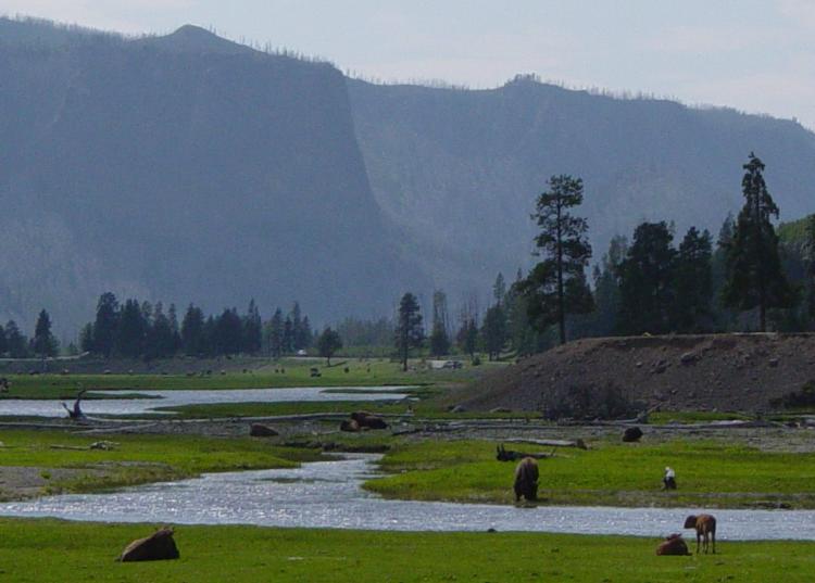 Gibbon RiverCanoeing · ~43 min drivePhoto: Daniel Mayer, CC BY-SA 3.0 (via Wikimedia Commons)
Best time to visit South Fork Madison River
Best months: June–August. Best months have typical highs of 55–85 °F, lows of 30 °F or warmer (32 °F where the station doesn't record snow), at most one snowy day and no more than 12 wet days.
Jan
27° / 0°
Feb
31° / 1°
Mar
40° / 9°
Apr
48° / 21°
May
59° / 29°
Jun
68° / 34°
Jul
80° / 39°
Aug
78° / 36°
Sep
68° / 30°
Oct
51° / 21°
Nov
36° / 11°
Dec
26° / 3°
Typical high / low (°F) and days with rain or snow, 1991–2020. Measured at W Yellowstone Gateway, MT, 4.4 mi away at 6,679 ft. This station doesn't record snowfall. Source: NOAA NCEI U.S. Climate Normals 1991–2020.
