North Fork Milk River
- 15.6 mi
- distance
- 4,504 ft
- high point
- May–Sep
- best months
Caution today
Weather is marginal · OpenWeather · checked just now
North Fork Milk River is a canoeing route in Montana, managed by the Bureau of Indian Affairs and located about 13 miles from the town of Wetzel. The river is a paddling destination rather than a trail, so there is no climb or distance to plan around, and the route is measured in miles of water rather than steps on foot. Summer is the most comfortable time to paddle. Typical averages from a nearby weather station at Del Bonita show July and August highs around 76°F with lows in the upper 40s, while winter highs stay near freezing. The Middle Fork Milk River, another canoeing route, lies about 7 miles away. For time on land, the Canal Trail is about 3 miles from the North Fork.
Local outfitters
- Glacier Park Boat Company41 mi away
Not on Roamze yet. Their page has how to reach them.
Source: Roamze catalog (indexable pages within 10 miles, PostGIS distance)
 Saint Mary RiverCanoeing · ~55 min drivePhoto: Royalbroil, CC BY-SA 3.0 (via Wikimedia Commons)
- Rising SunBoat launch · ~44 min drive
 Two Medicine RiverCanoeing · ~58 min drivePhoto: Steve Wilson, CC BY-SA 2.0 (via Wikimedia Commons)
- Golden Stairs Boat RampBoat launch · ~44 min drive
 Cut Bank CreekCanoeing · ~39 min drivePhoto: Royalbroil, CC BY-SA 3.0 (via Wikimedia Commons)
- Swiftcurrent Boat RampBoat launch · ~46 min drive
- Middle Fork Milk RiverCanoeing · ~12 min drive
- Two Medicine Boat RampBoat launch · ~58 min drive
- Milk RiverCanoeing · ~19 min drive
- Lake McDonald LodgeBoat launch · ~1h 11m drive
Also worth it near here
- Horse LakeLake fishing · ~26 min drive
 Beaver Pond TrailHiking · ~35 min drivePhoto: GlacierNPS, Public Domain Mark (via Flickr)
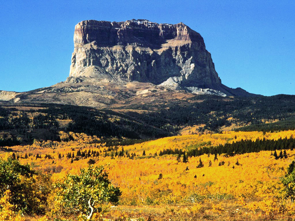 Chief MountainSummit · ~39 min drivePhoto: Public domain (via Wikimedia Commons)
 Rising Sun CampgroundCamping · ~43 min drivePhoto: GlacierNPS, CC BY 2.0 (via Wikimedia Commons)
Best time to visit North Fork Milk River
Best months: May–September. Best months have typical highs of 55–85 °F, lows of 30 °F or warmer (32 °F where the station doesn't record snow), at most one snowy day and no more than 12 wet days.
Jan
29° / 11°
4 wet
Feb
31° / 13°
4 wet
Mar
39° / 19°
5 wet
Apr
50° / 27°
6 wet
May
61° / 36°
7 wet
Jun
67° / 44°
8 wet
Jul
76° / 49°
7 wet
Aug
76° / 47°
6 wet
Sep
67° / 40°
5 wet
Oct
52° / 30°
4 wet
Nov
37° / 20°
5 wet
Dec
30° / 12°
5 wet
Typical high / low (°F) and days with rain or snow, 1991–2020. Measured at Del Bonita, MT, 15.3 mi away at 4,337 ft. This station doesn't record snowfall. Source: NOAA NCEI U.S. Climate Normals 1991–2020.
