Wanless Lake
- 0.2 mi
- distance
- 127 ft
- climb
Caution today
Agency alerts are in effect for this area; weather is good · USFS, OpenWeather · checked 10 h ago
Is Wanless Lake open right now?
Closure in the area
There's a closure order in Kootenai National Forest. It doesn't name Wanless Lake, so check the source for the area it covers.
Kootenai Flood Event & Inaccessible Areas
Agency closure covering Kootenai National Forest · USFS · Kootenai National Forest
Updated Skillet Fire Area, Road, Trail Closure
Agency alert covering Kootenai National Forest · Order 01-10- · USFS · Kootenai National Forest
As of · Source: USFS · Kootenai National Forest. Agencies don't list every closure — check before you go.
Wanless Lake is a short mountain biking route in the Cabinet Mountains Wilderness, part of the Cabinet Ranger District of Kootenai National Forest in northwest Montana. The Forest Service manages the land, and the ride sits within the wilderness, about 0.24 miles long with a total elevation gain of 127 feet. The climb starts at 5,092 feet and reaches 5,251 feet, with the steepest stretch at about 0.05 miles in, where the grade hits 11 percent. The route is a quick, low-elevation outing, and it pairs easily with other rides and trails in the area. Buck Lake is about 0.6 miles away, and Cabinet Divide South is about 1.1 miles off. Swamp Creek Trail, a hike, is about 0.7 miles away, and the Cabinet Divide South Trail is about 1.1 miles away.
Local outfitters
- CDA River RV48 mi away
Not on Roamze yet. Their page has how to reach them.
Keep exploring — more rides worth the drive
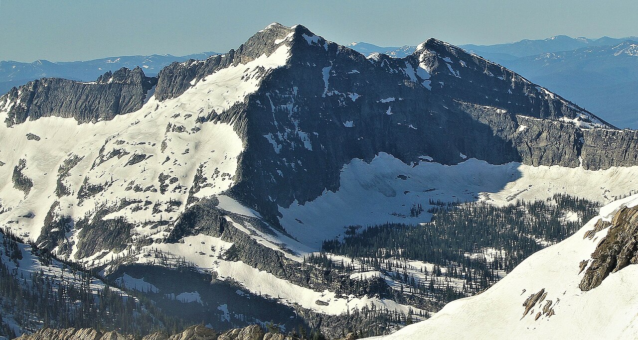
 Photo: Matt Lavin, CC BY-SA 2.0 (via Wikimedia Commons)
Grambauer Ridge
~48 min drive
0.92-mile trail at Grambauer Mountain with 858 ft gain
RIDE
Buck Lake
Next door
0.31-mile trail at Carney Peak with 194 ft elevation gain
RIDE
Cabinet Divide South
~2 min drive
0.91-mile trail at Carney Peak with 1,261 ft elevation gain
RIDE
Upper Geiger Lake
~3 min drive
0.28-mile trail at Carney Peak with 144 ft elevation gain
RIDE
Lake Creek
~3 min drive
Lake Creek is a 2.14-mile trail in Montana's Carney Peak system.
RIDE
Fourth of July
~5 min drive
2.73-mile trail at Carney Peak with 1,832 ft elevation gain
RIDE
Bramlet Creek
~6 min drive
Bramlet Creek is a 0.38-mile point-to-point trail at Carney Peak with 472 ft of elevation gain.
RIDE
Mill/ozette
~6 min drive
0.08-mile loop at Carney Peak with 28 ft elevation gain
RIDE
Great Northern Mountain
~10 min drive
2.11-mile trail at Carney Peak with 993 ft elevation gain
RIDE
Howard Lake
~11 min drive
Howard Lake is a 1.31-mile trail in Montana's Carney Peak system with 652 ft of elevation gain.
Map and trail data © OpenStreetMap contributors
