Three Larches
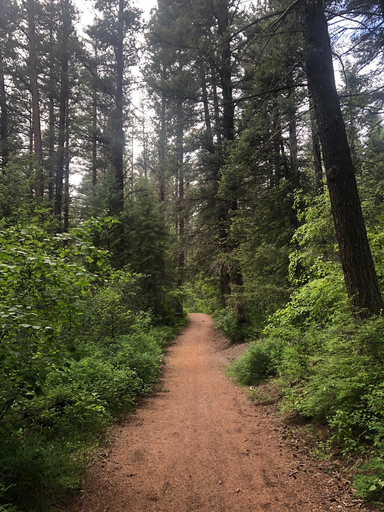 Photo: Forest Service - Northern Region, Public Domain Mark (via Flickr)
- 4.4 mi
- round trip
- 508 ft
- climb
- 4,955 ft
- high point
- Out and back
- route
- Jul–Oct
- best months
Is Three Larches open right now?
Alert in the area
The Forest Service lists an alert for Lolo National Forest.
East Fork Big Creek Road & Trail Closure- Superior Ranger District
Agency alert covering Lolo National Forest · Order 26-003- · USFS · Lolo National Forest
As of · Source: USFS · Lolo National Forest. Agencies don't list every closure — check before you go.
Three Larches is a moderate hike in Montana's Lolo National Forest, within the Missoula Ranger District. It is a 4.4-mile out-and-back route that climbs from about 4,421 feet to a high point of 4,955 feet, a gain of about 508 feet. The trail is managed by the Forest Service, and the parking area at the Woods Gulch Trailhead sits at the start. The trail is a natural surface route, and bikes are allowed. That makes it a practical option for hikers and mountain bikers alike. The woods around it hold several other routes close by, including the Three Larches Cutoff and the Marshall Grade, which sits about 0.1 mile away. The most comfortable time for a visit is summer. Typical averages from a nearby weather station show July highs around 85°F and lows near 52°F, with fewer wet days than the rest of the year. That station sits roughly 1,500 feet below the trail, so temperatures on the route run cooler. The Pattee Canyon Picnic Area, about 8 miles away, is the closest campground.
Local outfitters
- Granite Peak RV Resort10 mi away
Not on Roamze yet. Their page has how to reach them.
Best time to go · Jul–Oct
Best time to visit Three Larches
Best months: July–October. Best months have typical highs of 55–85 °F, lows of 30 °F or warmer (32 °F where the station doesn't record snow), at most one snowy day and no more than 12 wet days.
Jan
34° / 20°
14 wet · 10 snow
Feb
39° / 22°
11 wet · 8 snow
Mar
49° / 27°
13 wet · 6 snow
Apr
57° / 33°
12 wet · 2 snow
May
67° / 41°
13 wet
Jun
73° / 47°
13 wet
Jul
85° / 52°
7 wet
Aug
84° / 51°
7 wet
Sep
73° / 44°
8 wet
Oct
56° / 34°
10 wet · 1 snow
Nov
41° / 26°
12 wet · 6 snow
Dec
33° / 20°
14 wet · 10 snow
Typical high / low (°F) and days with rain or snow, 1991–2020. Measured at Missoula 2 Ne, MT, 2.3 mi away at 3,420 ft. The station sits about 1,500 ft lower than this place, so expect it a little cooler here. Source: NOAA NCEI U.S. Climate Normals 1991–2020.
Keep exploring — more trails worth the drive
Photo: Forest Service - Northern Region, Public Domain Mark (via Flickr)Sheep Mountain
~2 min drive
28.25-mile out-and-back trail in Montana with 3,314 ft elevation gain.
Photo: Forest Service - Northern Region, Public Domain Mark (via Flickr)Missoula Rattlesnake
~3 min drive
1.30-mile out-and-back trail in Montana with 57 ft of elevation gain.
 Photo: Forest Service - Northern Region, Public Domain Mark (via Flickr)
Spring Gulch
~3 min drive
3.64-mile out-and-back trail in Montana with 450 ft elevation gain.
 Photo: Forest Service - Northern Region, Public Domain Mark (via Flickr)
Rattlesnake Creek
~3 min drive
28.25-mile out-and-back trail in Montana with 1,641 ft of elevation gain.
Photo: Forest Service - Northern Region, Public Domain Mark (via Flickr)Sawmill Gulch Wooten Ranch
~3 min drive
2.68-mile out-and-back trail in Montana with 324 ft gain.
 Photo: Forest Service - Northern Region, Public Domain Mark (via Flickr)
SAWMILL GULCH CUTOFF D
~6 min drive
2.36-mile out-and-back trail in Montana with 1,250 ft gain/loss and max elevation 4,810 ft.
Photo: Forest Service - Northern Region, Public Domain Mark (via Flickr)Stuart Peak
~3 min drive
26.06-mile out-and-back trail to Stuart Peak in Montana with 7,461 ft of elevation gain.
Photo: Forest Service - Northern Region, Public Domain Mark (via Flickr)RATTLESNAKE CREEK CUTOFF A
~3 min drive
1.94-mile out-and-back trail in Montana with 379 ft gain/loss.
 Photo: Charles Nadeau from San Mateo, CA, CC BY 2.0 (via Wikimedia Commons)
US West trail
~7 min drive
2.98-mile out-and-back trail in Montana with 2,350 ft elevation gain.
HIKE
Sawmill Gulch (Rattlesnake)
~5 min drive
8.76-mile out-and-back trail in Montana with 1,466 ft elevation gain.

