Overlook Trail
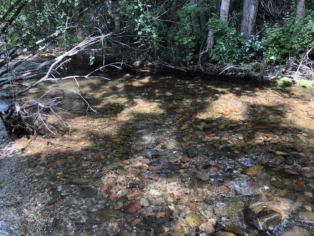 Photo: supercraigtalbert, CC BY 2.0 (via Flickr)
- 0.4 mi
- round trip
- 158 ft
- climb
- 3,737 ft
- high point
- Out and back
- route
- Jul–Oct
- best months
Overlook Trail is a short, easy hike in western Montana, about a mile from Westview Park. The trail is an out-and-back, roughly 0.7 miles long with about 158 feet of total elevation gain, so you can expect to walk a little over a mile and come back to your starting point. The climb is front-loaded, with the steepest stretch at the start, where the grade reaches about 8 percent. Summer is the most comfortable time to go. Typical averages from a nearby weather station in Missoula show July highs around 85°F and lows near 52°F, with fewer wet days than the rest of the year. Winters there are cold and snowy, with January highs around 34°F. The trail sits close to several other short routes. Red Tail Trail is about 0.1 mile away, and Hoot Owl Loop and Bluebird Trail are each about 0.3 mile off. For a longer outing, Pattee Canyon Picnic Area is about 6 miles away.
Local outfitters
- Granite Peak RV Resort6 mi away
Not on Roamze yet. Their page has how to reach them.
- Red Tail TrailHikingPhoto: supercraigtalbert, CC BY 2.0 (via Flickr)0.1 mi
 Hoot Owl LoopHikingPhoto: supercraigtalbert, CC BY 2.0 (via Flickr)0.3 mi
- Bluebird TrailHikingPhoto: supercraigtalbert, CC BY 2.0 (via Flickr)0.3 mi
- Hoot Owl CutoffHikingPhoto: supercraigtalbert, CC BY 2.0 (via Flickr)0.4 mi
- Turkey TrailHiking2.2 mi
- Mountain ViewHiking2.3 mi
- Sunlight LoopHiking2.4 mi
 Pattee Canyon Picnic AreaCampingPhoto: Recreation.gov (RIDB) / public domain6.2 mi
Source: Roamze catalog (indexable pages within 10 miles, PostGIS distance)
- Red Tail TrailHiking · Next doorPhoto: supercraigtalbert, CC BY 2.0 (via Flickr)
 SAWMILL GULCH CUTOFF DHiking · ~4 min drivePhoto: Forest Service - Northern Region, Public Domain Mark (via Flickr)
 Stuart PeakHiking · ~6 min drivePhoto: Forest Service - Northern Region, Public Domain Mark (via Flickr)
- Bluebird TrailHiking · Next doorPhoto: supercraigtalbert, CC BY 2.0 (via Flickr)
- Spring GulchHiking · ~6 min drivePhoto: Forest Service - Northern Region, Public Domain Mark (via Flickr)
 Rattlesnake CreekHiking · ~5 min drivePhoto: Forest Service - Northern Region, Public Domain Mark (via Flickr)
- Hoot Owl LoopHiking · Next doorPhoto: supercraigtalbert, CC BY 2.0 (via Flickr)
 US West trailHiking · ~7 min drivePhoto: Charles Nadeau from San Mateo, CA, CC BY 2.0 (via Wikimedia Commons)
 Sheep MountainHiking · ~6 min drivePhoto: Forest Service - Northern Region, Public Domain Mark (via Flickr)
- Hoot Owl CutoffHiking · Next doorPhoto: supercraigtalbert, CC BY 2.0 (via Flickr)
Best time to visit Overlook Trail
Best months: July–October. Best months have typical highs of 55–85 °F, lows of 30 °F or warmer (32 °F where the station doesn't record snow), at most one snowy day and no more than 12 wet days.
Jan
34° / 20°
14 wet · 10 snow
Feb
39° / 22°
11 wet · 8 snow
Mar
49° / 27°
13 wet · 6 snow
Apr
57° / 33°
12 wet · 2 snow
May
67° / 41°
13 wet
Jun
73° / 47°
13 wet
Jul
85° / 52°
7 wet
Aug
84° / 51°
7 wet
Sep
73° / 44°
8 wet
Oct
56° / 34°
10 wet · 1 snow
Nov
41° / 26°
12 wet · 6 snow
Dec
33° / 20°
14 wet · 10 snow
Typical high / low (°F) and days with rain or snow, 1991–2020. Measured at Missoula 2 Ne, MT, 3 mi away at 3,420 ft. Source: NOAA NCEI U.S. Climate Normals 1991–2020.

Map and trail data © OpenStreetMap contributors
