Mount Tom
- 8.4 mi
- round trip
- 1,814 ft
- climb
- 5,829 ft
- high point
- Out and back
- route
Is Mount Tom open right now?
Closure in the area
There's a closure order in Kootenai National Forest. It doesn't name Mount Tom, so check the source for the area it covers.
Kootenai Flood Event & Inaccessible Areas
Agency closure covering Kootenai National Forest · USFS · Kootenai National Forest
Updated Skillet Fire Area, Road, Trail Closure
Agency alert covering Kootenai National Forest · Order 01-10- · USFS · Kootenai National Forest
Trail Advisory-Alexander Mountain Trail near Timber Harvest Activities
Agency alert covering Libby Ranger District · USFS · Libby Ranger District
Timberlane Campground Closure
Agency alert covering Libby Ranger District · Order 01-14-05-26-03 · USFS · Libby Ranger District
As of · Source: USFS · Kootenai National Forest. Agencies don't list every closure — check before you go.
Mount Tom is a hard hike in the Libby Ranger District of Montana's Kootenai National Forest, about 8.4 miles long with a one-way elevation gain of 1,814 feet. The trail is an out-and-back that starts at the Mount Tom TH 406 parking area and climbs from a low point of 3,215 feet to a high point of 5,829 feet. The route is on natural surface and is open from June 1 through November 30. Bikes are allowed, so it works for both hikers and riders. Several other destinations sit close by. Tom Poole Lake is 0.8 miles away, and Loon Lake Campground is 2.2 miles away. Turner Mountain is 1.2 miles away, and Pipe Creek, a canoeing spot, is 4.8 miles away.
Local outfitters
- Kootenai River Campground15 mi away
- Indian Springs Montana35 mi away
Not on Roamze yet. Their page has how to reach them.
Keep exploring — more trails worth the drive
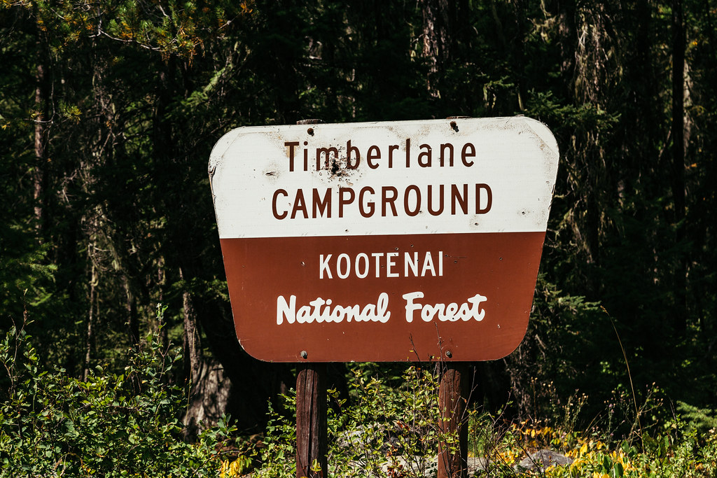 Photo: Tony Webster — CC BY 2.0 (via Flickr)
Timberlane
~14 min drive
0.79-mile loop trail in Montana with 18 ft of elevation gain.
 Photo: waterarchives, CC BY-SA 2.0 (via Flickr)
Kootenai Creek
~18 min drive
3.85-mile loop trail in Montana with 1,900 ft elevation gain.
HIKE
Upper Pipe
~2 min drive
6.75-mile out-and-back trail in Montana with 1,345 ft of elevation gain.
HIKE
GARDEN RIDGE SNOMOBILE SPUR
~12 min drive
38.8-mile out-and-back snomobile spur in Montana with 4,043 ft gain/loss
HIKE
Pulpit Mountain Spur
~15 min drive
0.7-mile out-and-back trail in Montana with 348 ft of elevation gain.
HIKE
Tom Poole Lake
~1 min drive
0.95-mile out-and-back trail to Tom Poole Lake in Montana with 336 ft of elevation gain.
HIKE
Bobtail
~3 min drive
5.20-mile out-and-back trail in Montana with 1,188 ft elevation gain.
HIKE
Turner Mountain
~2 min drive
11.60-mile out-and-back trail in Montana with 3,454 ft elevation gain.
HIKE
Pipe Divide
~13 min drive
9.33-mile out-and-back trail in Montana with 2,465 ft elevation gain.
HIKE
Rainbow Lake
~7 min drive
0.48-mile out-and-back trail to Rainbow Lake in Montana
Route details
- Distance
- 8.4 mi round trip
- Climbing
- About 1,814 ft
- Starts at
- MOUNT TOM TH 406 (about 3,677 ft)
- Summit
- 5,833 ft
- Difficulty
- Hard
- Time
- About 3.5 hours
Getting there
Park at MOUNT TOM TH 406.
Other routes up Mount Tom
Questions about this route
How long is the Mount Tom on Mount Tom?
About 8.4 mi round trip from MOUNT TOM TH 406 (about 3,677 ft).
How much elevation gain is on the Mount Tom?
About 1,814 ft of climbing round trip.
How hard is the Mount Tom?
It is rated hard.
Where does the Mount Tom start?
MOUNT TOM TH 406 (about 3,677 ft).
How long does the Mount Tom take?
About 3.5 hours round trip.
How many routes go up Mount Tom?
2: Mount Tom and Bobtail.
Conditions and forecast on Mount Tom
Daily highs and lows, wind and the chance of precipitation at the summit and route start for the next 7 days, from the Open-Meteo model.
