Lambrecht Creek
- 3.2 mi
- round trip
- 1,612 ft
- climb
- 7,329 ft
- high point
- Out and back
- route
- Jun–Aug
- best months
Caution today
Agency alerts are in effect for this area; weather is marginal · USFS, OpenWeather · checked just now
Is LAMBRECHT CREEK open right now?
Closure in the area
There's a closure order in Beaverhead-Deerlodge National Forest. It doesn't name LAMBRECHT CREEK, so check the source for the area it covers (2 listed).
Annual Food Storage Order
Agency closure covering Beaverhead-Deerlodge National Forest · Order 02-00-22-02 · USFS · Beaverhead-Deerlodge National Forest
Pallet Prohibition Order Butte Ranger District
Agency closure covering Beaverhead-Deerlodge National Forest · Order 01020425-01 · USFS · Beaverhead-Deerlodge National Forest
Lost Creek Area - Road Closure
Agency alert covering Beaverhead-Deerlodge National Forest · USFS · Beaverhead-Deerlodge National Forest
Montana BDR Alternative Route
Agency alert covering Beaverhead-Deerlodge National Forest · USFS · Beaverhead-Deerlodge National Forest
Lost Creek Area - Road Closure
Agency alert covering Beaverhead-Deerlodge National Forest · Order 01020826-02 · USFS · Beaverhead-Deerlodge National Forest
As of · Source: USFS · Beaverhead-Deerlodge National Forest. Agencies don't list every closure — check before you go.
Lambrecht Creek is a moderate out-and-back hike in Montana's Beaverhead-Deerlodge National Forest, within the Wisdom Ranger District and the West Pioneer Roadless Area. The trail is about 6.5 miles long, with a total elevation gain of 1,612 feet, and it starts at roughly 7,265 feet, rising to a high point of 7,329 feet before returning to the same level. Summer is the most comfortable time to go. Typical averages from the nearby Wisdom weather station, which sits about 1,270 feet lower, show July highs around 78°F with lows near 38°F, while winter highs stay in the mid-20s. The trip takes about three hours. Bobcat Lakes lies about half a mile away, and Bobcat Creek is about 1.6 miles off. For an overnight stay, Willow Campground is about 3.8 miles away and Lodgepole Campground about 4 miles.
Local outfitters
- Copper Court RV Park37 mi away
Not on Roamze yet. Their page has how to reach them.
- BOBCAT LAKESHiking0.6 mi
- Pioneer LoopHiking1.5 mi
- BOBCAT CREEKHiking1.6 mi
- Willow CampgroundCamping3.8 mi
- Lodgepole CampgroundCamping4 mi
- Boulder Creek CampgroundCamping4.8 mi
- Wise River Ranger DistrictRiver fishing9 mi
- Wise RiverCanoeing9 mi
Source: Roamze catalog (indexable pages within 10 miles, PostGIS distance)
 Brownes LakeHiking · ~12 min drivePhoto: TexasExplorer98, CC BY 2.0 (via Flickr)
 CLIFFORD CREEKHiking · ~13 min drivePhoto: TexasExplorer98, CC BY 2.0 (via Flickr)
- SHEEP CREEKHiking · ~13 min drivePhoto: TexasExplorer98, CC BY 2.0 (via Flickr)
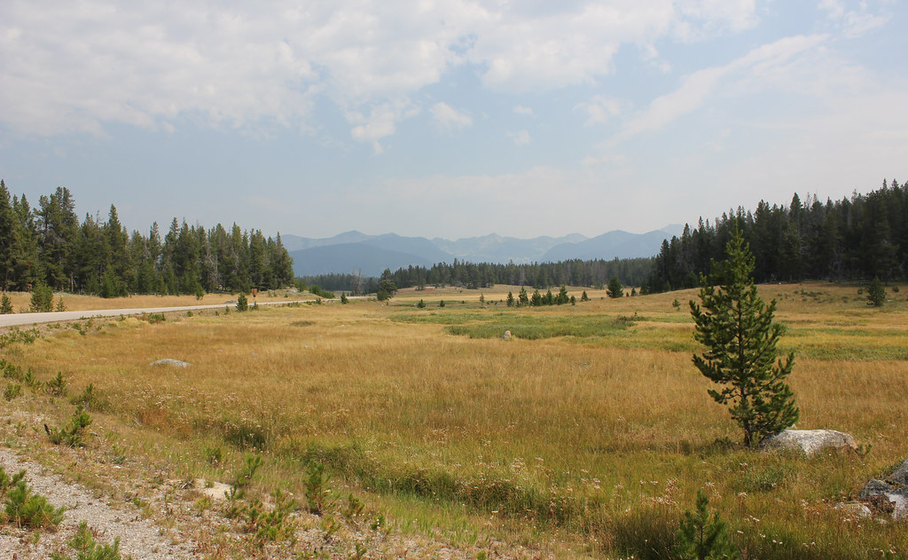 HARRISON PARK TRAILHiking · ~16 min drivePhoto: TexasExplorer98, CC BY 2.0 (via Flickr)
- BOBCAT LAKESHiking · ~1 min drive
- Pioneer LoopHiking · ~3 min drive
- COPPER CREEKHiking · ~7 min drive
 LION CREEKHiking · ~16 min drivePhoto: GSEC, CC BY 2.0 (via Flickr)
- WYMAN - OLD TIM CREEKHiking · ~9 min drive
- BOULDER CREEKHiking · ~8 min drive
Best time to visit LAMBRECHT CREEK
Best months: June–August. Best months have typical highs of 55–85 °F, lows of 30 °F or warmer (32 °F where the station doesn't record snow), at most one snowy day and no more than 12 wet days.
Jan
26° / 3°
8 wet
Feb
29° / 3°
8 wet
Mar
39° / 12°
8 wet
Apr
49° / 21°
9 wet
May
59° / 28°
12 wet
Jun
67° / 35°
11 wet
Jul
78° / 38°
8 wet
Aug
77° / 34°
7 wet
Sep
68° / 28°
7 wet
Oct
53° / 21°
8 wet
Nov
36° / 10°
9 wet
Dec
25° / 3°
9 wet
Typical high / low (°F) and days with rain or snow, 1991–2020. Measured at Wisdom, MT, 14.3 mi away at 6,060 ft. The station sits about 1,300 ft lower than this place, so expect it a little cooler here. This station doesn't record snowfall. Source: NOAA NCEI U.S. Climate Normals 1991–2020.
