Hole in the Wall Campground Trail
 Photo: lamblukas from San Francisco, United States, CC BY 2.0 (via Wikimedia Commons)
- 0.6 mi
- round trip
- 472 ft
- climb
- 6,636 ft
- high point
- Out and back
- route
Is Hole in the Wall Campground Trail open right now?
Closure in the area
There's a closure order in Glacier National Park. It doesn't name Hole in the Wall Campground Trail, so check the source for the area it covers.
Going-to-the-Sun Road Seasonal Closure
Park closure covering Glacier National Park · NPS · Glacier National Park
As of · Source: NPS · Glacier National Park. Agencies don't list every closure — check before you go.
Hole in the Wall Campground Trail is a short, easy hike in Glacier National Park in Montana, managed by the National Park Service. The route is about 1.3 miles long and is an out-and-back, with the high point at 6,636 feet and the low point at 6,325 feet. The trail starts at the high point, so the climb is a rolling descent to the low point and back up again, with a total gain of 472 feet for the round trip. The steepest stretch comes early, at about 0.1 mile from the start, with a grade of 21 percent. The hike takes about half an hour, so it works well as a quick stop before or after another outing in the park. Bowman Lake Trail lies about 1.3 miles away, and North Boundary Trail and Rainbow Falls Trail are each about 7.2 miles off. Bowman Creek, a canoeing spot, is roughly 8.2 miles away.
Local outfitters
- North American RV Park & Yurt Village36 mi away
- Indian Springs Montana45 mi away
Not on Roamze yet. Their page has how to reach them.
 Bowman Lake TrailHikingPhoto: lamblukas, CC BY 2.0 (via Flickr)1.3 mi
 North Boundary TrailHikingPhoto: Greg Willis from Denver, CO, usa, CC BY-SA 2.0 (via Wikimedia Commons)7.2 mi
- Rainbow Falls TrailHikingPhoto: Greg Willis from Denver, CO, usa, CC BY-SA 2.0 (via Wikimedia Commons)7.2 mi
- Goat Haunt Overlook TrailHikingPhoto: Greg Willis from Denver, CO, usa, CC BY-SA 2.0 (via Wikimedia Commons)7.6 mi
 Porcupine Lookout TrailHikingPhoto: -ted, CC BY 2.0 (via Wikimedia Commons)7.9 mi
- Bowman CreekCanoeing8.2 mi
- Stoney Indian Pass TrailHiking8.3 mi
- Kootenai Cabin TrailHiking8.5 mi
Source: Roamze catalog (indexable pages within 10 miles, PostGIS distance)
- Bowman Lake TrailHiking · ~2 min drivePhoto: lamblukas, CC BY 2.0 (via Flickr)
- North Boundary TrailHiking · ~12 min drivePhoto: Greg Willis from Denver, CO, usa, CC BY-SA 2.0 (via Wikimedia Commons)
- Porcupine Lookout TrailHiking · ~13 min drivePhoto: -ted, CC BY 2.0 (via Wikimedia Commons)
 Crypt Lake TrailHiking · ~18 min drivePhoto: daveynin, CC BY 2.0 (via Wikimedia Commons)
- Numa Lookout TrailheadHiking · ~19 min drive
- Rainbow Falls TrailHiking · ~12 min drivePhoto: Greg Willis from Denver, CO, usa, CC BY-SA 2.0 (via Wikimedia Commons)
- Goat Haunt Overlook TrailHiking · ~13 min drivePhoto: Greg Willis from Denver, CO, usa, CC BY-SA 2.0 (via Wikimedia Commons)
 Numa Ridge Lookout TrailHiking · ~18 min drivePhoto: Mobilus In Mobili, CC BY-SA 2.0 (via Flickr)
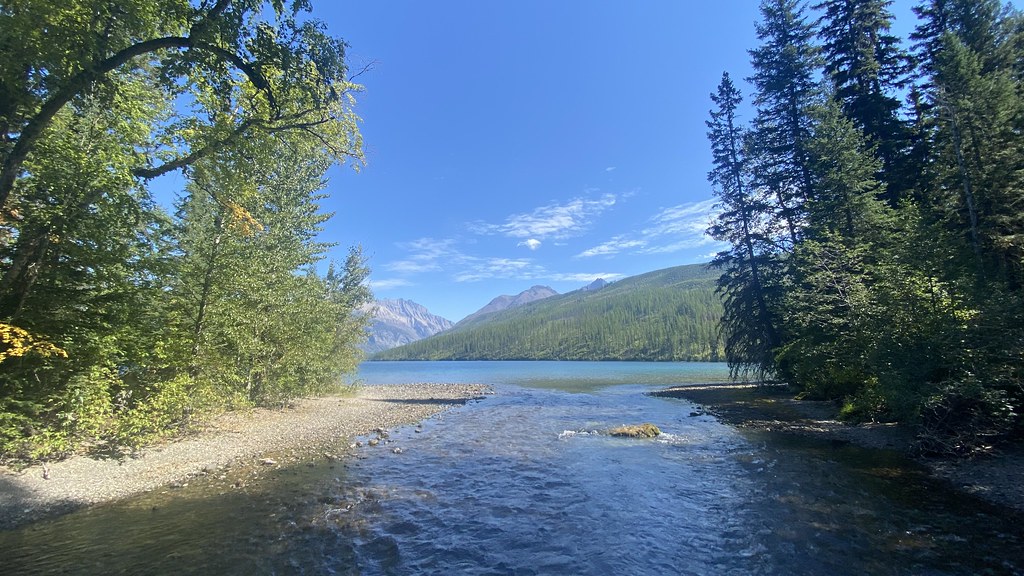 Boulder Pass TrailHiking · ~23 min drivePhoto: lamblukas, CC BY 2.0 (via Flickr)
- Rainbow Falls TrailheadHiking · ~13 min drive
Also worth it near here
 Chapman PeakSummit · ~3 min drivePhoto: Traveler100, CC BY-SA 3.0 (via Wikimedia Commons)
- Carcajou LakeLake fishing · ~5 min drive
 Alderson LakeCamping · ~11 min drivePhoto: aoiaio, CC BY 3.0 (via Wikimedia Commons)
 Lower Bertha FallsWaterfall · ~13 min drivePhoto: R. Sieben, CC BY 3.0 (via Wikimedia Commons)
Map and trail data © OpenStreetMap contributors
