Hemlock Point
- 12.0 mi
- round trip
- 1,761 ft
- climb
- 7,732 ft
- high point
- Out and back
- route
Is Hemlock Point open right now?
Alert in the area
The Forest Service lists 5 alerts for Flathead National Forest.
Camp Creek Fire Updated Trail Closure
Agency alert covering Flathead National Forest · Order 01-10- · USFS · Flathead National Forest
FK&L Area Closed to Public Access Starting July 22, 2026
Agency alert covering Flathead National Forest · Order 01-10- · USFS · Flathead National Forest
Trail 800 Tally-Ashely Closure
Agency alert covering Flathead National Forest · Order 01-10- · USFS · Flathead National Forest
Ryan Creek Occupancy and Use Order
Agency alert covering Flathead National Forest · Order 1-10- · USFS · Flathead National Forest
Logan Creek Hoke Creek Closure
Agency alert covering Flathead National Forest · Order 01-10- · USFS · Flathead National Forest
As of · Source: USFS · Flathead National Forest. Agencies don't list every closure — check before you go.
Hemlock Point is a 12-mile out-and-back hike in the Swan Lake Ranger District of Flathead National Forest in northwest Montana. The trail gains about 1,761 feet from its low point of 4,543 feet to the high point of 7,732 feet, and it is rated hard. The Forest Service manages the land, and the trail is open year-round with a parking area labeled "561- 9576-3 HEMLOCK PEAK TH #515" at the trailhead. Horses are allowed on this natural-surface trail, which is not accessible. The climb is a long one, with the high point near Hemlock Point reached in the middle of the route. Plan on a full day, and expect the pace to be demanding from start to finish. Several other outings sit close by. Hemlock Feeder and Hemlock Lake are both within about a mile and a half. Glacier Creek, a paddling route, is about 2 miles away, and Lindbergh Lake Campground offers a place to stay roughly 5 miles off.
Local outfitters
- Granite Peak RV Resort37 mi away
Not on Roamze yet. Their page has how to reach them.
- Hemlock FeederHiking1.3 mi
- Hemlock LakeHiking1.4 mi
- Glacier CreekCanoeing2.2 mi
- Glacier SloughHiking4.2 mi
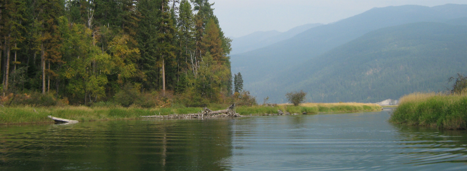 Swan RiverCanoeingPhoto: USFWS, Public domain (via Wikimedia Commons)4.6 mi
- Lindbergh Lake CampgroundCamping4.9 mi
- Pine RidgeCamping6.1 mi
- Barber Creek Gravel Pit - Road 10563Camping6.4 mi
Source: Roamze catalog (indexable pages within 10 miles, PostGIS distance)
 E. Holland Lake Connect.Hiking · ~16 min drivePhoto: lumachrome, CC BY-SA 2.0 (via Flickr)
- East FoothillHiking · ~18 min drivePhoto: lumachrome, CC BY-SA 2.0 (via Flickr)
- Holland Lake Nature TrailHiking · ~15 min drive
- Moon LakeHiking · ~15 min drive
- Hemlock LakeHiking · ~2 min drive
- Holland LookoutHiking · ~18 min drivePhoto: lumachrome, CC BY-SA 2.0 (via Flickr)
- Swartz Lake LoopHiking · ~17 min drive
- Kakashe MountainHiking · ~23 min drive
- Glacier SloughHiking · ~7 min drive
- Crystal LakeHiking · ~13 min drive
Route details
- Distance
- 12.0 mi round trip
- Climbing
- About 1,761 ft
- Starts at
- 561- 9576-3 HEMLOCK PEAK TH #515 (about 5,697 ft)
- Summit
- 7,777 ft
- Difficulty
- Hard
- Time
- About 5 hours
Getting there
Park at 561- 9576-3 HEMLOCK PEAK TH #515.
Season
Season: Year-round.
Questions about this route
How long is the Hemlock Point on Hemlock Point?
About 12.0 mi round trip from 561- 9576-3 HEMLOCK PEAK TH #515 (about 5,697 ft).
How much elevation gain is on the Hemlock Point?
About 1,761 ft of climbing round trip.
How hard is the Hemlock Point?
It is rated hard.
Where does the Hemlock Point start?
561- 9576-3 HEMLOCK PEAK TH #515 (about 5,697 ft).
How long does the Hemlock Point take?
About 5 hours round trip.
When is the best time for the Hemlock Point?
Year-round.
Conditions and forecast on Hemlock Point
Daily highs and lows, wind and the chance of precipitation at the summit and route start for the next 7 days, from the Open-Meteo model.
