Granite Park Trail
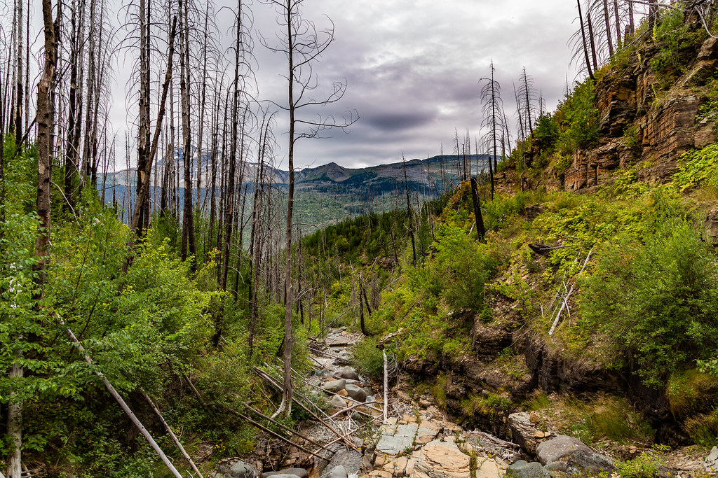 Photo: Tony Webster, CC BY 2.0 (via Flickr)
- 4.0 mi
- round trip
- 4,151 ft
- climb
- 6,676 ft
- high point
- Out and back
- route
Is Granite Park Trail open right now?
Closure in the area
There's a closure order in Glacier National Park. It doesn't name Granite Park Trail, so check the source for the area it covers.
Going-to-the-Sun Road Seasonal Closure
Park closure covering Glacier National Park · NPS · Glacier National Park
As of · Source: NPS · Glacier National Park. Agencies don't list every closure — check before you go.
Granite Park Trail is a hard out-and-back hike in Glacier National Park in Montana, managed by the National Park Service. The route is about 8 miles long, with a total elevation gain of 4,151 feet, and it reaches a high point of 6,676 feet. The climb is front-loaded, with the steepest stretch at about 2.3 miles in, where the grade reaches 41 percent. The trail starts at roughly 4,381 feet and ends at a similar elevation, so the total loss is the same as the total gain. The trip takes about 4.5 hours. Plan for a long day with a significant climb, and expect the most challenging part of the route to come early on. Packer's Roost Trail lies about half a mile away, and Flattop Mountain Trail is about a mile off. Garden Wall Trail and Swiftcurrent Lookout Trail are both within about 2 miles.
Local outfitters
- North American RV Park & Yurt Village25 mi away
- Rocky Mountain Outfitter45 mi away
Not on Roamze yet. Their page has how to reach them.
 Packer's Roost TrailHikingPhoto: zenm, CC BY 2.0 (via Flickr)0.5 mi
 Flattop Mountain TrailHikingPhoto: Jon Gudorf Photography, CC BY-SA 2.0 (via Flickr)1 mi
 Garden Wall TrailHikingPhoto: daveynin, CC BY 2.0 (via Flickr)2.1 mi
 Swiftcurrent Lookout TrailHikingPhoto: Greg Willis from Denver, CO, usa, CC BY-SA 2.0 (via Wikimedia Commons)2.2 mi
 Grinnell Lake TrailHikingPhoto: Greg Willis from Denver, CO, usa, CC BY-SA 2.0 (via Wikimedia Commons)4.5 mi
 Ahern Pass OverlookHikingPhoto: Greg Willis from Denver, CO, usa, CC BY-SA 2.0 (via Wikimedia Commons)4.5 mi
 Feather Plume CutoffHikingPhoto: Bas van Oorschot, CC BY-SA 3.0 (via Wikimedia Commons)4.6 mi
 Saint Mary RiverCanoeingPhoto: Royalbroil, CC BY-SA 3.0 (via Wikimedia Commons)9.7 mi
Source: Roamze catalog (indexable pages within 10 miles, PostGIS distance)
- Packer's Roost TrailHiking · Next doorPhoto: zenm, CC BY 2.0 (via Flickr)
- Flattop Mountain TrailHiking · ~2 min drivePhoto: Jon Gudorf Photography, CC BY-SA 2.0 (via Flickr)
- Grinnell Lake TrailHiking · ~8 min drivePhoto: Greg Willis from Denver, CO, usa, CC BY-SA 2.0 (via Wikimedia Commons)
 Trail of the CedarsHiking · ~9 min drivePhoto: Ken Lund, CC BY-SA 2.0 (via Flickr)
 Ptarmigan TrailHiking · ~10 min drivePhoto: Greg Willis from Denver, CO, usa, CC BY-SA 2.0 (via Wikimedia Commons)
- Garden Wall TrailHiking · ~4 min drivePhoto: daveynin, CC BY 2.0 (via Flickr)
 Highline TrailHiking · ~10 min drivePhoto: Public domain (via Wikimedia Commons)
- Ahern Pass OverlookHiking · ~8 min drivePhoto: Greg Willis from Denver, CO, usa, CC BY-SA 2.0 (via Wikimedia Commons)
- Avalanche CreekHiking · ~9 min drive
 Avalanche Campground TrailHiking · ~11 min drivePhoto: Greg Willis from Denver, CO, usa, CC BY-SA 2.0 (via Wikimedia Commons)


Map and trail data © OpenStreetMap contributors
