Engine House Ruins Trail
- 0.4 mi
- round trip
- 99 ft
- climb
- 1,267 ft
- high point
- Out and back
- route
- Mar–Jun, Aug–Oct
- best months
Engine House Ruins Trail is an easy 0.8-mile out-and-back hike in Missouri, sitting about half a mile from the town of Graniteville. The route rises only 24 feet from its starting point, with the high point at 1,267 feet, so it is a short walk that can be done in under an hour. Spring and fall are the most comfortable times to go. Typical averages from a nearby weather station in Potosi show October highs around 68°F with lows near 46°F, and April highs around 66°F. Bikes and horses are not allowed on the trail. The Braille Trail and the EM: Elephant Rocks SP climbing area both lie about 0.2 miles away. Brogans Trail and the Pilot Knob Guided Hike Route are a little farther out, at roughly 4 miles.
 Braille TrailHikingPhoto: Wikipedian Kbh3rd, CC BY-SA 3.0 (via Wikimedia Commons)0.2 mi
 D: The PorchRock climbingPhoto: Fredlyfish4, CC BY-SA 3.0 (via Wikimedia Commons)0.2 mi
 EM: Elephant Rocks SPRock climbingPhoto: Fredlyfish4, CC BY-SA 3.0 (via Wikimedia Commons)0.2 mi
- G: North MountainRock climbingPhoto: Fredlyfish4, CC BY-SA 3.0 (via Wikimedia Commons)0.2 mi
- Brogans TrailHiking3.8 mi
 Pilot Knob Guided Hike RouteHikingPhoto: Missouri State Archives, No restrictions (via Wikimedia Commons)4.2 mi
 Stouts CreekCanoeingPhoto: Adam Moss from Macomb, IL, United States, CC BY-SA 2.0 (via Wikimedia Commons)4.5 mi
- Cedar CreekCanoeing7.7 mi
Source: Roamze catalog (indexable pages within 10 miles, PostGIS distance)
- Braille TrailHiking · Next doorPhoto: Wikipedian Kbh3rd, CC BY-SA 3.0 (via Wikimedia Commons)
- Pilot Knob Guided Hike RouteHiking · ~7 min drivePhoto: Missouri State Archives, No restrictions (via Wikimedia Commons)
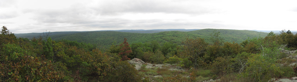 Bell MountainHiking · ~18 min drivePhoto: cm195902, CC BY 2.0 (via Flickr)
 Goggins Mountain Equestrian TrailHiking · ~21 min drivePhoto: Kbh3rd, CC BY-SA 3.0 (via Wikimedia Commons)
 Scour TrailHiking · ~19 min drivePhoto: CC BY-SA 3.0 (via Wikimedia Commons)
 Ozark Trail - Taum SaukHiking · ~22 min drivePhoto: cm195902, CC BY 2.0 (via Flickr)
- Bell MountainHiking · ~16 min drive
- Campground Trail SystemHiking · ~20 min drivePhoto: CC BY-SA 3.0 (via Wikimedia Commons)
- Lindsey Mountain TrailHiking · ~14 min drive
- Ozark Trail - Marble CreekHiking · ~30 min drive
Also worth it near here
- D: The PorchRock climbing · Next doorPhoto: Fredlyfish4, CC BY-SA 3.0 (via Wikimedia Commons)
- Stouts CreekCanoeing · ~8 min drivePhoto: Adam Moss from Macomb, IL, United States, CC BY-SA 2.0 (via Wikimedia Commons)
 Russell MountainSummit · ~10 min drivePhoto: US Geologic Survey, Public domain (via Wikimedia Commons)
- Mina Sauk FallsWaterfall · ~12 min drive
Best time to visit Engine House Ruins Trail
Best months: March–June and August–October. Best months have typical highs of 55–85 °F, lows of 30 °F or warmer (32 °F where the station doesn't record snow), at most one snowy day and no more than 12 wet days.
Jan
40° / 21°
8 wet
Feb
45° / 25°
8 wet
Mar
55° / 33°
10 wet
Apr
66° / 44°
11 wet
May
74° / 54°
12 wet
Jun
82° / 63°
10 wet
Jul
86° / 67°
9 wet
Aug
85° / 65°
8 wet
Sep
78° / 57°
7 wet
Oct
68° / 46°
9 wet
Nov
54° / 35°
8 wet
Dec
43° / 26°
8 wet
Typical high / low (°F) and days with rain or snow, 1991–2020. Measured at Potosi 4 Sw, MO, 18.6 mi away at 1,105 ft. This station doesn't record snowfall. Source: NOAA NCEI U.S. Climate Normals 1991–2020.
