Markham Springs
- Mar–Jun, Sep–Nov
- best months
Is Markham Springs open right now?
Closure in the area
There's a closure order in Poplar Bluff Ranger District. It doesn't name Markham Springs, so check the source for the area it covers.
Beaver Lake Temporary Closure
Agency closure covering Poplar Bluff Ranger District · Order 09-05-04-26-07 · USFS · Poplar Bluff Ranger District
Crane Lake Dam
Agency alert covering Mark Twain National Forest · USFS · Mark Twain National Forest
Delays on Forest Road 557
Agency alert covering Mark Twain National Forest · USFS · Mark Twain National Forest
Forest Order - Trail 119 Closure Extended (Chadwick Motorized Trail System)
Agency alert covering Mark Twain National Forest · USFS · Mark Twain National Forest
Weather Conditions
Agency alert covering Mark Twain National Forest · USFS · Mark Twain National Forest
As of · Source: USFS · Poplar Bluff Ranger District. Agencies don't list every closure — check before you go.
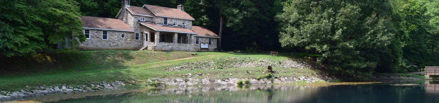
Overview Markham Springs Campground is set on the Black River in a scenic and historic recreation area in the southwestern corner of Missouri's Mark Twain National Forest. The area provides access to multiple trails and recreational opportunities. Markham Springs Recreation Area gets its name from former owner, M. J. Markham, who acquired the property in 1901 and operated a lumber mill at the site until the 1930s. The Fuchs House, a five-bedroom concrete and native stone home, also sits on the property, along with a neighboring mill. At times, it is also available for rent.Recreation River and stream fishing are popular activities near the campground. The Black River boasts bass, sunfish, walleye and catfish. Many anglers fish from boats, but others fish from the riverbanks. Canoeing and kayaking is also possible on the river. Various day hikes within the Markham Springs Trail System are accessible from the campground. Eagle Bluff Trail is a 1.5-mile loop along the river, where birding and wildlife viewing are favorite pastimes.Facilities The campground offers single and double sites for tent and RV camping. Some rather primitive sites are located in a wooded setting near the river. Electric hookups are provided, as well as tables and campfire rings with grills. Lantern posts are also available. Accessible vault toilets, drinking water, showers and trash collection are provided. Natural Features Located adjacent to the Black River, the recreation area contains a small pond that dates back to the 1800s. The area is covered by a dense forest of colorful trees, including ash, elm, maple and poplar. Nearby Attractions The small town of Williamsville is just 3 miles from the campground, offering a general store and fuel station.
- Bubble Springs TrailHiking0.3 mi
- Eagle Bluff TrailHiking0.4 mi
- MarkhamCamping0.6 mi
- Upalika Pond TH SpurHiking3.2 mi
- Ozark Trail-VictoryHiking8 mi
- Victory Horse TrailHiking8.6 mi
- Ozark Trail Wappapello 172 LpHiking9.9 mi
- Ozark Trail Wappapello SectionHiking9.9 mi
Source: Roamze catalog (indexable pages within 10 miles, PostGIS distance)
- River Road ParkRiver fishing · ~25 min drive
- Pinewoods Lake Rec AreaPier fishing · ~18 min drive
- Greenville Recreation AreaLake fishing · ~20 min drive
- Current RiverRiver fishing · ~1h 9m drive
- Lake WappapelloLake fishing · ~26 min drive
- Big SpringRiver fishing · ~36 min drive
- Loggers Lake CampgroundPier fishing · ~1h 19m drive
- Bluff View(clearwater Lake)Lake fishing · ~30 min drive
- Jacks ForkRiver fishing · ~1h 23m drive
- Highway KRiver fishing · ~44 min drive
Best time to visit Markham Springs
Best months: March–June and September–November. Best months have typical highs of 55–85 °F, lows of 30 °F or warmer (32 °F where the station doesn't record snow), at most one snowy day and no more than 12 wet days.
Jan
43° / 23°
8 wet
Feb
48° / 27°
8 wet
Mar
58° / 35°
9 wet
Apr
69° / 44°
9 wet
May
77° / 54°
10 wet
Jun
85° / 63°
9 wet
Jul
89° / 68°
8 wet
Aug
88° / 66°
8 wet
Sep
80° / 57°
7 wet
Oct
70° / 45°
7 wet
Nov
57° / 35°
8 wet
Dec
46° / 27°
8 wet
Typical high / low (°F) and days with rain or snow, 1991–2020. Measured at Clearwater Dam, MO, 14.6 mi away at 660 ft. This station doesn't record snowfall. Source: NOAA NCEI U.S. Climate Normals 1991–2020.

Similar waters
Like this spot? Try:
