Markham
- Mar–Jun, Sep–Nov
- best months
Is Markham open right now?
Closure in the area
There's a closure order in Poplar Bluff Ranger District. It doesn't name Markham, so check the source for the area it covers.
Beaver Lake Temporary Closure
Agency closure covering Poplar Bluff Ranger District · Order 09-05-04-26-07 · USFS · Poplar Bluff Ranger District
Crane Lake Dam
Agency alert covering Mark Twain National Forest · USFS · Mark Twain National Forest
Delays on Forest Road 557
Agency alert covering Mark Twain National Forest · USFS · Mark Twain National Forest
Forest Order - Trail 119 Closure Extended (Chadwick Motorized Trail System)
Agency alert covering Mark Twain National Forest · USFS · Mark Twain National Forest
Weather Conditions
Agency alert covering Mark Twain National Forest · USFS · Mark Twain National Forest
As of · Source: USFS · Poplar Bluff Ranger District. Agencies don't list every closure — check before you go.
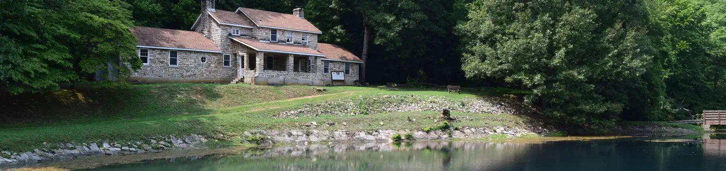
Markham is a Forest Service boat launch in the Poplar Bluff Ranger District of Mark Twain National Forest in Missouri, about 3 miles from the town of Williamsville. Spring and fall are the most comfortable times to visit. Typical averages from the nearby Clearwater Dam weather station show October highs around 70°F with lows near 45°F, and April highs near 69°F. July is the warmest month, with highs around 89°F. The launch sits right beside Markham Springs, a river fishing spot about 0.2 miles away, and the Bubble Springs Trail and Eagle Bluff Trail are both within a third of a mile. Farther out, the Ozark Trail-Victory lies about 8 miles away.
- Managed by
- Forest Service
- Bubble Springs TrailHiking0.2 mi
 Markham SpringsRiver fishing0.2 mi
- Eagle Bluff TrailHiking0.3 mi
- Upalika Pond TH SpurHiking3.4 mi
- Ozark Trail-VictoryHiking8.1 mi
- Victory Horse TrailHiking8.7 mi
- Ozark Trail Wappapello 172 LpHiking9.8 mi
- Ozark Trail Wappapello SectionHiking9.9 mi
Source: Roamze catalog (indexable pages within 10 miles, PostGIS distance)
 Black RiverCanoeing · ~19 min drivePhoto: Kbh3rd, CC BY 4.0 (via Wikimedia Commons)
- Black RiverBoat launch · ~4 min drive
- Big SpringTubing · ~36 min drive
 Saint Francis RiverCanoeing · ~39 min drivePhoto: NOAA employee, Public domain (via Wikimedia Commons)
- Hendrickson Boat LaunchBoat launch · ~15 min drive
- Eleven Point/Doniphan Ranger DistrictTubing · ~43 min drive
 Buffalo CreekCanoeing · ~44 min drivePhoto: Melbr00ks, CC BY-SA 4.0 (via Wikimedia Commons)
- Holliday Landing MarinaBoat launch · ~18 min drive
- Cane CreekCanoeing · ~29 min drive
- Chaonia Landing MarinaBoat launch · ~23 min drive
Best time to visit Markham
Best months: March–June and September–November. Best months have typical highs of 55–85 °F, lows of 30 °F or warmer (32 °F where the station doesn't record snow), at most one snowy day and no more than 12 wet days.
Jan
43° / 23°
8 wet
Feb
48° / 27°
8 wet
Mar
58° / 35°
9 wet
Apr
69° / 44°
9 wet
May
77° / 54°
10 wet
Jun
85° / 63°
9 wet
Jul
89° / 68°
8 wet
Aug
88° / 66°
8 wet
Sep
80° / 57°
7 wet
Oct
70° / 45°
7 wet
Nov
57° / 35°
8 wet
Dec
46° / 27°
8 wet
Typical high / low (°F) and days with rain or snow, 1991–2020. Measured at Clearwater Dam, MO, 14.5 mi away at 660 ft. This station doesn't record snowfall. Source: NOAA NCEI U.S. Climate Normals 1991–2020.

Map and trail data © OpenStreetMap contributors
