Strong River
- 22.0 mi
- distance
- 436 ft
- high point
- Sep–May
- best months
Is Strong River open right now?
Closure in the area
There's a closure order in National Forests in Mississippi. It doesn't name Strong River, so check the source for the area it covers (2 listed).
Forest Order No. 08-11-37-23 Weapons
Agency closure covering National Forests in Mississippi · Order 08-11-37-23-152 · USFS · National Forests in Mississippi
Weapons Use FOREST ORDER NO. 08-11-37-23-152-1
Agency closure covering National Forests in Mississippi · USFS · National Forests in Mississippi
National Forests in Mississippi seeks community members to serve on advisory committee
Agency alert covering National Forests in Mississippi · USFS · National Forests in Mississippi
De Soto RD Temporary Recreation Site Closures
Agency alert covering National Forests in Mississippi · USFS · National Forests in Mississippi
Forest Closure Orders
Agency alert covering National Forests in Mississippi · Order 08-11-37-23-152 · USFS · National Forests in Mississippi
As of · Source: USFS · National Forests in Mississippi. Agencies don't list every closure — check before you go.
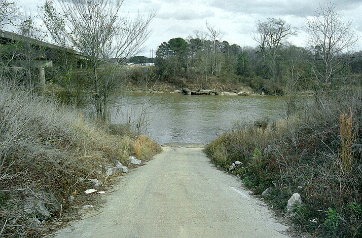
Strong River is a paddling route in Mississippi's National Forests in Mississippi, within the Bienville Ranger District. It's a canoeing destination, and the nearest town is roughly 22 miles away. Spring and fall are the most comfortable seasons for paddling. Typical averages from a nearby weather station run from highs around 74°F and lows near 49°F in April to highs around 76°F and lows near 50°F in October, with fewer wet days in October than in the middle of the year. Other paddling spots close by include Caney Creek, about 3 miles away, and Tallabogue and Raspberry Creek, each about 8 miles off. Beaver Lake, about 7 miles away, offers lake fishing.
- Caney CreekCanoeing3.3 mi
- Beaver LakeLake fishing7.4 mi
- TallabogueCanoeing8.3 mi
- Raspberry CreekCanoeing8.5 mi
Source: Roamze catalog (indexable pages within 10 miles, PostGIS distance)
 Leaf RiverCanoeing · ~24 min drivePhoto: The original uploader was Malepheasant at English Wikipedia., CC BY-SA 2.5 (via Wikimedia Commons)
- Caney CreekCanoeing · ~6 min drive
- TallabogueCanoeing · ~14 min drive
- Raspberry CreekCanoeing · ~15 min drive
- Purvis CreekCanoeing · ~19 min drive
- Pelahatchie CreekCanoeing · ~23 min drive
- Eutacutachee CreekCanoeing · ~24 min drive
- Shockaloo CreekCanoeing · ~24 min drive
- Clear CreekCanoeing · ~24 min drive
- Hontokalo CreekCanoeing · ~26 min drive
Best time to visit Strong River
Best months: September–May. Best months have typical highs of 55–85 °F, lows of 30 °F or warmer (32 °F where the station doesn't record snow), at most one snowy day and no more than 12 wet days.
Jan
55° / 33°
10 wet
Feb
60° / 36°
9 wet
Mar
67° / 43°
9 wet
Apr
74° / 49°
8 wet
May
82° / 58°
9 wet
Jun
87° / 66°
10 wet
Jul
90° / 68°
12 wet
Aug
90° / 67°
12 wet
Sep
85° / 62°
8 wet
Oct
76° / 50°
6 wet
Nov
66° / 40°
7 wet
Dec
58° / 35°
9 wet
Typical high / low (°F) and days with rain or snow, 1991–2020. Measured at Raleigh 6n, MS, 9.8 mi away at 446 ft. This station doesn't record snowfall. Source: NOAA NCEI U.S. Climate Normals 1991–2020.

