Leaf River
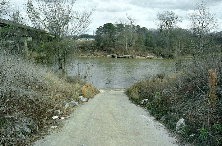 Photo: The original uploader was Malepheasant at English Wikipedia., CC BY-SA 2.5 (via Wikimedia Commons)
- 21.9 mi
- distance
- 457 ft
- high point
- Sep–May
- best months
Is Leaf River open right now?
Closure in the area
There's a closure order in National Forests in Mississippi. It doesn't name Leaf River, so check the source for the area it covers (2 listed).
Forest Order No. 08-11-37-23 Weapons
Agency closure covering National Forests in Mississippi · Order 08-11-37-23-152 · USFS · National Forests in Mississippi
Weapons Use FOREST ORDER NO. 08-11-37-23-152-1
Agency closure covering National Forests in Mississippi · USFS · National Forests in Mississippi
National Forests in Mississippi seeks community members to serve on advisory committee
Agency alert covering National Forests in Mississippi · USFS · National Forests in Mississippi
De Soto RD Temporary Recreation Site Closures
Agency alert covering National Forests in Mississippi · USFS · National Forests in Mississippi
Forest Closure Orders
Agency alert covering National Forests in Mississippi · Order 08-11-37-23-152 · USFS · National Forests in Mississippi
As of · Source: USFS · National Forests in Mississippi. Agencies don't list every closure — check before you go.
Leaf River is a canoeing route in Mississippi's National Forests in Mississippi, within the Bienville Ranger District. The Forest Service manages the surrounding land, and the trip is about 22 miles long. Spring and fall are the most comfortable seasons to paddle. Typical averages from a nearby weather station run from highs around 74°F in April to about 76°F in October, with fewer wet days in October than in summer. July and August typically reach about 90°F with around 12 wet days a month. Marathon Lake campground sits about 4 miles away. Ichusa Creek and Little Ichusa Creek, both canoeing routes, are within about 5 miles. West Tallahala Creek is a little over 6 miles off.
- Marathon LakeCamping3.9 mi
- Little Ichusa CreekCanoeing5.2 mi
- Ichusa CreekCanoeing5.6 mi
- Greentree ReservoirLake fishing5.6 mi
- West Tallahala CreekCanoeing6.5 mi
- TallabogueCanoeing7.2 mi
- Shongelo LakeLake fishing7.6 mi
- Shongelo CreekCanoeing8.4 mi
Source: Roamze catalog (indexable pages within 10 miles, PostGIS distance)
- Little Ichusa CreekCanoeing · ~9 min drive
- Ichusa CreekCanoeing · ~10 min drive
- West Tallahala CreekCanoeing · ~11 min drive
- TallabogueCanoeing · ~12 min drive
- Shongelo CreekCanoeing · ~14 min drive
- Caney CreekCanoeing · ~18 min drive
- Strong RiverCanoeing · ~24 min drive
- Hontokalo CreekCanoeing · ~24 min drive
- Oakohay CreekCanoeing · ~25 min drive
- Warrior CreekCanoeing · ~25 min drive
Best time to visit Leaf River
Best months: September–May. Best months have typical highs of 55–85 °F, lows of 30 °F or warmer (32 °F where the station doesn't record snow), at most one snowy day and no more than 12 wet days.
Jan
55° / 33°
10 wet
Feb
60° / 36°
9 wet
Mar
67° / 43°
9 wet
Apr
74° / 49°
8 wet
May
82° / 58°
9 wet
Jun
87° / 66°
10 wet
Jul
90° / 68°
12 wet
Aug
90° / 67°
12 wet
Sep
85° / 62°
8 wet
Oct
76° / 50°
6 wet
Nov
66° / 40°
7 wet
Dec
58° / 35°
9 wet
Typical high / low (°F) and days with rain or snow, 1991–2020. Measured at Raleigh 6n, MS, 8.2 mi away at 446 ft. This station doesn't record snowfall. Source: NOAA NCEI U.S. Climate Normals 1991–2020.

