Wachusett Mountain
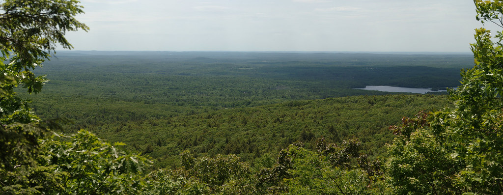
 Photo: Grendelkhan, CC BY-SA 3.0 (via Wikimedia Commons)
- 2,006 ft
- summit
- May–Oct
- best months
Wachusett Mountain is a summit in Massachusetts, rising to 2,006 feet about 6 miles from the town of Leominster. It sits at the center of a cluster of hiking and climbing, with the Wachusett Mountain Area climbing area just 0.1 mile away and the Mountain House Trail 0.3 mile off. Summer is the most comfortable time to visit. Typical averages from a nearby weather station in Ashburnham show July highs around 80°F with lows near 60°F, and September still runs in the low 70s. That station sits roughly 900 feet lower than the summit, so temperatures on top run cooler. The Playground Boulder climbing area is 0.4 mile away, and Redemption Crag is 1.6 miles off. For more hiking, the Brown Hill Loop is 2.3 miles away. Paddlers can reach the Quinapoxet River about 8 miles from the mountain.
Conditions and forecast
Daily highs and lows, wind and the chance of precipitation at the summit for the next 7 days, from the Open-Meteo model.
- Summit elevation
- 2,006 ft
Elevation from USGS 3D Elevation Program terrain data (about 10 m resolution).
We don't know of a mapped trail or route to the summit of Wachusett Mountain. Plan the approach with local maps, a guidebook or a local guide, and check conditions before you go.
Questions about Wachusett Mountain
How tall is Wachusett Mountain?
2,006 ft (611 m).
Is there a trail to the top of Wachusett Mountain?
We don't know of a mapped trail or route to the summit. Plan the approach with local maps, a guidebook or a local guide.
- Ball Hill1,195 ft · Massachusetts1 route3.1 mi away
- South Monoosnoc Hill1,156 ft · Massachusetts1 route5.1 mi away
- North Monoosnoc Hill981 ft · Massachusetts1 route5.9 mi away
- Pine Hill774 ft · Massachusetts5 routes6.6 mi away
- Mount Jefferson1,225 ft · Massachusetts1 route7.9 mi away
- Nutting Hill1,627 ft · Massachusetts2 routes15 mi away
- Wachusett Mountain AreaRock climbing0.1 mi
 Mountain House TrailHikingPhoto: xxv, CC BY-SA 2.0 (via Flickr)0.3 mi
- Playground BoulderRock climbing0.4 mi
- Redemption CragRock climbing1.6 mi
- Brown Hill LoopHiking2.3 mi
- Pasture TrailHiking2.6 mi
 Quinapoxet RiverCanoeingPhoto: en:User:LymanSchool (Richard B. Johnson), CC BY-SA 3.0 (via Wikimedia Commons)7.8 mi
- Upper Otter River Blue TrailCanoeing9.1 mi
Source: Roamze catalog (indexable pages within 10 miles, PostGIS distance)
 Gibbet HillSummit · ~32 min drivePhoto: John Phelan, CC BY 3.0 (via Wikimedia Commons)
 Sligo HillSummit · ~33 min drivePhoto: Mufasa510, CC BY-SA 4.0 (via Wikimedia Commons)
 Tully MountainSummit · ~37 min drivePhoto: Pgagnon999 Paul Gagnon, CC BY-SA 4.0 (via Wikimedia Commons)
 Pack Monadnock MountainSummit · ~44 min drivePhoto: Ken Gallager at en.wikipedia, CC BY 3.0 (via Wikimedia Commons)
 Quabbin HillSummit · ~45 min drivePhoto: Pi.1415926535, CC BY-SA 4.0 (via Wikimedia Commons)
 Punkatasset HillSummit · ~47 min drivePhoto: Worcester4life, CC0 (via Wikimedia Commons)
 Mount MiserySummit · ~48 min drivePhoto: Swampyank, CC BY-SA 4.0 (via Wikimedia Commons)
 Monadnock MountainSummit · ~48 min drivePhoto: Jonwmcinenrey, CC BY-SA 4.0 (via Wikimedia Commons)
- Ball HillSummit · ~5 min drive
- South Monoosnoc HillSummit · ~9 min drive
Best time to visit Wachusett Mountain
Best months: May–October. Best months have typical highs of 55–85 °F, lows of 30 °F or warmer (32 °F where the station doesn't record snow), at most one snowy day and no more than 12 wet days.
Jan
31° / 14°
13 wet · 9 snow
Feb
33° / 15°
11 wet · 8 snow
Mar
41° / 23°
13 wet · 6 snow
Apr
55° / 34°
12 wet · 2 snow
May
66° / 44°
12 wet
Jun
75° / 54°
12 wet
Jul
80° / 60°
11 wet
Aug
78° / 57°
10 wet
Sep
71° / 51°
9 wet
Oct
57° / 39°
11 wet
Nov
46° / 31°
11 wet · 2 snow
Dec
35° / 20°
13 wet · 7 snow
Typical high / low (°F) and days with rain or snow, 1991–2020. Measured at Ashburnham, MA, 9 mi away at 1,108 ft. The station sits about 900 ft lower than this place, so expect it a little cooler here. Source: NOAA NCEI U.S. Climate Normals 1991–2020.
