Hemlock Loop Trail
 Photo: aerugino, CC BY 2.0 (via Flickr)
- 0.3 mi
- round trip
- 372 ft
- climb
- 704 ft
- high point
- Out and back
- route
- Apr–Oct
- best months
Hemlock Loop Trail is a short out-and-back trail in Massachusetts covering 0.34 miles with 29 feet of elevation gain. The trail descends 201 feet from its highest point.
- Nearby · Sugar Farms Trail · Tower Trail (White Trail) · Robert Frost Trail
Best time to go · Apr–Oct
Best time to visit Hemlock Loop Trail
Best months: April–October. Best months have typical highs of 55–85 °F, lows of 30 °F or warmer (32 °F where the station doesn't record snow), at most one snowy day and no more than 12 wet days.
Jan
30° / 12°
Feb
35° / 12°
Mar
45° / 23°
Apr
58° / 34°
May
70° / 45°
Jun
79° / 55°
Jul
83° / 61°
Aug
82° / 59°
Sep
74° / 50°
Oct
60° / 39°
Nov
48° / 29°
Dec
37° / 20°
Typical high / low (°F) and days with rain or snow, 1991–2020. Measured at Leverett #2, MA, 3.4 mi away at 315 ft. This station doesn't record snowfall. Source: NOAA NCEI U.S. Climate Normals 1991–2020.
Keep exploring — more trails worth the drive
Photo: aerugino, CC BY 2.0 (via Flickr)Sugar Farms Trail
Next door
1.70-mile out-and-back hike in Massachusetts with 309 ft elevation gain.
 Photo: Arnab Majumdar, CC BY-SA 3.0 (via Wikimedia Commons)
Tower Trail (White Trail)
~21 min drive
2.6-mile out-and-back hike in Massachusetts with 1,213 ft elevation gain.
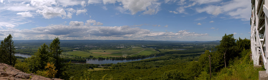 Photo: 6SN7, CC BY 2.0 (via Flickr)
Robert Frost Trail
~23 min drive
A 38-mile point-to-point trail through central Massachusetts woodlands and farmland.
 Photo: pjmorse, CC BY-SA 2.0 (via Wikimedia Commons)
Whsipering Winds Loop
~17 min drive
2.1-mile out-and-back trail in Massachusetts with 211 ft gain/loss.
HIKE
M&M Trail (Old Route)
~5 min drive
5.26-mile out-and-back trail in Massachusetts with 909 ft elevation gain.
HIKE
Farley Ledge Loop
~15 min drive
1.71-mile loop in Massachusetts with 745 ft gain and 854 ft loss.
 Photo: U. S. Fish and Wildlife Service - Northeast Region, Public domain (via Wikimedia Commons)
Fort River Birding and Nature Trail
~19 min drive
1.01-mile loop trail in Massachusetts with 152 ft of elevation gain.
HIKE
M&M Trail (old route)
~8 min drive
6.42-mile out-and-back trail in Massachusetts with 1,039 ft elevation gain
 Photo: 6SN7, CC BY 2.0 (via Flickr)
Steeplebush Trail
~22 min drive
2.38-mile out-and-back hike in Massachusetts with 489 ft elevation gain.
HIKE
Old Carriage Trail
~24 min drive
2.24-mile out-and-back trail in Massachusetts with 321 ft elevation gain.

Map and trail data © OpenStreetMap contributors
