East Loop trail
- 1.1 mi
- round trip
- 524 ft
- climb
- 956 ft
- high point
- Out and back
- route
- Apr–Oct
- best months
Clear today
Weather is good · OpenWeather · checked 8 h ago
East Loop trail is an easy out-and-back hike in western Massachusetts, about 2 miles from Roaring Brook Camp. The route is roughly 2 miles long, with a steady climb of about 500 feet up to a high point of 956 feet, and it returns to the starting elevation of 956 feet. The trail is a short outing of about an hour. The most comfortable time to go is late spring through early fall, when typical averages from a nearby weather station run from highs around 70°F in May to the low 80s in July and August. That station sits several hundred feet lower, so temperatures on the trail run cooler. Hen Hawk Trail lies about 2 miles away, and Mill River, a canoeing route, is about 2.5 miles off. Western MA, a climbing area, is about 3.4 miles away, and the D.A.R. Trail is about 4.5 miles away.
- Hen Hawk TrailHiking2.2 mi
- Mill RiverCanoeing2.5 mi
- Western MARock climbing3.4 mi
- D.A.R. TrailHiking4.5 mi
- Hall/O'Neil Conservation Area TrailsHiking4.9 mi
- NEMBA TrailHiking5.2 mi
- SunbowlRock climbing6.5 mi
- Sawmill RiverCanoeing9.8 mi
Source: Roamze catalog (indexable pages within 10 miles, PostGIS distance)
 Hemlock Loop TrailHiking · ~14 min drivePhoto: aerugino, CC BY 2.0 (via Flickr)
 Tower Trail (White Trail)Hiking · ~18 min drivePhoto: Arnab Majumdar, CC BY-SA 3.0 (via Wikimedia Commons)
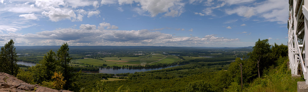 Robert Frost TrailHiking · ~20 min drivePhoto: 6SN7, CC BY 2.0 (via Flickr)
- Sugar Farms TrailHiking · ~14 min drivePhoto: aerugino, CC BY 2.0 (via Flickr)
- Old Carriage TrailHiking · ~15 min drive
 Old Telephone LineHiking · ~14 min drivePhoto: chipmunk_1, CC BY-SA 2.0 (via Flickr)
- M&M Trail (Old Route)Hiking · ~18 min drive
 Fort River Birding and Nature TrailHiking · ~17 min drivePhoto: U. S. Fish and Wildlife Service - Northeast Region, Public domain (via Wikimedia Commons)
- M&M Trail (old route)Hiking · ~22 min drive
 Walnut Trees PathHiking · ~19 min drivePhoto: allenran 917, CC BY 2.0 (via Flickr)
Best time to visit East Loop trail
Best months: April–October. Best months have typical highs of 55–85 °F, lows of 30 °F or warmer (32 °F where the station doesn't record snow), at most one snowy day and no more than 12 wet days.
Jan
30° / 12°
Feb
35° / 12°
Mar
45° / 23°
Apr
58° / 34°
May
70° / 45°
Jun
79° / 55°
Jul
83° / 61°
Aug
82° / 59°
Sep
74° / 50°
Oct
60° / 39°
Nov
48° / 29°
Dec
37° / 20°
Typical high / low (°F) and days with rain or snow, 1991–2020. Measured at Leverett #2, MA, 7.8 mi away at 315 ft. The station sits about 600 ft lower than this place, so expect it a little cooler here. This station doesn't record snowfall. Source: NOAA NCEI U.S. Climate Normals 1991–2020.
Map and trail data © OpenStreetMap contributors
