Copperhead Run Trail
- 1.6 mi
- round trip
- 1,441 ft
- climb
- 260 ft
- high point
- Out and back
- route
- Apr–Jun, Sep–Nov
- best months
Copperhead Run Trail is a 1.6-mile hike in Maryland, about 0.3 miles from the community of Burnt Mills. The trail is an out-and-back with a total length of about 3.2 miles, and it rises from a low point of 186 feet to a high of 260 feet, a climb of about 100 feet one way. It is rated moderate. Spring and fall are the most comfortable times to go. Typical averages from a nearby weather station in Beltsville show May highs around 74°F and October highs around 68°F, while July averages about 87°F. The trail sits right next to a cluster of climbing areas and the Northwest Branch Trail. North Bank - Hobo Cave Area and South Bank - Dirty Ernie are both about 0.1 mile away, and the Northwest Branch Trail is a similar distance. The Devere Loop Trail is about 0.7 mile off.
Best time to go · Apr–Jun, Sep–Nov
Best time to visit Copperhead Run Trail
Best months: April–June and September–November. Best months have typical highs of 55–85 °F, lows of 30 °F or warmer (32 °F where the station doesn't record snow), at most one snowy day and no more than 12 wet days.
Jan
43° / 25°
10 wet
Feb
45° / 27°
9 wet
Mar
53° / 34°
10 wet
Apr
65° / 44°
11 wet
May
74° / 54°
11 wet
Jun
83° / 63°
10 wet
Jul
87° / 68°
10 wet
Aug
86° / 66°
9 wet
Sep
79° / 59°
8 wet
Oct
68° / 47°
9 wet
Nov
57° / 37°
9 wet
Dec
47° / 30°
10 wet
Typical high / low (°F) and days with rain or snow, 1991–2020. Measured at Beltsville, MD, 3.8 mi away at 145 ft. This station doesn't record snowfall. Source: NOAA NCEI U.S. Climate Normals 1991–2020.
Keep exploring — more trails worth the drive
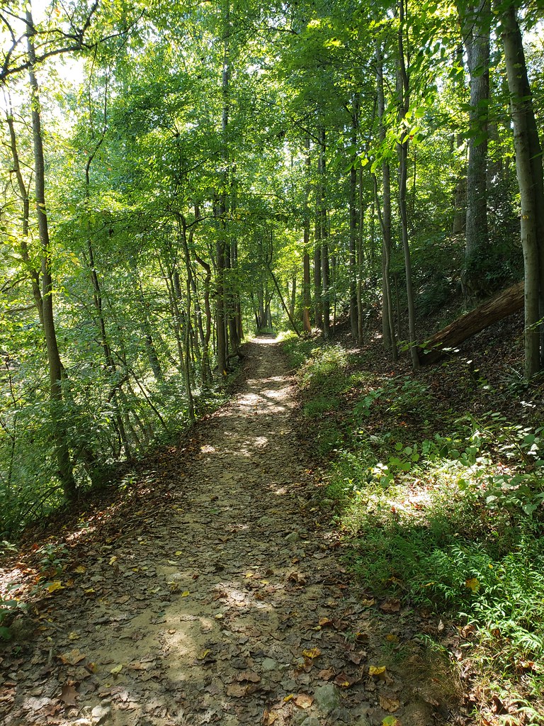 Photo: inkdroid, CC BY 2.0 (via Flickr)
Northwood-Chesapeake Bay Trail
~1 min drive
0.30-mile out-and-back trail along the Chesapeake Bay in Maryland.
HIKE
Raven's Run
~4 min drive
0.60-mile out-and-back trail in Maryland with 248 ft elevation gain.
HIKE
Western Ridge Trail
~7 min drive
1.77-mile point-to-point trail in Maryland with 423 ft gain
 Photo: Mr.TinMD, CC BY 2.0 (via Flickr)
Clifton Park River Trail
~3 min drive
0.63-mile out-and-back trail in Maryland with 197 ft of elevation gain.
HIKE
Rachel Carson Greenway Trail
~9 min drive
A 10.71-mile point-to-point greenway trail through Maryland's natural corridors.
 Photo: TrailVoice, CC BY-SA 2.0 (via Wikimedia Commons)
Matthew Henson Trail
~7 min drive
0.66-mile out-and-back trail in Maryland with 63 ft of elevation gain.
HIKE
Adt - Maryland - Seg 2
~11 min drive
A challenging 41.67-mile point-to-point Maryland backcountry trail.
Photo: TrailVoice, CC BY-SA 2.0 (via Wikimedia Commons)Matthew Henson Trail
~8 min drive
0.84-mile out-and-back trail in Maryland with 83 ft elevation gain
Photo: TrailVoice, CC BY-SA 2.0 (via Wikimedia Commons)Matthew Henson Trail
~9 min drive
1.14-mile out-and-back trail in Maryland with 76 ft elevation gain
Photo: TrailVoice, CC BY-SA 2.0 (via Wikimedia Commons)Matthew Henson Trail
~9 min drive
0.62-mile out-and-back trail in Maryland with 84 ft elevation gain.


Map and trail data © OpenStreetMap contributors
