Matthew Henson Trail
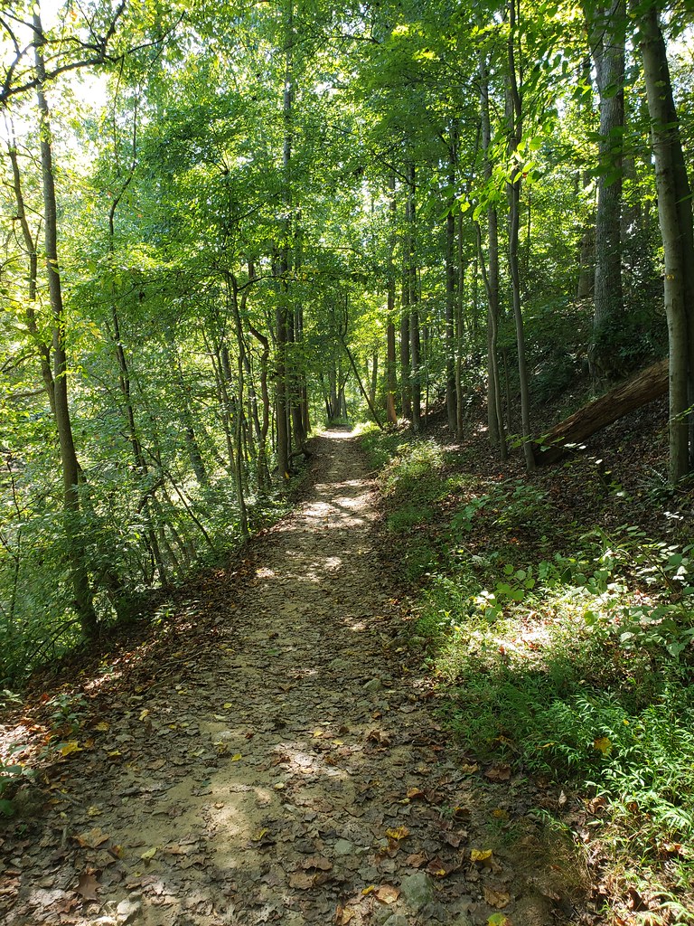
 Photo: TrailVoice, CC BY-SA 2.0 (via Wikimedia Commons)
- 0.3 mi
- round trip
- 63 ft
- climb
- 444 ft
- high point
- Out and back
- route
- Apr–Jun, Aug–Nov
- best months
The Matthew Henson Trail is a short, easy out-and-back hike in Maryland, about half a mile from Layhill Village. The route is just over half a mile long, with a total elevation gain of about 63 feet, and it is rated easy. The trail is nearly flat, with the steepest stretch at about 0.12 miles in, where the grade reaches about 5%. The high point is 444 feet, and the low point is 410 feet. The trip takes about half an hour. Spring and fall are the most comfortable times to go. Typical averages from a nearby weather station in Rockville show May highs around 74°F and October highs around 66°F, while July averages about 87°F. Nearby, the Poplar Run Trail is about 0.9 miles away, and the Northwest Branch Trail and Trolley Loop Trail are each about a mile off. Paddlers can reach the Northwest Branch Anacostia River, about 1.2 miles away.
- Poplar Run TrailHiking0.9 mi
- Northwest Branch TrailHiking1 mi
- Trolley Loop TrailHiking1 mi
 Northwest Branch Anacostia RiverCanoeingPhoto: Paul from USA, CC BY-SA 2.0 (via Wikimedia Commons)1.2 mi
- Downstream Slab AKA Snowflake FaceRock climbing4.2 mi
- Upstream SlabRock climbing4.2 mi
- North Bank - Uphill SlabRock climbing4.3 mi
- Little Falls BranchCanoeing9.3 mi
Source: Roamze catalog (indexable pages within 10 miles, PostGIS distance)
- Matthew Henson TrailHiking · ~3 min drivePhoto: TrailVoice, CC BY-SA 2.0 (via Wikimedia Commons)
 Lakeside TrailHiking · ~7 min drivePhoto: John Brighenti, CC BY 2.0 (via Flickr)
- Matthew Henson TrailHiking · ~5 min drivePhoto: TrailVoice, CC BY-SA 2.0 (via Wikimedia Commons)
 Lakeside TrailHiking · ~7 min drivePhoto: John Brighenti, CC BY 2.0 (via Flickr)
- Matthew Henson TrailHiking · ~5 min drivePhoto: TrailVoice, CC BY-SA 2.0 (via Wikimedia Commons)
 Parilla PathHiking · ~9 min drivePhoto: John Brighenti, CC BY 2.0 (via Flickr)
 Northwood-Chesapeake Bay TrailHiking · ~6 min drivePhoto: inkdroid, CC BY 2.0 (via Flickr)
- Raven's RunHiking · ~4 min drive
 Lakeside TrailHiking · ~7 min drivePhoto: John Brighenti, CC BY 2.0 (via Flickr)
- Copperhead Run TrailHiking · ~7 min drive
Best time to visit Matthew Henson Trail
Best months: April–June and August–November. Best months have typical highs of 55–85 °F, lows of 30 °F or warmer (32 °F where the station doesn't record snow), at most one snowy day and no more than 12 wet days.
Jan
42° / 27°
10 wet
Feb
45° / 28°
8 wet
Mar
54° / 36°
11 wet
Apr
66° / 46°
11 wet
May
74° / 55°
11 wet
Jun
82° / 64°
10 wet
Jul
87° / 69°
9 wet
Aug
85° / 67°
8 wet
Sep
77° / 60°
9 wet
Oct
66° / 48°
8 wet
Nov
56° / 38°
8 wet
Dec
46° / 31°
10 wet
Typical high / low (°F) and days with rain or snow, 1991–2020. Measured at Rockville 1 Ne, MD, 5.9 mi away at 440 ft. This station doesn't record snowfall. Source: NOAA NCEI U.S. Climate Normals 1991–2020.

Map and trail data © OpenStreetMap contributors
