Fiddlehead Campground SHOWERS
Campground
Campground · 7.5 mi from the trail
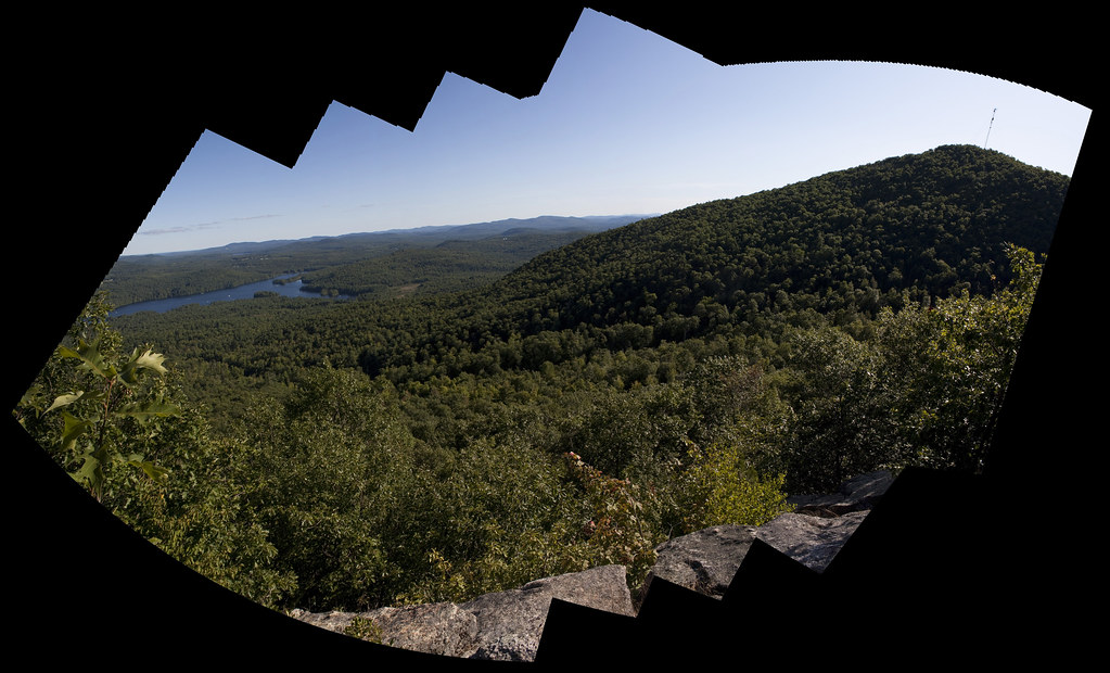
Peary Mountain Trail is a short out-and-back hike in western Maine, about 1.8 miles from the town of Merrill Corner. The trail is less than a mile long, with a total round-trip distance of about 0.64 miles and a total elevation gain of about 109 feet. The high point is 952 feet, and the steepest stretch comes at about 0.24 miles into the route, where the grade reaches about 7%. The most comfortable months for a visit are typically June through September. Typical averages from a nearby weather station in Fryeburg run from highs around 77°F in June to about 82°F in July, with September easing to around 73°F. That station sits roughly 500 feet lower than the trail, so temperatures on the higher ground run a little cooler. The trip takes about half an hour, so it works well as a quick outing. The surrounding area is also popular for ski touring, with Burnt Meadow Glades and Uphill Route both about 2.1 miles away. Climbers can find Jockey Cap Bouldering about 4.8 miles off, and the Saco River offers fishing roughly 9 miles away.
Fiddlehead Campground SHOWERS
Campground
Pace Galleries of Art
Gallery
Places © OpenStreetMap contributors
More in North ConwayDaily highs and lows, wind and the chance of precipitation at the summit and route start for the next 7 days, from the Open-Meteo model.
Source: Roamze catalog (indexable pages within 10 miles, PostGIS distance)
 Twin Brook TrailHiking · ~5 min drivePhoto: InAweofGod'sCreation, CC BY 2.0 (via Wikimedia Commons)Stone Mountain TrailHiking · ~5 min drivePhoto: InAweofGod'sCreation, CC BY 2.0 (via Wikimedia Commons)Burnt Meadow MountainHiking · ~6 min drivePhoto: InAweofGod'sCreation, CC BY 2.0 (via Wikimedia Commons)
 Fire Warden's TrailHiking · ~14 min drivePhoto: ImNotQuiteJack, CC BY-SA 2.0 (via Flickr)Bald Peak TrailHiking · ~13 min drivePhoto: ImNotQuiteJack, CC BY-SA 2.0 (via Flickr)
 North Ridge TrailHiking · ~15 min drivePhoto: AlisonChaiken, CC BY-SA 2.0 (via Flickr)
 Ledges TrailHiking · ~13 min drivePhoto: ImNotQuiteJack, CC BY-SA 2.0 (via Flickr)
 Narrow Gauge TrailHiking · ~17 min drivePhoto: jschauma, CC BY 2.0 (via Flickr)
 Middle Mountain TrailHiking · ~16 min drivePhoto: gotjen, CC BY 3.0 (via Wikimedia Commons)
Best months: September–October. Best months have typical highs of 55–85 °F, lows of 30 °F or warmer (32 °F where the station doesn't record snow), at most one snowy day and no more than 12 wet days.
Jan
31° / 7°
11 wet
Feb
34° / 9°
9 wet
Mar
42° / 19°
11 wet
Apr
56° / 30°
12 wet
May
68° / 42°
13 wet
Jun
77° / 51°
14 wet
Jul
82° / 56°
14 wet
Aug
81° / 54°
13 wet
Sep
73° / 46°
11 wet
Oct
59° / 35°
12 wet
Nov
47° / 26°
11 wet
Dec
36° / 15°
12 wet
Typical high / low (°F) and days with rain or snow, 1991–2020. Measured at Fryeburg E Slopes Ap, ME, 2.7 mi away at 445 ft. The station sits about 500 ft lower than this place, so expect it a little cooler here. This station doesn't record snowfall. Source: NOAA NCEI U.S. Climate Normals 1991–2020.
About 0.3 mi round trip.
About 109 ft of climbing round trip.
It is rated easy.
About 0 hours round trip.
2: Peary Mountain Trail and Peary Mountain Trail.
Map and trail data © OpenStreetMap contributors

