Granger Pond Camping Area
Campground
Campground · 6.5 mi from the trail
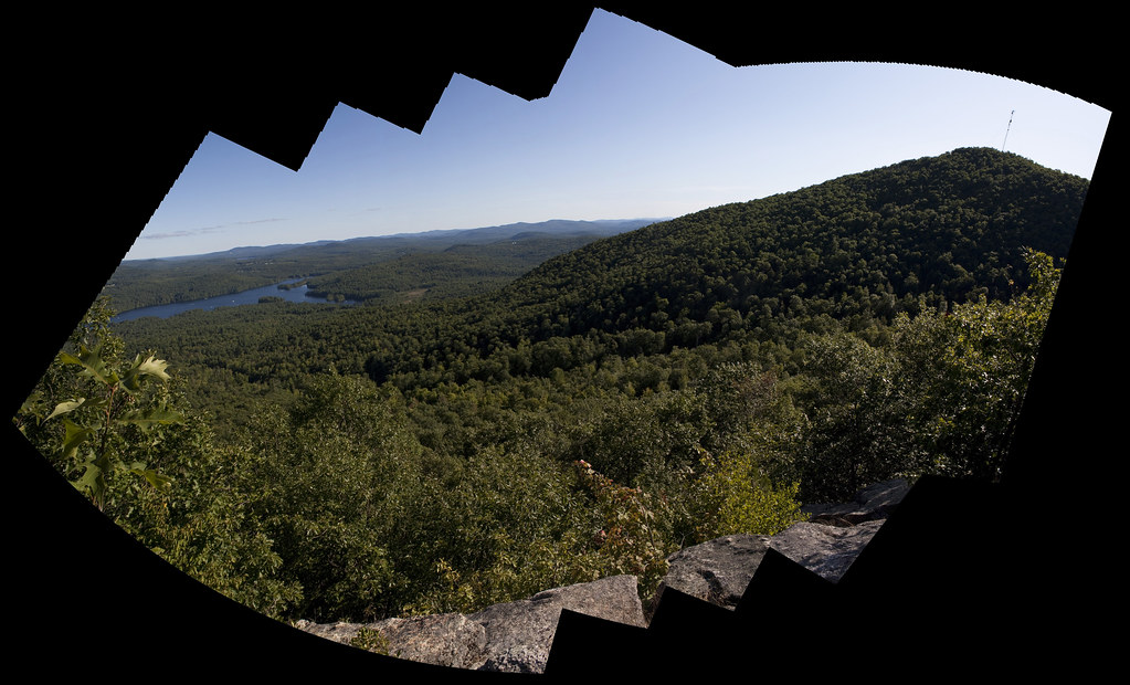
 Photo: InAweofGod'sCreation, CC BY 2.0 (via Wikimedia Commons)
Twin Brook Trail is a 3.5-mile out-and-back hike in Maine, about 1.2 miles from the town of Brownfield. The trail starts at 1,549 feet and climbs to a high point of 1,549 feet, which makes it a back-loaded route with the steepest stretch at about 1.1 miles in. The total elevation gain is 1,541 feet, and the trail is rated moderate. Summer is the most comfortable time to go. Typical averages from a nearby weather station in Fryeburg run to highs around 82°F in July, though that station sits well below the trail, so temperatures on the higher ground run cooler. Winters are cold, with January highs near 31°F. The trip takes about two hours. Stone Mountain Trail is just 0.4 miles away, and the ski touring routes at Brushfire and Buck Hunter are each about half a mile off. For climbing, Jockey Cap Bouldering is about 7.5 miles away.
Granger Pond Camping Area
Campground
Pace Galleries of Art
Gallery
Places © OpenStreetMap contributors, Places © Overture Maps Foundation
More in North ConwayStone Mountain TrailHikingPhoto: InAweofGod'sCreation, CC BY 2.0 (via Wikimedia Commons)0.4 miSource: Roamze catalog (indexable pages within 10 miles, PostGIS distance)
Stone Mountain TrailHiking · Next doorPhoto: InAweofGod'sCreation, CC BY 2.0 (via Wikimedia Commons)Burnt Meadow MountainHiking · ~2 min drivePhoto: InAweofGod'sCreation, CC BY 2.0 (via Wikimedia Commons) Narrow Gauge TrailHiking · ~13 min drivePhoto: jschauma, CC BY 2.0 (via Flickr)
 Bald Peak TrailHiking · ~14 min drivePhoto: ImNotQuiteJack, CC BY-SA 2.0 (via Flickr)Narrow Gauge TrailHiking · ~13 min drivePhoto: jschauma, CC BY 2.0 (via Flickr)
 Ledges TrailHiking · ~14 min drivePhoto: ImNotQuiteJack, CC BY-SA 2.0 (via Flickr)Fire Warden's TrailHiking · ~14 min drivePhoto: ImNotQuiteJack, CC BY-SA 2.0 (via Flickr)
 North Ridge TrailHiking · ~16 min drivePhoto: AlisonChaiken, CC BY-SA 2.0 (via Flickr)
Best months: September–October. Best months have typical highs of 55–85 °F, lows of 30 °F or warmer (32 °F where the station doesn't record snow), at most one snowy day and no more than 12 wet days.
Jan
31° / 7°
11 wet
Feb
34° / 9°
9 wet
Mar
42° / 19°
11 wet
Apr
56° / 30°
12 wet
May
68° / 42°
13 wet
Jun
77° / 51°
14 wet
Jul
82° / 56°
14 wet
Aug
81° / 54°
13 wet
Sep
73° / 46°
11 wet
Oct
59° / 35°
12 wet
Nov
47° / 26°
11 wet
Dec
36° / 15°
12 wet
Typical high / low (°F) and days with rain or snow, 1991–2020. Measured at Fryeburg E Slopes Ap, ME, 5.3 mi away at 445 ft. The station sits about 1,100 ft lower than this place, so expect it a little cooler here. This station doesn't record snowfall. Source: NOAA NCEI U.S. Climate Normals 1991–2020.
Map and trail data © OpenStreetMap contributors

