Cross Cushing Trail
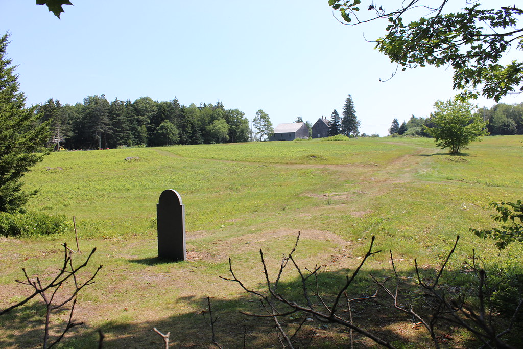 Photo: btwashburn, CC BY 2.0 (via Flickr)
- 1.0 mi
- loop
- 301 ft
- climb
- 163 ft
- high point
- Loop
- route
- Jun–Oct
- best months
The Cross Cushing Trail is a short, easy hike in Maine, about a quarter mile from the village of South Cushing. It covers roughly a mile of low-lying ground, starting at about 42 feet and rising to a high point of about 163 feet with a total gain of 301 feet. The route begins with a steep stretch of about 14% grade within the first sixth of a mile, but it soon eases into a gentler climb. The total descent of 206 feet means the trail is roughly balanced around its high point. A trip here takes about half an hour. Summer is the most comfortable time to go. Typical averages from the nearby Tenants Harbor weather station, which sits close to the same elevation, show July and August highs around 74°F with lows in the mid-50s. Winter is cold, with January highs near 35°F. Several other trails lie within a few miles. Meadowbrook Preserve trail is about 2.3 miles away, and Les Hyde Memorial Nature Trail is about 3.8 miles away. Mill Pond Trail and Goose River Loop are each about 4 miles from the trail.
- Meadowbrook Preserve trailHiking2.3 mi
- Les Hyde Memorial Nature TrailHiking3.8 mi
- Mill Pond TrailHiking4 mi
- Goose River LoopHiking4 mi
- Muscongus Bay Loop (green)Hiking4.2 mi
- Spruce Woods Loop (blue)Hiking4.4 mi
- Fort Point TrailHiking4.8 mi
- Jones Brook TrailHiking4.8 mi
Source: Roamze catalog (indexable pages within 10 miles, PostGIS distance)
 Hilton O’Connor Trail (Blue Loop)Hiking · ~12 min drivePhoto: daveyboyvt, CC BY 2.0 (via Flickr)
 Blue TrailHiking · ~19 min drivePhoto: Cgg1, CC BY-SA 3.0 (via Wikimedia Commons)
 Blue TrailHiking · ~17 min drivePhoto: Sarah and Jason, CC BY-SA 2.0 (via Flickr)
- Blue TrailHiking · ~14 min drive
- Gale's TrailHiking · ~20 min drivePhoto: Cgg1, CC BY-SA 3.0 (via Wikimedia Commons)
- Shore TrailHiking · ~23 min drive
- Blue TrailHiking · ~21 min drivePhoto: Cgg1, CC BY-SA 3.0 (via Wikimedia Commons)
 Oyster Creek TrailHiking · ~21 min drivePhoto: Sarah and Jason, CC BY-SA 2.0 (via Flickr)
 Bayside TrailHiking · ~21 min drivePhoto: Sarah and Jason, CC BY-SA 2.0 (via Flickr)
 Great Salt Bay and Hart Family Heritage TrailHiking · ~22 min drivePhoto: jmlwinder, CC BY 2.0 (via Flickr)
Best time to visit Cross Cushing Trail
Best months: June–October. Best months have typical highs of 55–85 °F, lows of 30 °F or warmer (32 °F where the station doesn't record snow), at most one snowy day and no more than 12 wet days.
Jan
35° / 17°
11 wet
Feb
37° / 19°
10 wet
Mar
43° / 25°
12 wet
Apr
51° / 34°
12 wet
May
61° / 43°
13 wet
Jun
69° / 50°
12 wet
Jul
74° / 56°
12 wet
Aug
74° / 57°
10 wet
Sep
68° / 51°
10 wet
Oct
58° / 43°
11 wet
Nov
49° / 34°
11 wet
Dec
41° / 24°
13 wet
Typical high / low (°F) and days with rain or snow, 1991–2020. Measured at Tenants Harbor, ME, 3.3 mi away at 21 ft. This station doesn't record snowfall. Source: NOAA NCEI U.S. Climate Normals 1991–2020.
Map and trail data © OpenStreetMap contributors
