Sheltowee Trace
- 2.3 mi
- round trip
- 871 ft
- climb
- 1,484 ft
- high point
- Out and back
- route
- Mar–Jun, Sep–Nov
- best months
Is Sheltowee Trace open right now?
Closure in the area
There's a closure order in Daniel Boone National Forest. It doesn't name Sheltowee Trace, so check the source for the area it covers (2 listed).
National Visitor Use Monitoring, Oct 2026-Sept 2027
Agency closure covering Daniel Boone National Forest · USFS · Daniel Boone National Forest
Scott Creek Boat ramp briefly inaccessible, July 30
Agency closure covering Daniel Boone National Forest · USFS · Daniel Boone National Forest
Low water levels at Laurel River Lake
Agency alert covering Daniel Boone National Forest · USFS · Daniel Boone National Forest
Active logging operations near Redbird Crest Trail Sections 17-19
Agency alert covering Daniel Boone National Forest · USFS · Daniel Boone National Forest
Tornado Damaged Area Closure in London, Pulaski counties
Agency alert covering London Ranger District · Order 08-02-14-26-02 · USFS · London Ranger District
As of · Source: USFS · Daniel Boone National Forest. Agencies don't list every closure — check before you go.
Sheltowee Trace is a 4.5-mile out-and-back hike in Kentucky's Daniel Boone National Forest, within the London Ranger District. It rises from a low point of 1,071 feet to a high of 1,484 feet, with a total elevation gain of 871 feet over the course of the route. The climb is front-loaded, peaking in steepness at about 0.7 miles with a grade of 12 percent, and the trail is rated easy. Spring and fall are the most comfortable times to go. Typical averages from a nearby weather station at Berea College show October highs around 70°F with lows near 49°F, and April is similar, while July highs climb to about 87°F. The hike takes about two hours. The trail starts at 1,071 feet, and the round-trip gain of 871 feet means the return is as steep as the climb up. Foxtown Boulders, a climbing area about 3.5 miles away, and the Knuckles, Ironfist, Panda climbing area, about 4.5 miles out, are close by. S-Tree Campground, about 5.6 miles away, and the Renfro Loop Trail #302, about 5.4 miles away, round out the options.
Local outfitters
- Miguels Rock Climbing Shop29 mi away
Not on Roamze yet. Their page has how to reach them.
- Foxtown BouldersRock climbing3.5 mi
- Knuckles, Ironfist, PandaRock climbing4.5 mi
- Racoon Creek RoadMountain biking5.2 mi
- Renfro Loop Trail #302Hiking5.4 mi
- S-Tree CampgroundCamping5.6 mi
- Turkey Foot CampgroundCamping6.1 mi
- Laurel ForkCanoeing6.1 mi
- Middle Fork Rockcastle RiverCanoeing6.3 mi
Source: Roamze catalog (indexable pages within 10 miles, PostGIS distance)
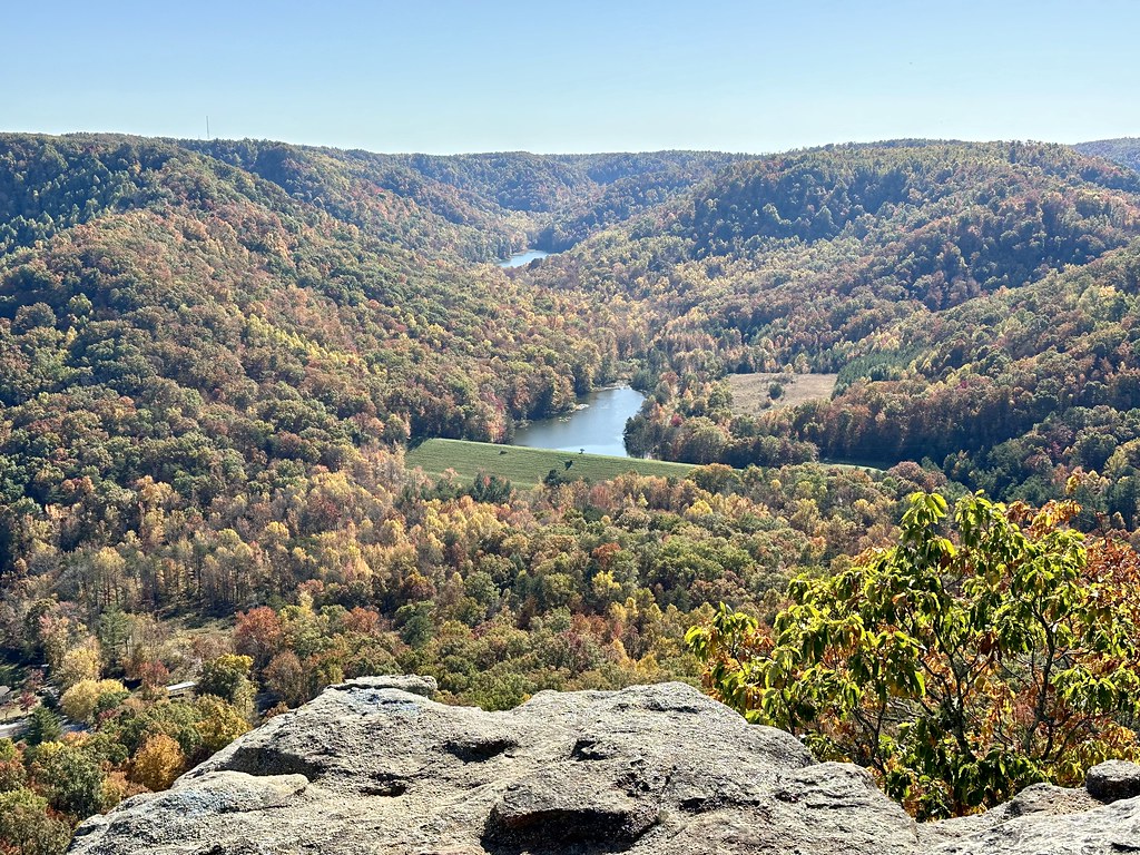 Upper East Pinnacle TrailHiking · ~23 min drivePhoto: Navin75, CC BY-SA 2.0 (via Flickr)
- Sheltowee TraceHiking · ~4 min drive
- Turkey Foot LoopHiking · ~11 min drive
- Sheltowee TraceHiking · ~15 min drive
- Walnut TrailHiking · ~24 min drivePhoto: Navin75, CC BY-SA 2.0 (via Flickr)
- Turkey Foot Loop BHiking · ~11 min drive
- Upper West Pinnacle TrailHiking · ~24 min drivePhoto: Navin75, CC BY-SA 2.0 (via Flickr)
- Anglin Falls TrailHiking · ~19 min drive
- Renfro Loop Trail #302Hiking · ~9 min drive
- East Pinnacle TrailHiking · ~22 min drive
Best time to visit Sheltowee Trace
Best months: March–June and September–November. Best months have typical highs of 55–85 °F, lows of 30 °F or warmer (32 °F where the station doesn't record snow), at most one snowy day and no more than 12 wet days.
Jan
45° / 29°
Feb
51° / 32°
Mar
60° / 39°
Apr
70° / 48°
May
78° / 57°
Jun
84° / 64°
Jul
87° / 67°
Aug
86° / 66°
Sep
80° / 60°
Oct
70° / 49°
Nov
58° / 40°
Dec
49° / 33°
Typical high / low (°F) and days with rain or snow, 1991–2020. Measured at Berea College, KY, 16.6 mi away at 1,070 ft. This station doesn't record snowfall. Source: NOAA NCEI U.S. Climate Normals 1991–2020.
Map and trail data © OpenStreetMap contributors
