Portage Lakefront and Riverwalk Trail
- 2.1 mi
- one way
- 22 ft
- climb
- 618 ft
- high point
- Point to point
- route
- Apr–Oct
- best months
Clear at last check
Weather is good · OpenWeather · checked 17 h ago
Is Portage Lakefront and Riverwalk Trail open right now?
Closure in the area
There's a closure order in Indiana Dunes National Park. It doesn't name Portage Lakefront and Riverwalk Trail, so check the source for the area it covers (6 listed).
Partial Trail Closures on Bailly / Chellberg Trail
Park closure covering Indiana Dunes National Park · NPS · Indiana Dunes National Park
Closure - Heron Rookery Trail
Park closure covering Indiana Dunes National Park · NPS · Indiana Dunes National Park
Partial Closure - Upland Trail
Park closure covering Indiana Dunes National Park · NPS · Indiana Dunes National Park
Closure - Hobart Woodland Trail
Park closure covering Indiana Dunes National Park · NPS · Indiana Dunes National Park
Partial Trail Closure - Dunewood Trace
Park closure covering Indiana Dunes National Park · NPS · Indiana Dunes National Park
As of · Source: NPS · Indiana Dunes National Park. Agencies don't list every closure — check before you go.
Portage Lakefront and Riverwalk Trail is a 2.1-mile point-to-point walk in Indiana, set within Indiana Dunes National Park and the Portage Lakefront and Riverwalk area. The route is rated easy, with a total elevation gain of 22 feet, and it is managed by city land. The trail runs from a low point of about 581 feet to a high of about 618 feet, with the steepest stretch at about 0.35 miles in, where the grade reaches 7%. The start sits at roughly 604 feet, so the climb is minimal and the walk stays nearly flat. Late spring and early fall are the most comfortable times to go. Typical averages from a nearby weather station show May highs around 68°F and September highs around 74°F, with July the warmest month at about 82°F. Several other trails lie close by. Dlt J - Midwest to Howe is about half a mile away, and Dunes Long Trail Alternates is about 0.7 miles off. Tolleston Dunes Trail is about 1.5 miles away, and West Beach Trail - Three Loops is about 1.8 miles away.
- Dlt J - Midwest to HoweHiking0.5 mi
- Dunes Long Trail AlternatesHiking0.7 mi
 Tolleston Dunes TrailHikingPhoto: hakkun, CC BY-SA 3.0 (via Wikimedia Commons)1.5 mi
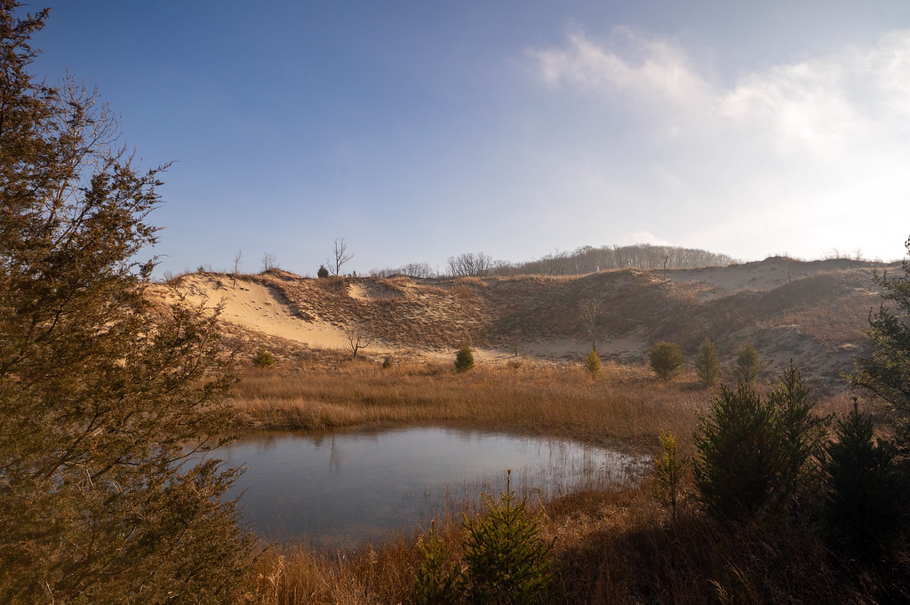 West Beach Trail - Three LoopsHikingPhoto: RuggyBearLA, CC BY 2.0 (via Flickr)1.8 mi
- Little Calumet River TrailHiking3.7 mi
- Cowles Bog TrailHiking4 mi
- Dlt N - Howe Rd to BroadwayHiking4.2 mi
- Lake Michigan Water TrailCanoeing4.7 mi
Source: Roamze catalog (indexable pages within 10 miles, PostGIS distance)
- Tolleston Dunes TrailHiking · ~3 min drivePhoto: hakkun, CC BY-SA 3.0 (via Wikimedia Commons)
 Dlt H - N. Lake to Midwest RdHiking · ~8 min drivePhoto: phcordner, CC BY-SA 2.0 (via Flickr)
- Dlt N - Howe Rd to BroadwayHiking · ~7 min drive
- West Beach Trail - Three LoopsHiking · ~3 min drivePhoto: RuggyBearLA, CC BY 2.0 (via Flickr)
- Glenwood Dunes Trail (Main)Hiking · ~15 min drive
- Glenwood Dunes TrailsHiking · ~14 min drive
- Calumet Dunes TrailHiking · ~16 min drive
- Dlt J - Midwest to HoweHiking · Next door
- Adt - Indiana (North) - G - Seg 3Hiking · ~32 min drive
- Glenwood Dunes Trail (Alternate)Hiking · ~16 min drive
Best time to visit Portage Lakefront and Riverwalk Trail
Best months: April–October. Best months have typical highs of 55–85 °F, lows of 30 °F or warmer (32 °F where the station doesn't record snow), at most one snowy day and no more than 12 wet days.
Jan
32° / 18°
12 wet
Feb
36° / 21°
10 wet
Mar
46° / 30°
11 wet
Apr
57° / 40°
11 wet
May
68° / 50°
12 wet
Jun
78° / 60°
11 wet
Jul
82° / 64°
10 wet
Aug
80° / 63°
10 wet
Sep
74° / 56°
10 wet
Oct
62° / 45°
11 wet
Nov
49° / 34°
11 wet
Dec
37° / 24°
12 wet
Typical high / low (°F) and days with rain or snow, 1991–2020. Measured at Indiana Dunes Nl, IN, 4.7 mi away at 680 ft. This station doesn't record snowfall. Source: NOAA NCEI U.S. Climate Normals 1991–2020.
Closures we've recorded since August 2026
Partial Trail Closure at Portage Lakefront and Riverwalk
Indiana Dunes National Park · seen Aug 23, 2026, no lift recorded · National Park Service
Map and trail data © OpenStreetMap contributors
