Weasel Point
- 4,545 ft
- summit
- Jul–Sep
- best months
Is Weasel Point open right now?
Closure in the area
There's a closure order in Nez Perce-Clearwater National Forest. It doesn't name Weasel Point, so check the source for the area it covers.
Updated 250 Road Closure
Agency closure covering Nez Perce-Clearwater National Forest · USFS · Nez Perce-Clearwater National Forest
Selway Falls Campground Closure
Agency alert covering Moose Creek Ranger District · Order 01-17-06-26-003 · USFS · Moose Creek Ranger District
O'Hara Beach Area Closure
Agency alert covering Moose Creek Ranger District · Order 01-17-06-26-00 · USFS · Moose Creek Ranger District
Laird Park Water Unavailable For 2026 Season
Agency alert covering Nez Perce-Clearwater National Forest · USFS · Nez Perce-Clearwater National Forest
As of · Source: USFS · Nez Perce-Clearwater National Forest. Agencies don't list every closure — check before you go.
Weasel Point is a summit of 4,545 feet in Idaho's Selway-Bitterroot Wilderness, within the Moose Creek Ranger District of the Nez Perce-Clearwater National Forest. The nearest town is Red River Hot Springs, about 21 miles away. Summer is the most comfortable time to visit. Typical averages from a nearby weather station at Elk City show July and August highs around 83°F with lows near 40°F and the fewest wet days of the year. Winter is cold, with January highs around 35°F and lows near 15°F. The Highline Ridge Trail passes just 0.8 miles from the summit, and the Mink Peak Trail and Three Links Creek Trail are each about 1.8 miles away. Paddlers can find Marten Creek roughly 2.8 miles off.
Conditions and forecast
Daily highs and lows, wind and the chance of precipitation at the summit for the next 7 days, from the Open-Meteo model.
- Summit elevation
- 4,545 ft
Elevation from USGS 3D Elevation Program terrain data (about 10 m resolution).
We don't know of a mapped trail or route to the summit of Weasel Point. Plan the approach with local maps, a guidebook or a local guide, and check conditions before you go.
Questions about Weasel Point
How tall is Weasel Point?
4,545 ft (1,385 m).
Is there a trail to the top of Weasel Point?
We don't know of a mapped trail or route to the summit. Plan the approach with local maps, a guidebook or a local guide.
- Highline Ridge TrailHiking0.8 mi
 Mink Peak TrailHikingPhoto: araddon, CC BY 2.0 (via Flickr)1.8 mi
- Three Links Creek TrailHikingPhoto: araddon, CC BY 2.0 (via Flickr)1.8 mi
- Martin Creek Crossing TrailHiking2 mi
- Marten CreekCanoeing2.8 mi
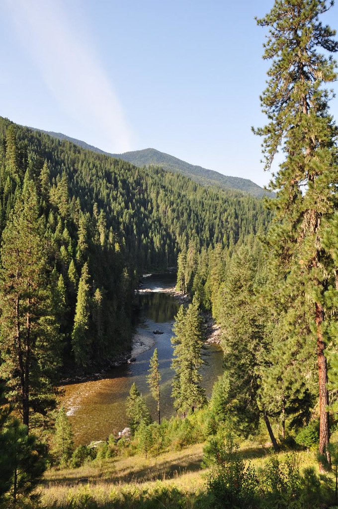 Old Selway River TrailHikingPhoto: araddon, CC BY 2.0 (via Flickr)3 mi
- MEEKER RIDGEHiking3.1 mi
- HALFWAY CREEKHiking4.7 mi
Source: Roamze catalog (indexable pages within 10 miles, PostGIS distance)
- Mink PeakSummit · ~4 min drive
- Meeker PointSummit · ~8 min drive
- Big Fog MountainSummit · ~12 min drive
- Shissler PeakSummit · ~15 min drive
- Vermilion PeakSummit · ~18 min drive
- Gedney MountainSummit · ~19 min drive
- Trout PeakSummit · ~20 min drive
- Barren HillSummit · ~23 min drive
- Archer PointSummit · ~24 min drive
- Horse PointSummit · ~24 min drive
Best time to visit Weasel Point
Best months: July–September. Best months have typical highs of 55–85 °F, lows of 30 °F or warmer (32 °F where the station doesn't record snow), at most one snowy day and no more than 12 wet days.
Jan
35° / 15°
16 wet
Feb
41° / 16°
13 wet
Mar
47° / 21°
15 wet
Apr
53° / 27°
16 wet
May
63° / 33°
15 wet
Jun
71° / 40°
14 wet
Jul
83° / 42°
8 wet
Aug
83° / 39°
6 wet
Sep
74° / 32°
7 wet
Oct
58° / 28°
12 wet
Nov
43° / 22°
15 wet
Dec
33° / 14°
16 wet
Typical high / low (°F) and days with rain or snow, 1991–2020. Measured at Elk City 1ne, ID, 25.3 mi away at 4,058 ft. This station doesn't record snowfall. Source: NOAA NCEI U.S. Climate Normals 1991–2020.
