Deer Creek Boat Ramp
- May–Sep
- best months
Is Deer Creek Boat Ramp open right now?
Closure in the area
There's a closure order in Boise National Forest. It doesn't name Deer Creek Boat Ramp, so check the source for the area it covers.
UPDATED Sept. 19 - Crooked Fire Area, Road, and Trail Closure
Agency closure covering Boise National Forest · Order 0402-03-140 · USFS · Boise National Forest
Lava Fire Road Closure
Agency alert covering Boise National Forest · Order 0402-06-84 · USFS · Boise National Forest
As of · Source: USFS · Boise National Forest. Agencies don't list every closure — check before you go.
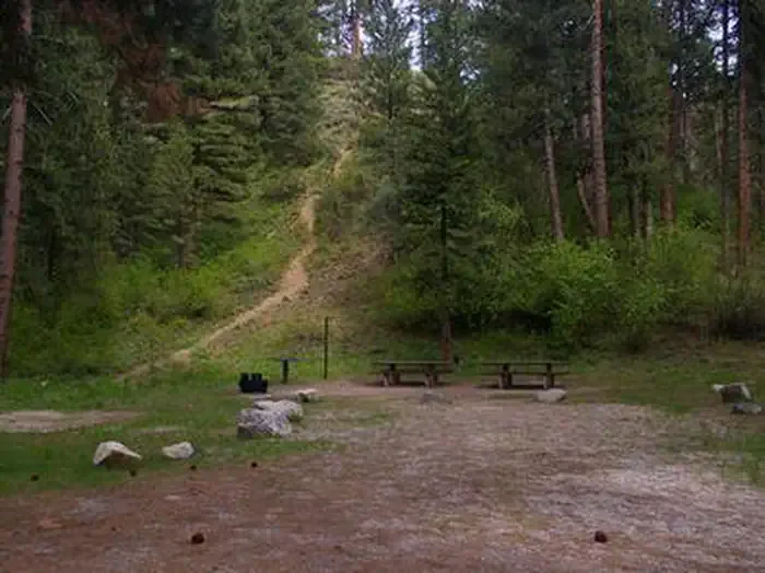
Deer Creek Boat Ramp is a Forest Service boat launch in the Mountain Home Ranger District of Boise National Forest in Idaho, about 1.7 miles from the town of Pine. It is a simple put-in point rather than a developed recreation site, and it is not reservable. Summer is the most comfortable time to visit. Typical averages from a nearby weather station show July and August highs around 85°F with lows in the mid-40s, and those months see the fewest wet days of the year. Pine Campground Boat Ramp sits about a mile away. Anderson Ranch Reservoir, about 3 miles off, offers lake fishing. Dog Creek Campground and the Lime Creek canoeing route are both within about 5 miles.
- Managed by
- Forest Service
- Pine Campground Boat RampCamping1 mi
- Anderson Ranch ReservoirLake fishing3 mi
- CAMP CREEKHiking3.9 mi
- Dog Creek CampgroundCamping4.5 mi
 Dog Creek (id)CampingPhoto: Recreation.gov (RIDB) / public domain4.6 mi
- Lime CreekCanoeing4.7 mi
- SLICKEAR RIDGEHiking4.9 mi
- Mineral CreekHiking5.2 mi
Source: Roamze catalog (indexable pages within 10 miles, PostGIS distance)
 Mores CreekCanoeing · ~1h 2m drivePhoto: U.S. Forest Service, Public domain (via Wikimedia Commons)
- Pine Airport Boat RampBoat launch · ~2 min drive
- Dog CreekFloat trip · ~8 min drive
 Grimes CreekCanoeing · ~1h 13m drivePhoto: Rickmouser45, CC BY-SA 4.0 (via Wikimedia Commons)
- Curlew Creek Boating SiteBoat launch · ~3 min drive
- Elks Flat CampgroundFloat trip · ~9 min drive
- North Fork Lime CreekCanoeing · ~14 min drive
- Fall Creek Boat RampBoat launch · ~9 min drive
- Spillway CampgroundFloat trip · ~18 min drive
- South Fork Lime CreekCanoeing · ~19 min drive
Best time to visit Deer Creek Boat Ramp
Best months: May–September. Best months have typical highs of 55–85 °F, lows of 30 °F or warmer (32 °F where the station doesn't record snow), at most one snowy day and no more than 12 wet days.
Jan
29° / 9°
11 wet
Feb
32° / 12°
8 wet
Mar
42° / 21°
8 wet
Apr
54° / 29°
8 wet
May
65° / 35°
8 wet
Jun
75° / 40°
6 wet
Jul
85° / 47°
4 wet
Aug
85° / 45°
3 wet
Sep
76° / 37°
4 wet
Oct
61° / 28°
5 wet
Nov
43° / 20°
9 wet
Dec
30° / 11°
11 wet
Typical high / low (°F) and days with rain or snow, 1991–2020. Measured at Hill City 1 W, ID, 15.9 mi away at 5,100 ft. The station sits about 900 ft higher than this place, so expect it a little warmer here. This station doesn't record snowfall. Source: NOAA NCEI U.S. Climate Normals 1991–2020.

