Camp Creek
- 5.6 mi
- round trip
- 3,815 ft
- climb
- 6,779 ft
- high point
- Out and back
- route
Is CAMP CREEK open right now?
Closure in the area
There's a closure order in Boise National Forest. It doesn't name CAMP CREEK, so check the source for the area it covers.
UPDATED Sept. 19 - Crooked Fire Area, Road, and Trail Closure
Agency closure covering Boise National Forest · Order 0402-03-140 · USFS · Boise National Forest
Lava Fire Road Closure
Agency alert covering Boise National Forest · Order 0402-06-84 · USFS · Boise National Forest
As of · Source: USFS · Boise National Forest. Agencies don't list every closure — check before you go.
Camp Creek is a hard out-and-back hike in Idaho's Boise National Forest, within the Mountain Home Ranger District. The trail is roughly 11 miles long, with a total elevation gain of about 3,800 feet, and it starts near 6,000 feet, rising to about 6,780 feet at its high point. The climb is steep right from the start, with a 32% grade at around 0.2 miles into the route. That makes the first part of the hike the most challenging, and it's worth going in with plenty of energy and supplies for the long day ahead. The trip takes about 5.5 hours to complete, and the round trip is roughly twice the one-way gain. Because of the high elevation, the weather up top can change quickly, so plan for conditions that match the higher end of the day. For an anchor, Ice Springs Campground sits about 2 miles away, and Dog Creek Campground is about 3.4 miles off. The Mineral Creek hike is close by at about 1.7 miles, and Anderson Ranch Reservoir is about 6 miles away for a change of pace.
Local outfitters
- Camp Perkins40 mi away
Not on Roamze yet. Their page has how to reach them.
- MINERAL CREEKHiking1.7 mi
- Ice Springs CampgroundCamping2.2 mi
- Dog Creek CampgroundCamping3.4 mi
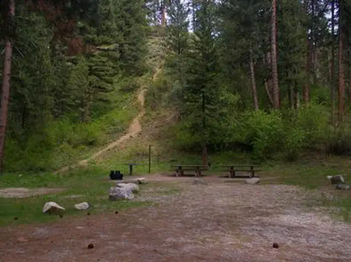 Dog Creek (id)CampingPhoto: Recreation.gov (RIDB) / public domain3.4 mi
- KNOX CREEKHiking4.6 mi
- GREEN CREEKHiking4.7 mi
- Anderson Ranch ReservoirLake fishing6 mi
- Lime CreekCanoeing8.6 mi
Source: Roamze catalog (indexable pages within 10 miles, PostGIS distance)
 GRANITE CREEKHiking · ~21 min drivePhoto: jburum, CC BY-SA 3.0 (via Wikimedia Commons)
- GREEN CREEKHiking · ~8 min drive
- Old Pack TrailHiking · ~13 min drive
- North Fork Lime Creek TrailHiking · ~21 min drive
- Mineral CreekHiking · ~3 min drive
- YELLOW PINE LOOPHiking · ~12 min drive
- DEER CREEK RIDGEHiking · ~15 min drive
- SHAKE CREEKHiking · ~23 min drive
- MEADOW CREEK LOOPHiking · ~10 min drive
- TRINITY CREEK LOWERHiking · ~18 min drive
