Lower Camp Ground
Campground
Campground · 1.1 mi from the trail
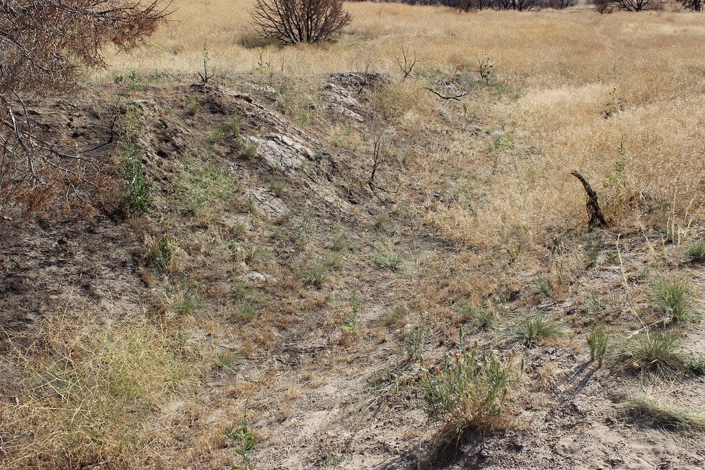 Photo: AllAroundTheWest, CC BY-SA 2.0 (via Flickr)
Wagon Rut Trail is a short, easy out-and-back hike in Massacre Rocks State Park in Idaho, managed by State Park and Recreation. The trail is about 0.66 miles long, with a total elevation gain of 235 feet, and it starts and ends at roughly 4,287 feet. The climb is steady, with the steepest stretch at about 0.16 miles in, and the high point reaches 4,330 feet. The most comfortable months for a visit are typically June and September. A nearby weather station records typical average highs of 78°F in June and 77°F in September, with lows around 46°F and 43°F. July and August are warmer, with typical highs near 89°F. The trip takes about half an hour. Canyon Trail lies about 0.8 miles away, and the Ancient Cluster and Hindu climbing areas are each about 1.1 miles off. Pipeline Campground, about 4.9 miles away, is the closest place to camp.
Lower Camp Ground
Campground
Ringo's Tavern
Sports bar
Places © Overture Maps Foundation
More in American FallsNot on Roamze yet. Their page has how to reach them.
 Canyon TrailHikingPhoto: Matt Lavin, CC BY-SA 2.0 (via Flickr)0.8 miRiver TrailHikingPhoto: Matt Lavin, CC BY-SA 2.0 (via Flickr)1.1 mi
 Pohogwe TrailHikingPhoto: Matt Lavin, CC BY-SA 2.0 (via Flickr)1.3 mi
Source: Roamze catalog (indexable pages within 10 miles, PostGIS distance)
Canyon TrailHiking · ~1 min drivePhoto: Matt Lavin, CC BY-SA 2.0 (via Flickr) Birch CreekHiking · ~40 min drivePhoto: JF Hobbs, CC BY 3.0 (via Wikimedia Commons)
 Sterling JusticeHiking · ~46 min drivePhoto: JF Hobbs, CC BY 3.0 (via Wikimedia Commons)River TrailHiking · ~2 min drivePhoto: Matt Lavin, CC BY-SA 2.0 (via Flickr)
 Rocky KnollHiking · ~42 min drivePhoto: JF Hobbs, CC BY 3.0 (via Wikimedia Commons)Pohogwe TrailHiking · ~2 min drivePhoto: Matt Lavin, CC BY-SA 2.0 (via Flickr)
 EAST WILD HORSE MTN. TRAILHiking · ~43 min drivePhoto: JF Hobbs, CC BY 3.0 (via Wikimedia Commons)
Best months: April–June and September–October. Best months have typical highs of 55–85 °F, lows of 30 °F or warmer (32 °F where the station doesn't record snow), at most one snowy day and no more than 12 wet days.
Jan
35° / 17°
10 wet
Feb
39° / 21°
9 wet
Mar
51° / 27°
9 wet
Apr
59° / 33°
10 wet
May
68° / 39°
10 wet
Jun
78° / 46°
7 wet
Jul
89° / 53°
5 wet
Aug
88° / 52°
6 wet
Sep
77° / 43°
6 wet
Oct
62° / 34°
7 wet
Nov
47° / 24°
9 wet
Dec
35° / 18°
10 wet
Typical high / low (°F) and days with rain or snow, 1991–2020. Measured at Massacre Rocks Sp, ID, 2.1 mi away at 4,195 ft. This station doesn't record snowfall. Source: NOAA NCEI U.S. Climate Normals 1991–2020.
Map and trail data © OpenStreetMap contributors


