Valley Creek Cut-Off
- 0.7 mi
- round trip
- 140 ft
- climb
- 6,818 ft
- high point
- Out and back
- route
- Jul–Aug
- best months
Is VALLEY CREEK CUT-OFF open right now?
Alert in the area
The Forest Service lists an alert for Salmon-Challis National Forest.
Stoddard Bridge Construction Closure
Agency alert covering Salmon-Challis National Forest · Order 0413-07-17 · USFS · Salmon-Challis National Forest
As of · Source: USFS · Salmon-Challis National Forest. Agencies don't list every closure — check before you go.
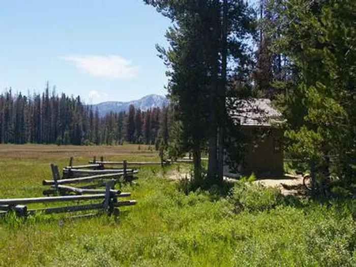
Valley Creek Cut-Off is a short, easy out-and-back hike in Idaho's Salmon-Challis National Forest, within the Challis-Yankee Fork Ranger District. The trail is managed by the Forest Service and sits at about 6,800 feet, with a high point of 6,818 feet and a low of 6,774 feet. The route is 1.5 miles long, and the total elevation gain is 140 feet, so it works well as a quick stop or a warm-up before heading to Valley Creek, which lies about 0.2 miles away. Summer is the most comfortable time to go. Typical averages from the nearby Stanley weather station, which sits about 570 feet lower, show July highs around 80°F with lows near 34°F. Winter is harsh, with January highs around 26°F and lows near -3°F. The trip takes about half an hour. Trap Creek Campground, about 3 miles away, and Sheep Trail Campground, about 3.4 miles away, are the closest places to camp. The Trap Creek Trail and the Cape Horn Trail to Guard Stat are also within about 4 miles.
Local outfitters
- The Sawmill Station30 mi away
- Camp Perkins31 mi away
Not on Roamze yet. Their page has how to reach them.
- VALLEY CREEKHiking0.2 mi
 Trap Creek CampgroundCampingPhoto: Recreation.gov (RIDB) / public domain3 mi
- Cape Horn Winter RentalCamping3.1 mi
- Sheep Trail CampgroundCamping3.4 mi
- Trap Creek TrailHiking3.5 mi
- CAPE HORN TRAIL, TO GUARD STATHiking3.9 mi
- Marsh CreekCanoeing4.3 mi
- Beaver CreekCanoeing6.3 mi
Source: Roamze catalog (indexable pages within 10 miles, PostGIS distance)
 LUPINE LOOP SKIHiking · ~9 min drivePhoto: BY-YOUR-⌘ from Spain, CC BY 2.0 (via Wikimedia Commons)
 ELK MOUNTAIN CUTOFFHiking · ~12 min drivePhoto: Argyleist from Sugarhood, Utah, USA, CC BY 2.0 (via Wikimedia Commons)
 ELK MOUNTAINHiking · ~12 min drivePhoto: Fredlyfish4 at English Wikipedia, Public domain (via Wikimedia Commons)
 SEGO LOOP SKIHiking · ~9 min drivePhoto: treegrow, CC BY 2.0 (via Flickr)
- Alpine Way TrailHiking · ~14 min drivePhoto: Fredlyfish4 at English Wikipedia, Public domain (via Wikimedia Commons)
 ELK MOUNTAIN LOOKOUTHiking · ~13 min drivePhoto: Stephen Hanafin from Twin Falls, ID, United States, CC BY-SA 2.0 (via Wikimedia Commons)
- Iron Creek-Stanley Lake TrailHiking · ~13 min drivePhoto: Fredlyfish4 at English Wikipedia, Public domain (via Wikimedia Commons)
- SWAMP CREEKHiking · ~7 min drive
 LITTLE BASIN CREEKHiking · ~13 min drivePhoto: U.S. Forest Service employees, Public domain (via Wikimedia Commons)
- KELLY CREEK TRAILHiking · ~15 min drivePhoto: U.S. Forest Service employees, Public domain (via Wikimedia Commons)
Best time to visit VALLEY CREEK CUT-OFF
Best months: July–August. Best months have typical highs of 55–85 °F, lows of 30 °F or warmer (32 °F where the station doesn't record snow), at most one snowy day and no more than 12 wet days.
Jan
26° / -3°
Feb
33° / -1°
Mar
43° / 9°
Apr
50° / 18°
May
60° / 26°
Jun
69° / 31°
Jul
80° / 34°
Aug
79° / 32°
Sep
70° / 25°
Oct
56° / 19°
Nov
38° / 10°
Dec
25° / -2°
Typical high / low (°F) and days with rain or snow, 1991–2020. Measured at Stanley, ID, 11.2 mi away at 6,249 ft. The station sits about 600 ft lower than this place, so expect it a little cooler here. This station doesn't record snowfall. Source: NOAA NCEI U.S. Climate Normals 1991–2020.
