Lupine Ridge
- 0.7 mi
- round trip
- 315 ft
- climb
- 6,958 ft
- high point
- Out and back
- route
- May–Sep
- best months
Is LUPINE RIDGE open right now?
Closure in the area
There's a closure order in Boise National Forest. It doesn't name LUPINE RIDGE, so check the source for the area it covers.
UPDATED Sept. 19 - Crooked Fire Area, Road, and Trail Closure
Agency closure covering Boise National Forest · Order 0402-03-140 · USFS · Boise National Forest
Lava Fire Road Closure
Agency alert covering Boise National Forest · Order 0402-06-84 · USFS · Boise National Forest
As of · Source: USFS · Boise National Forest. Agencies don't list every closure — check before you go.
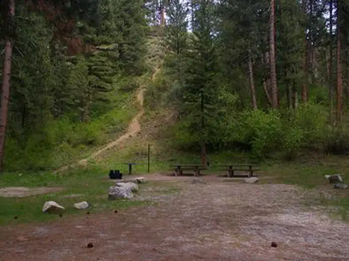
Lupine Ridge is a short, easy hike in Idaho's Boise National Forest, within the Mountain Home Ranger District. The Forest Service manages the land, and the trail's low point sits at about 6,785 feet. The climb is front-loaded, with the steepest stretch at around 0.26 miles from the start, and the high point reaches 6,958 feet. The route is out and back, about 1.3 miles long, with a total elevation gain of 315 feet. The most comfortable months for a visit are July and August, when typical averages from a nearby weather station in Ketchum run to highs around 80°F and lows in the mid-40s. That station sits roughly 1,000 feet lower than the ridge, so expect cooler temperatures on the trail. The trip takes about half an hour. The closest neighbors are N Fork Deer Creek, about 1.3 miles away, and the Yellow Pine Loop at 1.5 miles. For an overnight stay, Elks Flat Campground is about 4.6 miles off.
Local outfitters
- Camp Perkins34 mi away
Not on Roamze yet. Their page has how to reach them.
- N FORK DEER CREEKHiking1.3 mi
- YELLOW PINE LOOPHiking1.5 mi
- DEER CREEK RIDGEHiking1.6 mi
- North Fork Lime CreekCanoeing4.2 mi
 Elks Flat CampgroundCampingPhoto: Recreation.gov (RIDB) / public domain4.6 mi
- Dog Creek CampgroundCamping5 mi
 Dog Creek (id)CampingPhoto: Recreation.gov (RIDB) / public domain5 mi
- Lime CreekCanoeing6.7 mi
Source: Roamze catalog (indexable pages within 10 miles, PostGIS distance)
 Jumbo CreekHiking · ~15 min drivePhoto: Fredlyfish4, CC BY-SA 4.0 (via Wikimedia Commons)
- WEST FORK BEAVER CREEKHiking · ~15 min drivePhoto: Fredlyfish4, CC BY-SA 4.0 (via Wikimedia Commons)
- Big Water GulchHiking · ~19 min drivePhoto: Fredlyfish4, CC BY-SA 4.0 (via Wikimedia Commons)
- North Fork Lime Creek TrailHiking · ~11 min drive
- YELLOW PINE LOOPHiking · ~2 min drive
- N FORK DEER CREEKHiking · ~2 min drive
- DEER CREEK RIDGEHiking · ~3 min drive
- SHAKE CREEKHiking · ~13 min drive
- GREEN CREEKHiking · ~8 min drive
- LITTLE DEER CREEKHiking · ~4 min drive
Best time to visit LUPINE RIDGE
Best months: May–September. Best months have typical highs of 55–85 °F, lows of 30 °F or warmer (32 °F where the station doesn't record snow), at most one snowy day and no more than 12 wet days.
Jan
31° / 8°
10 wet · 9 snow
Feb
35° / 11°
9 wet · 7 snow
Mar
43° / 19°
8 wet · 5 snow
Apr
52° / 27°
7 wet · 2 snow
May
62° / 35°
8 wet
Jun
70° / 40°
7 wet
Jul
80° / 45°
5 wet
Aug
79° / 43°
4 wet
Sep
69° / 36°
4 wet
Oct
56° / 28°
5 wet · 1 snow
Nov
41° / 17°
7 wet · 4 snow
Dec
30° / 9°
10 wet · 9 snow
Typical high / low (°F) and days with rain or snow, 1991–2020. Measured at Ketchum Rs, ID, 43.8 mi away at 5,890 ft. The station sits about 1,100 ft lower than this place, so expect it a little cooler here. Source: NOAA NCEI U.S. Climate Normals 1991–2020.
