Bernard Creek Trail
- 6.4 mi
- round trip
- 7,618 ft
- climb
- 6,008 ft
- high point
- Out and back
- route
- May–Sep
- best months
Is Bernard Creek Trail open right now?
Closure in the area
There's a closure order in Wallowa-Whitman National Forest. It doesn't name Bernard Creek Trail, so check the source for the area it covers.
Anthony Fire Area Closure
Agency closure covering Wallowa-Whitman National Forest · USFS · Wallowa-Whitman National Forest
PHASE B FIRE RESTRICTIONS WALLOW-WHITMAN NATIONAL FOREST
Agency alert covering Wallowa-Whitman National Forest · Order 06-16-00-25-01 · USFS · Wallowa-Whitman National Forest
PHASE A FIRE RESTRICTIONS Wallowa-Whitman NATIONAL FOREST
Agency alert covering Wallowa-Whitman National Forest · Order 06-16-00-25-00 · USFS · Wallowa-Whitman National Forest
As of · Source: USFS · Wallowa-Whitman National Forest. Agencies don't list every closure — check before you go.
Bernard Creek Trail is a 12.7-mile out-and-back hike in Idaho's Hells Canyon National Recreation Area, part of the Wallowa-Whitman National Forest. The route starts at 1,384 feet and climbs to 6,008 feet, with a total gain of 7,618 feet over the round trip. The climb is front-loaded, and the steepest stretch comes at about 3 miles in, where the grade reaches 47%. The trail is rated expert, and the trip is estimated to take about 8 hours. Summer is the most comfortable time to go. Typical averages from a nearby weather station in McCall, Idaho, show July and August highs around 81°F with only about five wet days a month, while winter brings highs near 30°F and regular snow days. The Snake River Trail lies less than a mile away, and the Four Mile Trail and Hat Point Trail are within about 3.5 miles. For paddling, Sheep Creek is about 4.8 miles off.
Local outfitters
- Oregon Backcountry Outfitting30 mi away
- Eagle Cap Mountain Guides39 mi away
Not on Roamze yet. Their page has how to reach them.
- Snake River TrailHiking0.9 mi
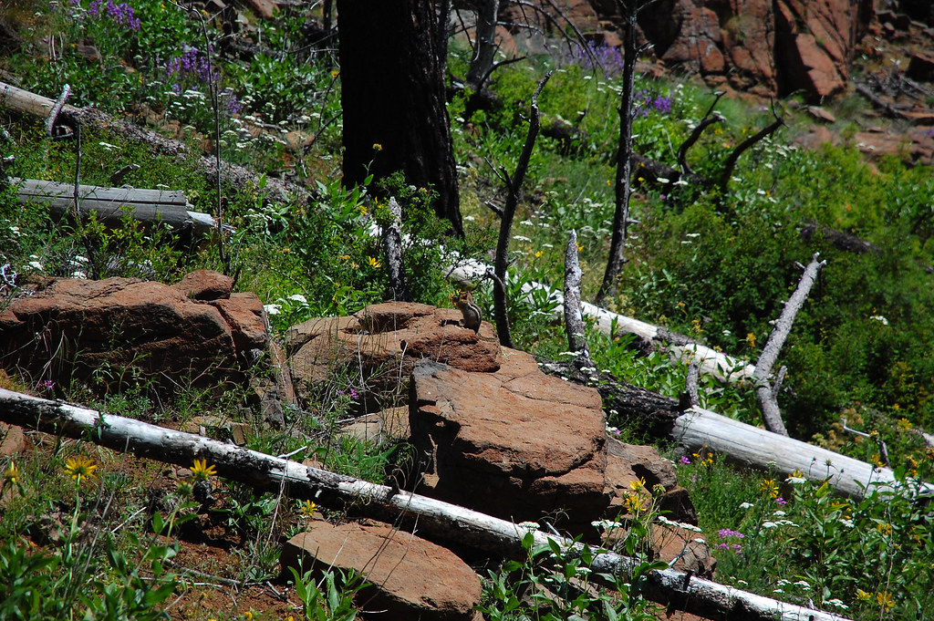 Four Mile TrailHikingPhoto: ilya_ktsn, CC BY 2.0 (via Flickr)2.4 mi
 Hat Point TrailHikingPhoto: ilya_ktsn, CC BY 2.0 (via Flickr)3.5 mi
- Sheep CreekCanoeing4.8 mi
- Saddle Creek CampgroundCamping5.4 mi
- Undertow WallRock climbing7.8 mi
- Funky Buddha AreaRock climbing7.8 mi
- Granite CreekCanoeing8.8 mi
Source: Roamze catalog (indexable pages within 10 miles, PostGIS distance)
- Four Mile TrailHiking · ~4 min drivePhoto: ilya_ktsn, CC BY 2.0 (via Flickr)
- Hat Point TrailHiking · ~6 min drivePhoto: ilya_ktsn, CC BY 2.0 (via Flickr)
 Bernard Lakes TrailHiking · ~7 min drivePhoto: David Dugan, CC BY-SA 3.0 (via Wikimedia Commons)
 Heaven's Gate TrailHiking · ~10 min drivePhoto: David Dugan, CC BY-SA 3.0 (via Wikimedia Commons)
 Little Granite Creek TrailHiking · ~7 min drivePhoto: Sam Beebe/Ecotrust, CC BY-SA 3.0 (via Wikimedia Commons)
 He Devil Climber's TrailHiking · ~10 min drivePhoto: David Dugan, CC BY-SA 3.0 (via Wikimedia Commons)
- Dry Diggins Ridge TrailHiking · ~7 min drivePhoto: David Dugan, CC BY-SA 3.0 (via Wikimedia Commons)
- Cannon Lakes TrailHiking · ~13 min drivePhoto: David Dugan, CC BY-SA 3.0 (via Wikimedia Commons)
- Devils Farm TrailHiking · ~8 min drivePhoto: Sam Beebe/Ecotrust, CC BY-SA 3.0 (via Wikimedia Commons)
- Old Timer TrailHiking · ~8 min drive
Best time to visit Bernard Creek Trail
Best months: May–September. Best months have typical highs of 55–85 °F, lows of 30 °F or warmer (32 °F where the station doesn't record snow), at most one snowy day and no more than 12 wet days.
Jan
31° / 13°
14 wet · 11 snow
Feb
36° / 14°
12 wet · 9 snow
Mar
43° / 20°
13 wet · 7 snow
Apr
51° / 27°
12 wet · 3 snow
May
61° / 35°
12 wet · 1 snow
Jun
70° / 40°
10 wet
Jul
81° / 45°
5 wet
Aug
81° / 43°
5 wet
Sep
72° / 36°
6 wet
Oct
57° / 28°
9 wet · 2 snow
Nov
40° / 21°
13 wet · 7 snow
Dec
30° / 13°
15 wet · 12 snow
Typical high / low (°F) and days with rain or snow, 1991–2020. Measured at Mccall, ID, 43.3 mi away at 5,025 ft. The station sits about 1,000 ft lower than this place, so expect it a little cooler here. Source: NOAA NCEI U.S. Climate Normals 1991–2020.
Map and trail data © OpenStreetMap contributors
