Georgia · Hiking
Deerstand Trail
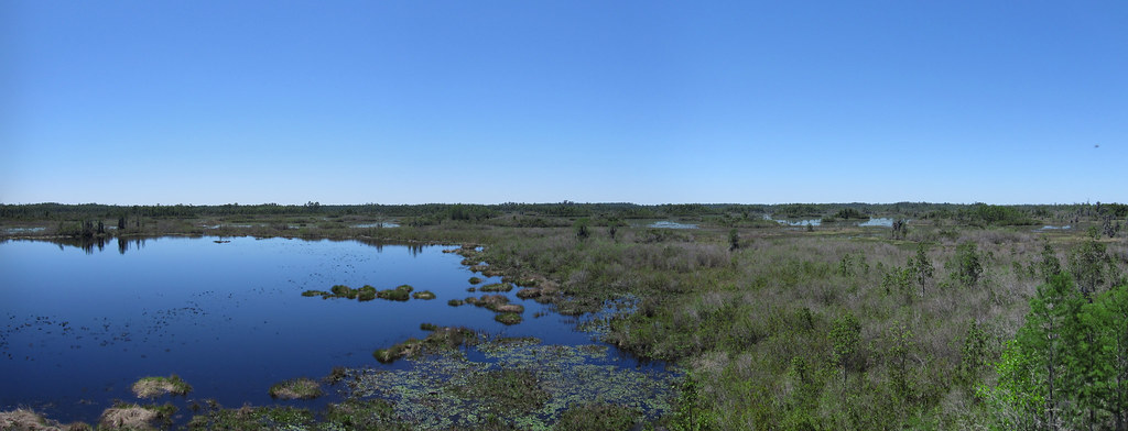 Photo: cm195902, CC BY 2.0 (via Flickr)
- 0.5 mi
- round trip
- 128 ft
- high point
- Out and back
- route
- Easy
- difficulty
- Oct–Apr
- best months
Loading this week's forecast
Deerstand Trail is a short out-and-back hike in Georgia covering 0.47 miles with a maximum elevation of 128 feet. The trail follows an out-and-back route type.
 Chesser Island BoardwalkHiking · Next doorPhoto: pseabolt, CC BY 3.0 (via Wikimedia Commons)
- Ralph E Simmons Memorial State Forest TrailHiking · ~23 min drive
- Old Alachua TrailHiking · ~28 min drive
 Canal Diggers TrailHiking · ~4 min drivePhoto: pseabolt, CC BY 3.0 (via Wikimedia Commons)
- River Glen SidewalkHiking · ~53 min drive
- GREEN HORSE TRAILHiking · ~1h 1m drive
 Billys Island TrailHiking · ~22 min drivePhoto: ken ratcliff, CC BY 2.0 (via Flickr)
 Trembling Earth Nature TrailHiking · ~24 min drivePhoto: ken ratcliff, CC BY 2.0 (via Flickr)
- Chesser Island Homestead Nature TrailHiking · Next doorPhoto: cm195902, CC BY 2.0 (via Flickr)
- Ralph E. Simmons Memorial State Forest TrailHiking · ~23 min drive
Best time to visit Deerstand Trail
Best months: October–April. Best months have typical highs of 55–85 °F, lows of 30 °F or warmer (32 °F where the station doesn't record snow), at most one snowy day and no more than 12 wet days.
Jan
67° / 44°
9 wet
Feb
70° / 46°
8 wet
Mar
76° / 51°
8 wet
Apr
83° / 57°
7 wet
May
88° / 64°
8 wet
Jun
93° / 70°
13 wet
Jul
94° / 73°
15 wet
Aug
93° / 73°
14 wet
Sep
90° / 70°
11 wet
Oct
83° / 61°
8 wet
Nov
75° / 52°
6 wet
Dec
68° / 46°
8 wet
Typical high / low (°F) and days with rain or snow, 1991–2020. Measured at Folkston 9 Sw, GA, 2.8 mi away at 120 ft. Source: NOAA NCEI U.S. Climate Normals 1991–2020.

