Cumberland Island National Seashore Camping Permits
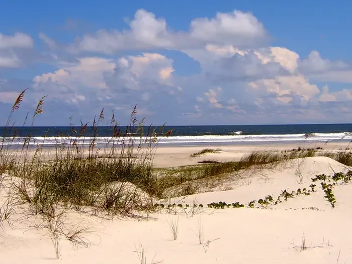 Photo: Recreation.gov (RIDB) / public domain
- 47
- sites
- Oct–May
- best months
Is Cumberland Island National Seashore Camping Permits open right now?
Alert in the area
The National Park Service lists an alert for Cumberland Island National Seashore.
Scam Warning - Book ferry tickets through concessioner site only
Park alert covering Cumberland Island National Seashore · NPS · Cumberland Island National Seashore
As of · Source: NPS · Cumberland Island National Seashore. Agencies don't list every closure — check before you go.
- 47 sites for group campingReservable on Recreation.gov
- At 6 ft
- Near St. MarysCumberland Island National Seashore
Whether you are looking to spend a night with family and friends around a campfire under the moss covered branches of the live oak trees, or looking for the rugged challenges and solitude of the wilderness, you will find it on Cumberland Island National Seashore. The park includes a designated Wilderness area, undeveloped beaches, historic sites, cultural ruins, critical habitat and nesting areas, as well as numerous plant and animal communities. The national seashore also offers a wide variety of camping opportunities. Watch the "Camping on Cumberland Island" video for information to help you plan an d prepare for your trip. Campgrounds Cumberland Island offers five campgrounds , which include designated campsites at Sea Camp and Stafford Beach; and Wilderness campsites at: Hickory Hill, Yankee Paradise and Brickhill Bluff. Camping is only permitted in these five campgrounds. A permit is required to camp in any of these five camping areas.
 Parallel TrailHikingPhoto: Rob Bixby, CC BY 2.0 (via Flickr)5.2 mi
 Beach Creek TrailHikingPhoto: Douglas Goldman, CC BY-SA 4.0 (via Wikimedia Commons)5.2 mi
- Dungeness CrossingHikingPhoto: Douglas Goldman, CC BY-SA 4.0 (via Wikimedia Commons)5.3 mi
- Sea Camp TrailHikingPhoto: Rob Bixby, CC BY 2.0 (via Flickr)5.6 mi
- Fort Clinch State Park TrailHiking5.7 mi
- South Point TrailHiking5.8 mi
- Hiking and Biking TrailHiking5.9 mi
 Ranger Station TrailHikingPhoto: djuggler, CC BY-SA 2.0 (via Flickr)6 mi
Source: Roamze catalog (indexable pages within 10 miles, PostGIS distance)
 Love's RV HookupCamping · ~33 min drivePhoto: qwesy qwesy, CC BY 3.0 (via Wikimedia Commons)
 Jenny Ridge RV ParkCamping · ~47 min drivePhoto: Michael Rivera, CC BY-SA 4.0 (via Wikimedia Commons)
- Okefenokee National Wildlife Refuge Overnight Camping PermitCamping · ~1h 18m drive
- Eagle Hammock RV ParkCamping · ~6 min drive
- Sea Camp CampgroundCamping · ~10 min drive
- Group Camp 3Camping · ~11 min drive
- Group Camp 2Camping · ~11 min drive
- Primitive Group Camp (Youth)Camping · ~11 min drive
- Group Camp 1Camping · ~11 min drive
- KOA HolidayCamping · ~11 min drive
Best time to visit Cumberland Island National Seashore Camping Permits
Best months: October–May. Best months have typical highs of 55–85 °F, lows of 30 °F or warmer (32 °F where the station doesn't record snow), at most one snowy day and no more than 12 wet days.
Jan
64° / 45°
9 wet
Feb
67° / 49°
8 wet
Mar
72° / 54°
8 wet
Apr
77° / 60°
7 wet
May
84° / 68°
7 wet
Jun
88° / 73°
11 wet
Jul
91° / 75°
13 wet
Aug
90° / 75°
13 wet
Sep
86° / 73°
12 wet
Oct
80° / 65°
8 wet
Nov
72° / 56°
7 wet
Dec
66° / 49°
9 wet
Typical high / low (°F) and days with rain or snow, 1991–2020. Measured at Fernandina Beach, FL, 6.9 mi away at 49 ft. Source: NOAA NCEI U.S. Climate Normals 1991–2020.
Cumberland Island National Seashore Camping Permits
47 sites for group camping
