East Slough Ada Hikiing Trail
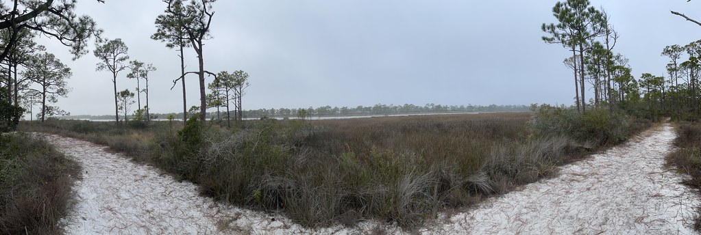 Photo: Dreaming in the deep south, CC BY 2.0 (via Flickr)
- 1.6 mi
- one way
- 11 ft
- high point
- Point to point
- route
- Easy
- difficulty
- Oct–May
- best months
East Slough Ada Hikiing Trail is a 1.55-mile point-to-point hike in Florida with 84 feet of elevation loss. The trail reaches a maximum elevation of 11 feet.
- Nearby · Maritime Hammock Trail · Gf&a · Fnst - Lake George Section - Florida
Best time to go · Oct–May
Best time to visit East Slough Ada Hikiing Trail
Best months: October–May. Best months have typical highs of 55–85 °F, lows of 30 °F or warmer (32 °F where the station doesn't record snow), at most one snowy day and no more than 12 wet days.
Jan
64° / 44°
7 wet
Feb
67° / 46°
7 wet
Mar
72° / 52°
7 wet
Apr
77° / 57°
5 wet
May
85° / 65°
4 wet
Jun
90° / 73°
9 wet
Jul
92° / 75°
12 wet
Aug
91° / 75°
12 wet
Sep
88° / 71°
9 wet
Oct
82° / 62°
5 wet
Nov
74° / 51°
5 wet
Dec
67° / 46°
6 wet
Typical high / low (°F) and days with rain or snow, 1991–2020. Measured at Apalachicola Airport, FL, 15.9 mi away at 20 ft. Source: NOAA NCEI U.S. Climate Normals 1991–2020.
Keep exploring — more trails worth the drive
 Photo: Numinosity by Gary J Wood, CC BY-SA 2.0 (via Flickr)
Maritime Hammock Trail
~1h 6m drive
0.46-mile point-to-point trail in Florida with 34 ft elevation loss
 Photo: The Bushranger, CC BY-SA 3.0 (via Wikimedia Commons)
Gf&a
~1h 22m drive
4.80-mile out-and-back trail in Florida with 164 ft gain.
HIKE
Fnst - Lake George Section - Florida
~55 min drive
A 98-mile point-to-point Florida National Scenic Trail section through central Florida wilderness.
HIKE
Florida National Scenic Trail - Panhandle Region
~1h 25m drive
Epic 416-mile point-to-point trail through Florida's panhandle wilderness.
 Photo: Mike Tilley, CC BY 3.0 (via Wikimedia Commons)
Bayview Scenic Trail
~1h 7m drive
Bayview Scenic Trail is a 0.61-mile point-to-point trail in Florida with 31 feet of elevation loss.
 Photo: Mike Tilley, CC BY 3.0 (via Wikimedia Commons)
Sally Ward Trail
~1h 17m drive
3.47-mile out-and-back trail in Florida with 199 ft elevation gain.
HIKE
EQUESTRIAN TRAIL - MAIN LOOP
~1h 25m drive
16.89-mile loop trail in Florida with 627 ft elevation gain and loss.
HIKE
Apalachicola River Wildlife and Environmental Area Trail
~18 min drive
0.44-mile loop in Florida with 35 ft gain and loss.
HIKE
Florida Trail
~1h 15m drive
9.62-mile point-to-point trail in Florida with 509 ft gain.
HIKE
Wiregrass-Genetian
~37 min drive
0.90-mile loop trail in Florida with 121 ft elevation gain.

Map and trail data © OpenStreetMap contributors
