Blue Trail
- 1.5 mi
- one way
- 286 ft
- climb
- 372 ft
- high point
- Point to point
- route
- Apr, Jun–Oct
- best months
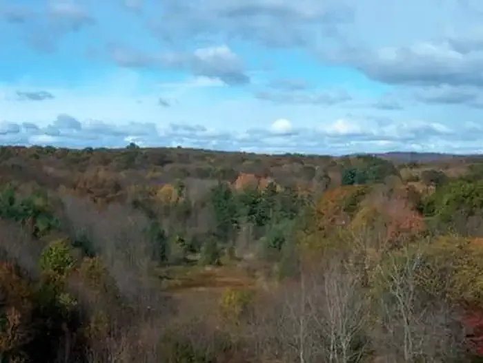
Blue Trail is a 1.5-mile loop hike in Connecticut, about 0.6 miles from the town of South Britain. The trail rises from a low point of 152 feet to a high of 372 feet, with a total elevation gain of 286 feet. The climb is rated easy, and the route is a loop, so you return to your starting point. The trail is short and straightforward, taking about half an hour to complete. The steepest stretch comes at about 1.3 miles in, where the grade reaches 26 percent. The total descent is 371 feet, which makes the loop a little longer on the way down than on the way up. For comfortable weather, aim for late spring or early fall. Typical averages from a nearby weather station in Danbury show May highs around 72°F and September highs around 75°F, with September also seeing the fewest wet days of the year. The Red Trail and Orange Trail both start about 0.3 miles away, and the Yellow Trail is about half a mile off. Kettletown State Park, a climbing area, is roughly 3.9 miles away.
- Red TrailHiking0.3 mi
- Orange TrailHiking0.3 mi
- Yellow TrailHiking0.5 mi
 Kettletown State ParkRock climbingPhoto: H. Morrow Long, CC BY-SA 3.0 (via Wikimedia Commons)3.9 mi
- Pomperaug RiverCanoeing4.9 mi
- Webb Mountain ParkRock climbing7.1 mi
- Blue Trail SectionRock climbing7.3 mi
 Hop Brook Lake Recreation AreaCampingPhoto: Recreation.gov (RIDB) / public domain9.7 mi
Source: Roamze catalog (indexable pages within 10 miles, PostGIS distance)
 Miller TrailHiking · ~5 min drivePhoto: H. Morrow Long, CC BY-SA 3.0 (via Wikimedia Commons)
 Larkin State Park TrailHiking · ~6 min drivePhoto: Dougtone, CC BY-SA 2.0 (via Flickr)
 Mission 22 TrailHiking · ~15 min drivePhoto: bellemarematt, CC BY-SA 2.0 (via Flickr)
- Pomperaug TrailHiking · ~6 min drivePhoto: H. Morrow Long, CC BY-SA 3.0 (via Wikimedia Commons)
 Zoar TrailHiking · ~7 min drivePhoto: H. Morrow Long, CC BY-SA 3.0 (via Wikimedia Commons)
- Al's TrailHiking · ~9 min drive
 Crest TrailHiking · ~6 min drivePhoto: Csouthard, CC BY-SA 3.0 (via Wikimedia Commons)
- Lillinoah TrailHiking · ~7 min drive
 Red TrailHiking · ~7 min drivePhoto: bellemarematt, CC BY-SA 2.0 (via Flickr)
- Paugussett TrailHiking · ~12 min drive
Best time to visit Blue Trail
Best months: April and June–October. Best months have typical highs of 55–85 °F, lows of 30 °F or warmer (32 °F where the station doesn't record snow), at most one snowy day and no more than 12 wet days.
Jan
36° / 21°
12 wet · 8 snow
Feb
39° / 22°
11 wet · 6 snow
Mar
48° / 29°
13 wet · 5 snow
Apr
61° / 39°
12 wet · 1 snow
May
72° / 49°
13 wet
Jun
80° / 59°
12 wet
Jul
85° / 64°
11 wet
Aug
82° / 63°
10 wet
Sep
75° / 55°
9 wet
Oct
62° / 43°
10 wet
Nov
50° / 34°
10 wet · 2 snow
Dec
40° / 26°
12 wet · 5 snow
Typical high / low (°F) and days with rain or snow, 1991–2020. Measured at Danbury, CT, 10.3 mi away at 405 ft. Source: NOAA NCEI U.S. Climate Normals 1991–2020.
Map and trail data © OpenStreetMap contributors
