Wetherill Mesa
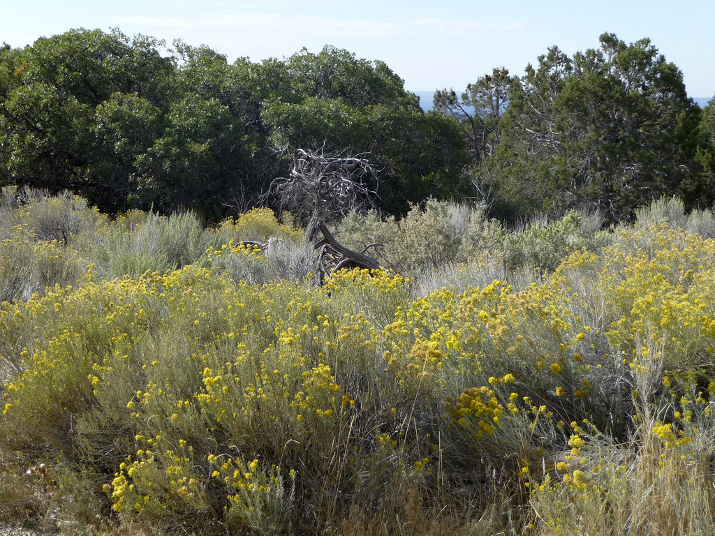
 Photo: Ken Lund from Las Vegas, Nevada, USA, CC BY-SA 2.0 (via Wikimedia Commons)
- 7,668 ft
- summit
- National Park Service
- managed by
- Apr–Oct
- best months
Is Wetherill Mesa open right now?
No closures listed
The National Park Service lists no closures for Mesa Verde National Park.
As of · Source: NPS · Mesa Verde National Park. Agencies don't list every closure — check before you go.
Wetherill Mesa is a summit of 7,668 feet in Mesa Verde National Park in Colorado, managed by the National Park Service. The nearest town is Cortez, about 8 miles away. Late spring and early fall are the most comfortable times to visit. Typical averages from a nearby weather station in Cortez show May highs around 65°F and September highs around 71°F, with July the warmest month at about 82°F. That station sits a few hundred feet higher than the summit, so temperatures on the mesa run slightly warmer. Several trails lie close by. Far View Community Sites is about 2.6 miles away and the Nordenskiold Site Overlook Trail about 3 miles. For climbing, Cortez - Hawkins Preserve is roughly 7 miles off, and Sleeping Ute RV Park offers camping about 8 miles away.
Conditions and forecast
Daily highs and lows, wind and the chance of precipitation at the summit for the next 7 days, from the Open-Meteo model.
- Summit elevation
- 7,668 ft
- Land manager
- National Park Service
Elevation from USGS 3D Elevation Program terrain data (about 10 m resolution).
We don't know of a mapped trail or route to the summit of Wetherill Mesa. Plan the approach with local maps, a guidebook or a local guide, and check conditions before you go.
Questions about Wetherill Mesa
How tall is Wetherill Mesa?
7,668 ft (2,337 m).
Is there a trail to the top of Wetherill Mesa?
We don't know of a mapped trail or route to the summit. Plan the approach with local maps, a guidebook or a local guide.
 Hesperus Mountain13,232 ft · Colorado1 route29 mi awayPhoto: Aroundwithme, CC BY-SA 4.0 (via Wikimedia Commons)
 Mount Moss13,183 ft · Colorado1 route30 mi awayPhoto: Brendan Bombaci, CC BY-SA 2.0 (via Wikimedia Commons)
 Centennial Peak13,062 ft · Colorado1 route30 mi awayPhoto: Bruno Rijsman, CC BY-SA 3.0 (via Wikimedia Commons)
- Animas City Mountain8,175 ft · Colorado2 routes38 mi away
- Storm Peak12,101 ft · Colorado1 route40 mi away
- Sockrider Peak12,320 ft · Colorado1 route43 mi away
 Far View Community SitesHikingPhoto: tpavel, CC BY 2.0 (via Flickr)2.6 mi
 Nordenskiold Site Overlook TrailHikingPhoto: markbyzewski, CC BY 2.0 (via Flickr)3 mi
 Pack TrailHikingPhoto: Fredlyfish4, CC BY-SA 4.0 (via Wikimedia Commons)3.9 mi
- Cortez - Hawkins PreserveRock climbing6.9 mi
- Sleeping Ute RV ParkCamping7.8 mi
- Sundance RV ParkCamping7.9 mi
- America's Tent LodgesCamping7.9 mi
- Mancos RiverCanoeing9.2 mi
Source: Roamze catalog (indexable pages within 10 miles, PostGIS distance)
 Park PointSummit · ~10 min drivePhoto: Dsdugan, CC BY-SA 4.0 (via Wikimedia Commons)
 Spiller PeakSummit · ~49 min drivePhoto: inkknife, CC BY-SA 2.5 (via Wikimedia Commons)
 Babcock PeakSummit · ~50 min drivePhoto: Nelson Minar, CC BY-SA 3.0 (via Wikimedia Commons)
 Lavender PeakSummit · ~51 min drivePhoto: Aroundwithme, CC BY-SA 4.0 (via Wikimedia Commons)
- Mount MossSummit · ~51 min drivePhoto: Brendan Bombaci, CC BY-SA 2.0 (via Wikimedia Commons)
- Centennial PeakSummit · ~51 min drivePhoto: Bruno Rijsman, CC BY-SA 3.0 (via Wikimedia Commons)
 Sharkstooth PeakSummit · ~52 min drivePhoto: Bruno Rijsman, CC BY-SA 2.0 (via Wikimedia Commons)
 Diorite PeakSummit · ~53 min drivePhoto: Bruno Rijsman, CC BY-SA 2.0 (via Wikimedia Commons)
 Smelter MountainSummit · ~1h 1m drivePhoto: Ron Clausen, CC BY-SA 4.0 (via Wikimedia Commons)
 Ship RockSummit · ~1h 10m drivePhoto: Bowie Snodgrass, CC BY 2.0 (via Wikimedia Commons)
Best time to visit Wetherill Mesa
Best months: April–October. Best months have typical highs of 55–85 °F, lows of 30 °F or warmer (32 °F where the station doesn't record snow), at most one snowy day and no more than 12 wet days.
Jan
35° / 22°
9 wet
Feb
38° / 24°
8 wet
Mar
47° / 30°
8 wet
Apr
55° / 35°
7 wet
May
65° / 44°
6 wet
Jun
76° / 54°
4 wet
Jul
82° / 58°
10 wet
Aug
79° / 57°
9 wet
Sep
71° / 50°
7 wet
Oct
58° / 40°
6 wet
Nov
45° / 30°
6 wet
Dec
35° / 22°
9 wet
Typical high / low (°F) and days with rain or snow, 1991–2020. Measured at Cortez 8 Se, CO, 3 mi away at 8,034 ft. This station doesn't record snowfall. Source: NOAA NCEI U.S. Climate Normals 1991–2020.
