Trinchera Peak
 Photo: David Herrera from Albuquerque, NM, Bernalillo, CC BY 2.0 (via Wikimedia Commons)
- 13,519 ft
- summit
- 1
- way up
- Forest Service
- managed by
Is Trinchera Peak open right now?
Closure in the area
There's a closure order in San Carlos Ranger District. It doesn't name Trinchera Peak, so check the source for the area it covers.
East Bear Gulch NFST 1333 seasonal closure
Agency closure covering San Carlos Ranger District · Order 02-12-03-26-14 · USFS · San Carlos Ranger District
Reduced Aspen Acres Fire closure order
Agency alert covering San Carlos Ranger District · Order 02-12-03-26-43 · USFS · San Carlos Ranger District
FSR 286, Radical Hill, is closed due to washouts and unsafe conditions
Agency alert covering Pike and San Isabel National Forests · USFS · Pike and San Isabel National Forests
Interlaken Hotel Tree Hazards
Agency alert covering Pike and San Isabel National Forests · USFS · Pike and San Isabel National Forests
Sharpe Fire Update
Agency alert covering Pike and San Isabel National Forests · USFS · Pike and San Isabel National Forests
As of · Source: USFS · San Carlos Ranger District. Agencies don't list every closure — check before you go.
Trinchera Peak is a summit in Costilla County, Colorado, on Forest Service land within the San Carlos Ranger District of the Pike and San Isabel National Forests. The nearest town is Stonewall Gap, about 11.4 miles away. A summit route leads to the top. Blue Lake Campground sits about 2.2 miles from the peak. The Coal Creek and North Fork hikes lie within about 3.6 miles, and paddlers can find the North Fork Purgatoire River roughly 8.8 miles away.
Conditions and forecast
Daily highs and lows, wind and the chance of precipitation at the summit and blue lakes trailhead for the next 7 days, from the Open-Meteo model.
- Summit elevation
- 13,519 ft
- Land manager
- Forest Service
Elevation from USGS 3D Elevation Program terrain data (about 10 m resolution).
Map © Mapbox © OpenStreetMap contributors Questions about Trinchera Peak
How tall is Trinchera Peak?
13,519 ft (4,121 m).
How many routes go to the summit of Trinchera Peak?
One: Trinchera Peak.
Where do the routes up Trinchera Peak start?
Trinchera Peak starts at Blue Lakes Trailhead.
- Raspberry Mountain11,245 ft · Colorado1 route8.8 mi away
 West Spanish Peak13,580 ft · Colorado1 route11 mi awayPhoto: Alethe88, CC BY-SA 3.0 (via Wikimedia Commons)
 Culebra Peak14,049 ft · Colorado2 routes12 mi awayPhoto: David Herrera from Albuquerque, NM, Bernalillo, CC BY 2.0 (via Wikimedia Commons)
 Red Mountain13,908 ft · Colorado1 route12 mi awayPhoto: David Herrera from Albuquerque, NM, Bernalillo, CC BY 2.0 (via Wikimedia Commons)
 Mount Lindsey14,050 ft · Colorado1 route26 mi awayPhoto: David Herrera from Albuquerque, NM, Bernalillo, CC BY 2.0 (via Wikimedia Commons)
 Little Bear Peak14,029 ft · Colorado1 route26 mi awayPhoto: Stargazer7121, CC BY-SA 3.0 (via Wikimedia Commons)
- Blue Lake CampgroundCamping2.2 mi
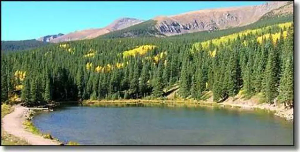 Blue Lake Campground - San Isabel NF (CO)CampingPhoto: Recreation.gov (RIDB) / public domain2.2 mi
- Coal CreekHiking2.7 mi
- North ForkHiking3.6 mi
- The StonewallRock climbing7.2 mi
- North Lake SouthRock climbing7.3 mi
- North Fork Purgatoire RiverCanoeing8.8 mi
- Guajatoyah CreekCanoeing8.8 mi
Source: Roamze catalog (indexable pages within 10 miles, PostGIS distance)
- West Spanish PeakSummit · ~19 min drivePhoto: Alethe88, CC BY-SA 3.0 (via Wikimedia Commons)
- Culebra PeakSummit · ~20 min drivePhoto: David Herrera from Albuquerque, NM, Bernalillo, CC BY 2.0 (via Wikimedia Commons)
- Red MountainSummit · ~21 min drivePhoto: David Herrera from Albuquerque, NM, Bernalillo, CC BY 2.0 (via Wikimedia Commons)
 East Spanish PeakSummit · ~26 min drivePhoto: Footwarrior, CC BY-SA 3.0 (via Wikimedia Commons)
 Mount MestasSummit · ~35 min drivePhoto: Jeffrey Beall, CC BY-SA 3.0 (via Wikimedia Commons)
 Iron MountainSummit · ~42 min drivePhoto: Jeffrey Beall, CC BY 4.0 (via Wikimedia Commons)
- Little Bear PeakSummit · ~45 min drivePhoto: Stargazer7121, CC BY-SA 3.0 (via Wikimedia Commons)
 Blanca PeakSummit · ~46 min drivePhoto: No machine-readable author provided. Meniscus~commonswiki assumed (based on copyright claims)., CC BY-SA 3.0 (via Wikimedia Commons)
- Ellingwood PointSummit · ~46 min drivePhoto: No machine-readable author provided. Meniscus~commonswiki assumed (based on copyright claims)., CC BY-SA 3.0 (via Wikimedia Commons)
 Sheep MountainSummit · ~47 min drivePhoto: Jeffrey Beall, CC BY 4.0 (via Wikimedia Commons)
