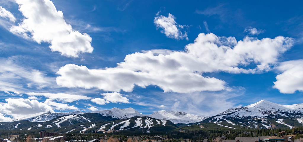
Breckenridge Area
Campground
Campground · 2.3 mi from the trail
 Photo: QKC, CC BY-SA 3.0 (via Wikimedia Commons)
Alert in the area
The Forest Service lists 6 alerts for White River National Forest.
FSR 286, Radical Hill, is closed due to washouts and unsafe conditions
Agency alert covering White River National Forest · USFS · White River National Forest
Limited parking at Snowmass Creek Trailhead
Agency alert covering White River National Forest · USFS · White River National Forest
Grizzly Creek Trail Closure
Agency alert covering White River National Forest · Order 2026-02 · USFS · White River National Forest
Ruedi Marina Day Use area Dump Station is CLOSED
Agency alert covering White River National Forest · USFS · White River National Forest
Asbestos safety closure - Camp Hale
Agency alert covering White River National Forest · USFS · White River National Forest
As of · Source: USFS · White River National Forest. Agencies don't list every closure — check before you go.
Nightmare On Baldy is a cross-country skiing route in Colorado's White River National Forest, within the Dillon Ranger District. The route is about 2.4 miles long, with a total elevation gain of 769 feet, and it rises from roughly 10,690 feet to about 11,470 feet. The steepest stretch comes at about 0.9 miles in, where the grade reaches 15 percent. Winter is the natural season for this route. Typical averages from the nearby Climax weather station, at a similar elevation, show January highs around 27°F with lows near 3°F and about 15 snow days. By June, highs reach about 61°F with only a couple of snow days. The Trail of Tears and the B&B Mine Trail both start within a few tenths of a mile, so it's easy to pair this route with a hike. The Blue River, about 2.9 miles away, offers canoeing, and Michigan Creek Campground, about 7.6 miles off, is the closest place to camp.
Breckenridge Area
Campground
Traverse Restaurant and Bar
Restaurant
 If it rainsJeremy Olson, CC BY-SA 4.0 · Wikimedia Commons
Places © OpenStreetMap contributors · Photos: Jeremy Olson, CC BY-SA 4.0 (commons)
More in LeadvilleNot on Roamze yet. Their page has how to reach them.
No month here meets our mild-weather rule. Best months have typical highs of 55–85 °F, lows of 30 °F or warmer (32 °F where the station doesn't record snow), at most one snowy day and no more than 12 wet days.
Jan
27° / 3°
15 wet · 15 snow
Feb
29° / 3°
15 wet · 15 snow
Mar
35° / 8°
14 wet · 14 snow
Apr
40° / 15°
13 wet · 13 snow
May
49° / 25°
10 wet · 8 snow
Jun
61° / 34°
8 wet · 2 snow
Jul
67° / 40°
13 wet
Aug
64° / 39°
15 wet
Sep
58° / 32°
11 wet · 2 snow
Oct
47° / 21°
9 wet · 7 snow
Nov
35° / 11°
12 wet · 12 snow
Dec
27° / 3°
15 wet · 15 snow
Typical high / low (°F) and days with rain or snow, 1991–2020. Measured at Climax, CO, 12.9 mi away at 11,344 ft. Source: NOAA NCEI U.S. Climate Normals 1991–2020.
Photo: QKC, CC BY-SA 3.0 (via Wikimedia Commons)B&B Mine Trail
Next door
Short, beginner-friendly Colorado ski tour near historic mining area.
 Photo: Earth Science and Remote Sensing Unit, NASA Johnson Space Center, Public domain (via Wikimedia Commons)
Southern Cross Trail
~2 min drive
Southern Cross Trail is a 0.94-mile route in Colorado with 407 feet of elevation gain.
 Photo: Pbritti, CC BY-SA 4.0 (via Wikimedia Commons)
Hoo Doo Voo Doo
~4 min drive
1.67-mile cross-country ski trail in Colorado with 472 ft of elevation gain.
 Photo: Bidgee, CC BY-SA 3.0 au (via Wikimedia Commons)
Troll Forest
~5 min drive
1.01-mile cross-country ski trail in Colorado with 75 ft of elevation gain.
Photo: QKC, CC BY-SA 3.0 (via Wikimedia Commons)Mount Baldy Road
~2 min drive
Moderate 2.74-mile road-based ski tour in Colorado with steady climbing.
 Photo: 좀비 브렌다, CC BY-SA 4.0 (via Wikimedia Commons)
Breckenridge
~8 min drive
Breckenridge is a ski area in Colorado with 35 lifts, 128 runs, and 3,256 ft vertical drop.
Photo: QKC, CC BY-SA 3.0 (via Wikimedia Commons)Turks
Next door
Short, beginner-friendly Colorado ski trail perfect for quick winter outings.
Photo: Pbritti, CC BY-SA 4.0 (via Wikimedia Commons)Preston Way Road
~3 min drive
Preston Way Road is a 0.68-mile route in Colorado with 148 feet of elevation gain.
 Photo: Bidgee, CC BY-SA 3.0 au (via Wikimedia Commons)
Shock Hill
~5 min drive
0.61-mile cross-country ski trail in Colorado with 215 ft of elevation gain.
 Photo: Thomson200, CC0 (via Wikimedia Commons)
Gold Digger
~6 min drive
Gold Digger is a 0.33-mile trail in Colorado with 67 feet of elevation gain.
Also worth it near here
Map and trail data © OpenStreetMap contributors