Portal Campground
Campground
Campground · 3.5 mi from the trail
Road closed
CO 82: road closure is listed as closed by CDOT 511 (3 listed).
CO 82: road closure
Closed · ~0.4 km from Mountain Boy · CDOT 511
CO 82: Independence Pass
Closed · ~2.3 km from Mountain Boy · CDOT 511
CO 82: road closure
Closed · ~0.4 km from Mountain Boy · CDOT 511
Willow Fire Area Closure
Agency closure covering Leadville Ranger District · Order 02-12-01-26-39 · USFS · Leadville Ranger District
FSR 286, Radical Hill, is closed due to washouts and unsafe conditions
Agency alert covering Pike and San Isabel National Forests · USFS · Pike and San Isabel National Forests
As of · Source: CDOT 511. Agencies don't list every closure — check before you go.
Mountain Boy is a cross-country ski route in the Leadville Ranger District of the Pike and San Isabel National Forests in Colorado, managed by the Forest Service. The out-and-back route is about 5.4 miles long, with a one-way climb of 1,699 feet from a low point of 10,592 feet to a high point of 12,068 feet. Winter is the natural season for skiing here. Typical averages from the nearby Climax weather station, which sits at a similar elevation, show January highs around 27°F and lows near 3°F, with about 15 snow days a month from December through February. Summer is the warmest stretch, with July highs averaging about 67°F and no snow days. Several other destinations lie within a few miles. Independence Pass Overlook is 0.8 miles away, Deer Mountain is 1.4 miles away, and Portal Campground is 3.5 miles away. Climbers can find Instant Karma Cliff about 1.6 miles off.
Portal Campground
Campground
 If it rainsLongled, CC BY-SA 3.0 · Wikimedia Commons
Historic frontier synagogue building
Places © OpenStreetMap contributors, Places © Overture Maps Foundation · Photos: Longled, CC BY-SA 3.0 (commons)
More in LeadvilleNot on Roamze yet. Their page has how to reach them.
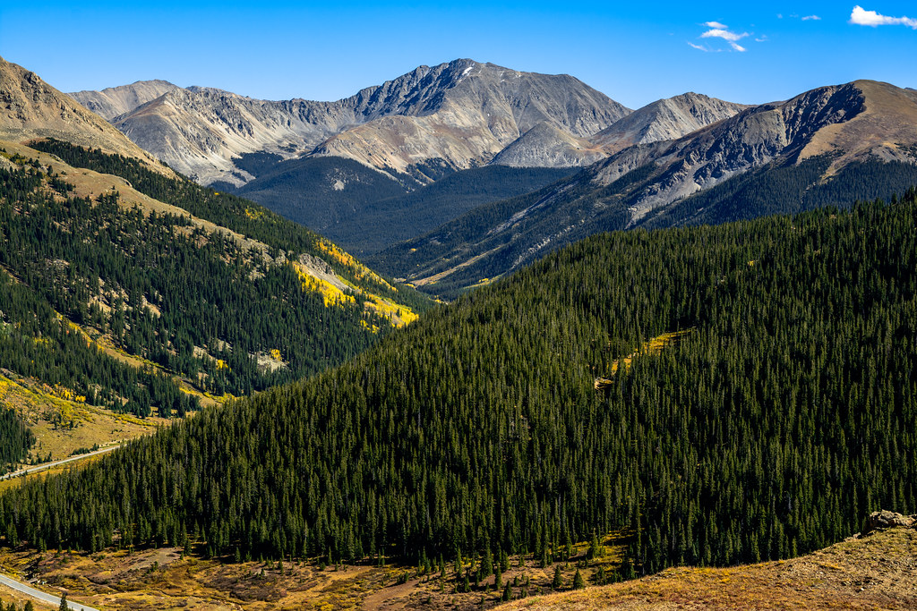 Independance Pass OverlookHikingPhoto: dconvertini, CC BY-SA 2.0 (via Flickr)0.8 mi
 Deer MountainHikingPhoto: Toshihiro Matsui, CC BY-SA 3.0 (via Wikimedia Commons)1.4 mi
Source: Roamze catalog (indexable pages within 10 miles, PostGIS distance)
 County Road 48Cross-country skiing · ~24 min drivePhoto: USFWS Mountain-Prairie, CC BY 2.0 (via Wikimedia Commons)
 East Of Aspen TrailCross-country skiing · ~24 min drivePhoto: This Photo was taken by Wolfgang Moroder.
Feel free to use my photos, but please mention me as the author and send me a message.
This image is not in the public domain. Please respect the copyright protection. It may only be used according to the rules mentioned here. This specifically excludes use in social media, if applicable terms of the licenses listed here not appropriate.
Please do not upload an updated image here without consultation with the Author. The author would like to make corrections only at his own source. This ensures that the changes are preserved.Please if you think that any changes should be required, please inform the author.Otherwise you can upload a new image with a new name. Please use one of the templates derivative or extract., CC BY-SA 3.0 (via Wikimedia Commons)
 Brush Creek SkiCross-country skiing · ~30 min drivePhoto: John Sowell, CC BY-SA 4.0 (via Wikimedia Commons)
 Maroon Gorge TrailCross-country skiing · ~30 min drivePhoto: Viktor Lapinskii, CC BY-SA 3.0 (via Wikimedia Commons)
 Missouri Mountain Northface Couloirs (Snow)Ski touring · ~24 min drivePhoto: xpda, CC BY-SA 4.0 (via Wikimedia Commons)
 Marolt TrailCross-country skiing · ~28 min drivePhoto: Denverjeffrey, CC BY-SA 3.0 (via Wikimedia Commons)
 Benedict TrailCross-country skiing · ~26 min drivePhoto: jofwooster, CC BY-SA 3.0 (via Wikimedia Commons)Brush Creek TrailCross-country skiing · ~30 min drivePhoto: John Sowell, CC BY-SA 4.0 (via Wikimedia Commons)
No month here meets our mild-weather rule. Best months have typical highs of 55–85 °F, lows of 30 °F or warmer (32 °F where the station doesn't record snow), at most one snowy day and no more than 12 wet days.
Jan
27° / 3°
15 wet · 15 snow
Feb
29° / 3°
15 wet · 15 snow
Mar
35° / 8°
14 wet · 14 snow
Apr
40° / 15°
13 wet · 13 snow
May
49° / 25°
10 wet · 8 snow
Jun
61° / 34°
8 wet · 2 snow
Jul
67° / 40°
13 wet
Aug
64° / 39°
15 wet
Sep
58° / 32°
11 wet · 2 snow
Oct
47° / 21°
9 wet · 7 snow
Nov
35° / 11°
12 wet · 12 snow
Dec
27° / 3°
15 wet · 15 snow
Typical high / low (°F) and days with rain or snow, 1991–2020. Measured at Climax, CO, 26.9 mi away at 11,344 ft. The station sits about 700 ft lower than this place, so expect it a little cooler here. Source: NOAA NCEI U.S. Climate Normals 1991–2020.
CO 82: Independence Pass closed
closed Oct 31, 2026, no reopening recorded · State DOT
CO 82: Independence Pass closed
closed Oct 31, 2026 → reopened Oct 31, 2026 · State DOT

