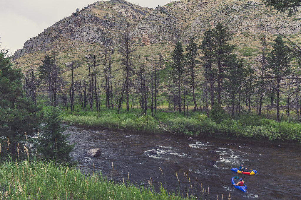
Stove Prairie Road Areas
Stove Prairie Road Areas in Colorado has 3 routes ranging from easy to hard, offering sport and trad climbing.
- 3 routes
- 5.6 – 5.10a
- Trad · Sport
Is Stove Prairie Road Areas open right now?
Alert in the area
The Forest Service lists 4 alerts for Canyon Lakes Ranger District.
Salt Cabin Prescribed (RX) Fire Closure
Agency alert covering Canyon Lakes Ranger District · Order 02-10-05-26-10 · USFS · Canyon Lakes Ranger District
Fire Restrictions
Agency alert covering Arapaho and Roosevelt National Forests · USFS · Arapaho and Roosevelt National Forests
West Crystal A - Mechanical Fuelbreak Area and Road Closure
Agency alert covering Canyon Lakes Ranger District · Order 02-10-05-26-04 · USFS · Canyon Lakes Ranger District
Cameron Peak Fire Road Closures
Agency alert covering Canyon Lakes Ranger District · Order 02-10-05-26-01 · USFS · Canyon Lakes Ranger District
As of · Source: USFS · Canyon Lakes Ranger District. Agencies don't list every closure — check before you go.
Best time to visit Stove Prairie Road Areas
Best months: May–October. Best months have typical highs of 55–85 °F, lows of 30 °F or warmer (32 °F where the station doesn't record snow), at most one snowy day and no more than 12 wet days.
Jan
40° / 21°
5 wet
Feb
40° / 20°
6 wet
Mar
47° / 26°
8 wet
Apr
51° / 30°
10 wet
May
60° / 39°
12 wet
Jun
72° / 49°
11 wet
Jul
79° / 56°
11 wet
Aug
78° / 55°
11 wet
Sep
70° / 47°
8 wet
Oct
57° / 36°
7 wet
Nov
47° / 28°
6 wet
Dec
40° / 20°
6 wet
Typical high / low (°F) and days with rain or snow, 1991–2020. Measured at Buckhorn Mtn 1 E, CO, 6.5 mi away at 7,400 ft. The station sits about 1,200 ft higher than this place, so expect it a little warmer here. This station doesn't record snowfall. Source: NOAA NCEI U.S. Climate Normals 1991–2020.
Stove Prairie Road Areas is a climbing area in the Canyon Lakes Ranger District of the Arapaho and Roosevelt National Forests in Colorado, managed by the Forest Service. It sits along the road network of the district, with several climbing areas and campgrounds within a short drive. Summer is the most comfortable time to visit. Typical averages from a nearby weather station show July highs around 79°F with lows near 56°F, while winter highs stay around 40°F. That station sits about 1,160 feet lower than the climbing area, so temperatures here run cooler. Cactus Garden, The is about half a mile away, and Stove Prairie Landing Campground is about 0.6 miles off. The Palace, The is roughly 0.9 miles away, and the Cache la Poudre River offers fishing about 1.6 miles from the area.
Routes (3)
PMA Crag(1)
Stove Prairie Cracks(2)
Keep exploring — more climbs worth the drive
The Cactus Garden
~1 min drive
Cactus Garden, Colorado has 5 sport climbing routes on 3 difficulty grades.
The Palace
~2 min drive
The Palace in Colorado has 17 climbing routes with 15 distinct difficulty grades.
The Citadel
~2 min drive
Citadel in Colorado has 7 routes from moderate to hard, offering sport and trad climbing.
Wall With a View
~2 min drive
6-route climbing area in Colorado with mixed and sport climbing.
The Palace Pages
~2 min drive
Palace Pages, The is a Colorado climbing crag with 10 routes, 9 difficulty grades, mixed and sport climbing.
The Chamber
~2 min drive
Chamber, The in Colorado has 17 sport climbing routes across 13 grades.
Big Beaver Tail
~2 min drive
Big Beaver Tail in Colorado has 6 sport climbing routes across 5 difficulty grades.
The Fishing Hole
~2 min drive
7 routes in Colorado spanning 5 grades, sport and trad climbing.
Middle Class Wall
~2 min drive
Middle Class Wall in Colorado has 11 climbing routes across 8 grades, offering sport and trad options.
Old Aid Wall aka Upper Echelon Wall
~2 min drive
Old Aid Wall aka Upper Echelon Wall is a Colorado climbing area with 10 routes spanning 9 grades, offering sport and trad options.