Mountain Sheep Point Boat Ramp
- Apr–Jun, Aug–Oct
- best months
Mountain Sheep Point Boat Ramp is a boat launch on Bureau of Land Management land in Colorado's Southwest District, about 5 miles from the town of Dove Creek. For comfortable weather, plan a visit between late spring and early fall. Typical averages from the nearby Dove Creek weather station run from highs around 69°F in May to about 75°F in September, with July the warmest month at an average high near 87°F. Winters are cold, with January highs averaging about 38°F and lows near 17°F. The closest listed spot for a land-based outing is the Wolf Den Connector Trail, roughly 7 miles away.
- Managed by
- Bureau of Land Management
Source: Roamze catalog (indexable pages within 10 miles, PostGIS distance)
 McElmo CreekCanoeing · ~56 min drivePhoto: Rationalobserver, CC BY-SA 4.0 (via Wikimedia Commons)
- Gypsum Valley Recreation Site Boat RampBoat launch · ~40 min drive
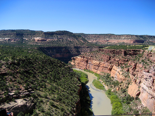 Dolores RiverCanoeing · ~1h 1m drivePhoto: Argyleist. Original uploader was Argyleist at en.wikipedia, CC BY 3.0 (via Wikimedia Commons)
- House Creek Boating SiteBoat launch · ~42 min drive
 San Miguel RiverCanoeing · ~1h 4m drivePhoto: Cawright2007, CC BY-SA 3.0 (via Wikimedia Commons)
- Mcphee Boating SiteBoat launch · ~43 min drive
 West Dolores RiverCanoeing · ~1h 11m drivePhoto: Jeffrey Beall, CC BY 4.0 (via Wikimedia Commons)
- Bedrock Boat RampBoat launch · ~1h 1m drive
 Leopard CreekCanoeing · ~1h 26m drivePhoto: Jeffrey Beall, CC BY 4.0 (via Wikimedia Commons)
- Ledges Rockhouse Boat RampBoat launch · ~1h 7m drive
Best time to visit Mountain Sheep Point Boat Ramp
Best months: April–June and August–October. Best months have typical highs of 55–85 °F, lows of 30 °F or warmer (32 °F where the station doesn't record snow), at most one snowy day and no more than 12 wet days.
Jan
38° / 17°
Feb
42° / 21°
Mar
50° / 28°
Apr
59° / 32°
May
69° / 41°
Jun
81° / 52°
Jul
87° / 58°
Aug
83° / 56°
Sep
75° / 49°
Oct
62° / 37°
Nov
49° / 27°
Dec
38° / 18°
Typical high / low (°F) and days with rain or snow, 1991–2020. Measured at Dove Creek, CO, 5.1 mi away at 6,863 ft. We don't have this place's elevation, so higher spots nearby can run cooler. This station doesn't record snowfall. Source: NOAA NCEI U.S. Climate Normals 1991–2020.

