Fish Creek
- 6.9 mi
- distance
- 10,834 ft
- high point
Caution at last check
Agency alerts are in effect for this area; weather is good · USFS, OpenWeather · checked 16 h ago
Is Fish Creek open right now?
Closure in the area
There's a closure order in San Juan National Forest. It doesn't name Fish Creek, so check the source for the area it covers (3 listed).
Travel is not advised to the San Juan NF
Agency closure covering San Juan National Forest · USFS · San Juan National Forest
Closures and dangerous conditions on roads, bridges, and trails from flooding
Agency closure covering San Juan National Forest · USFS · San Juan National Forest
Multiple roads and trails damaged by flooding on SJNF
Agency closure covering San Juan National Forest · USFS · San Juan National Forest
Bear Activity High Across San Juan National Forest
Agency alert covering San Juan National Forest · USFS · San Juan National Forest
West Fork Road and Bridge Closure Order
Agency alert covering Pagosa Ranger District · Order 02-13-06-25-19 · USFS · Pagosa Ranger District
As of · Source: USFS · San Juan National Forest. Agencies don't list every closure — check before you go.
Fish Creek is a 6.9-mile paddling stretch near Pagosa Springs, Colorado, running through the South San Juan Wilderness in the Pagosa Ranger District of San Juan National Forest. The surrounding land is managed by the Forest Service. The creek flows year-round, with a modeled average flow of about 31 cfs. Its gradient averages about 392 feet per mile, an extremely steep drop for a paddling run. Nearby, Fish Lake is a hike just 0.6 miles away, and Opal Lake and the Blanco River trail are each within about 3 miles. For more paddling, the Navajo River lies about 6 miles off.
Local outfitters
- Wilderness Journeys Pagosa19 mi away
- Blue Creek Lodge38 mi away
Not on Roamze yet. Their page has how to reach them.
- Fish LakeHiking0.6 mi
- Opal LakeHiking2.8 mi
- Blanco RiverHiking2.9 mi
- Blanco Basin CragsRock climbing3.2 mi
 Navajo RiverCanoeingPhoto: Dicklyon, CC BY-SA 4.0 (via Wikimedia Commons)6.1 mi
 Rio BlancoCanoeingPhoto: Dicklyon, CC BY-SA 4.0 (via Wikimedia Commons)7.5 mi
- V-Mountain aka V RockRock climbing8.2 mi
- Rito BlancoCanoeing9 mi
Source: Roamze catalog (indexable pages within 10 miles, PostGIS distance)
- Navajo RiverCanoeing · ~11 min drivePhoto: Dicklyon, CC BY-SA 4.0 (via Wikimedia Commons)
- Platoro Reservoir Boating SiteBoat launch · ~21 min drive
- Rio BlancoCanoeing · ~13 min drivePhoto: Dicklyon, CC BY-SA 4.0 (via Wikimedia Commons)
- Trujillo Meadows Boating SiteBoat launch · ~32 min drive
 East Fork San Juan RiverCanoeing · ~22 min drivePhoto: Dicklyon, CC BY-SA 4.0 (via Wikimedia Commons)
- Big Meadows Reservoir Boating SiteBoat launch · ~38 min drive
 San Juan RiverCanoeing · ~26 min drivePhoto: Kkaufman11 at English Wikipedia, Public domain (via Wikimedia Commons)
- Shaw Lake Boating SiteBoat launch · ~40 min drive
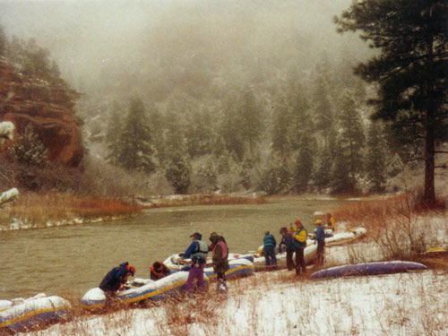 Rio ChamaCanoeing · ~32 min drivePhoto: Public domain (via Wikimedia Commons)
- Teal Boat RampBoat launch · ~59 min drive
Also worth it near here
- Blanco Basin CragsRock climbing · ~6 min drive
- Blue LakeLake fishing · ~9 min drive
 Conejos PeakSummit · ~16 min drivePhoto: Jeffrey Beall, CC BY 4.0 (via Wikimedia Commons)
 BLUE CREEK WINTERHiking · ~17 min drivePhoto: Dicklyon, CC BY-SA 4.0 (via Wikimedia Commons)
- Blanco River Group CampgroundCamping · ~18 min drive
