Miller High Life Trail
- 2.4 mi
- distance
- 317 ft
- climb
- Intermediate
- difficulty
- May–Jun, Aug–Sep
- best months
Miller High Life Trail is a mountain biking route on Bureau of Land Management land in Colorado's Colorado River Valley Field Office, about 2.4 miles long with a 317-foot elevation gain from a starting point near 6,119 feet to a high of 6,401 feet. The climb is steepest at about 1.5 miles in, where the grade reaches 12 percent. The most comfortable months for riding are typically late spring and early fall. Typical averages from a nearby weather station in Rifle show May highs around 72°F and September highs around 79°F, while July averages climb to 88°F and winter highs sit near 37°F. Wall Street, a mountain biking route, lies about 0.3 miles away, and Watch Tower Trail is a hike about 0.4 miles off. Climbers can head to Slab Routes, about 0.5 miles away, and Sage Campground is about 3 miles away for an overnight stay.
Local outfitters
- Hanging Lake Adventure Co-op26 mi away
- Palisade Basecamp45 mi away
Not on Roamze yet. Their page has how to reach them.
- wall streetMountain biking0.3 mi
- Watch Tower TrailHiking0.4 mi
- Slab RoutesRock climbing0.5 mi
- Rifle ArchRock climbing0.6 mi
 Sage CampgroundCampingPhoto: Jeffrey Beall, CC BY 4.0 (via Wikimedia Commons)3 mi
- Cedar CampgroundCampingPhoto: Jeffrey Beall, CC BY 4.0 (via Wikimedia Commons)3.1 mi
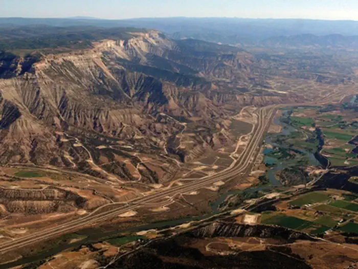 Roan Plateau - JQS Creek CrossRiver fishing3.3 mi
 Rifle CreekCanoeingPhoto: Jeffrey Beall, CC BY 4.0 (via Wikimedia Commons)3.9 mi
Source: Roamze catalog (indexable pages within 10 miles, PostGIS distance)
 Crimson RideMountain biking · ~25 min drivePhoto: Loco Steve, CC BY 3.0 (via Wikimedia Commons)
- MaverickMountain biking · ~25 min drivePhoto: Loco Steve, CC BY 3.0 (via Wikimedia Commons)
- wall streetMountain biking · Next door
- Haze TrailMountain biking · Next door
- Double-track UpMountain biking · Next door
- Cheap SunglassesMountain biking · Next door
- Watch Tower TrailMountain biking · Next door
- Notorious B-S.I.D.E TrailMountain biking · Next door
- Family Flow ClimbMountain biking · ~1 min drive
- Rio VerdeMountain biking · ~1 min drive
Best time to visit Miller High Life Trail
Best months: May–June and August–September. Best months have typical highs of 55–85 °F, lows of 30 °F or warmer (32 °F where the station doesn't record snow), at most one snowy day and no more than 12 wet days.
Jan
37° / 10°
8 wet
Feb
42° / 15°
7 wet
Mar
55° / 22°
7 wet
Apr
62° / 28°
9 wet
May
72° / 37°
9 wet
Jun
83° / 45°
6 wet
Jul
88° / 52°
9 wet
Aug
85° / 49°
9 wet
Sep
79° / 41°
8 wet
Oct
64° / 30°
8 wet
Nov
49° / 20°
7 wet
Dec
37° / 11°
8 wet
Typical high / low (°F) and days with rain or snow, 1991–2020. Measured at Rifle 3ene, CO, 6.3 mi away at 5,469 ft. The station sits about 900 ft lower than this place, so expect it a little cooler here. This station doesn't record snowfall. Source: NOAA NCEI U.S. Climate Normals 1991–2020.
Map and trail data © OpenStreetMap contributors
