Cedar Campground
Campground
Campground · 4.1 mi from the trail
 Photo: Jeffrey Beall, CC BY 4.0 (via Wikimedia Commons)
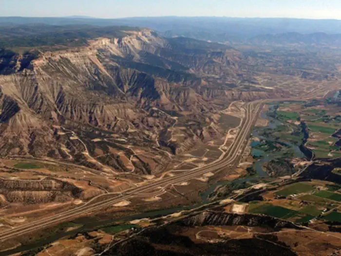
Rifle Creek is a 11-mile paddling stretch near Rifle, Colorado, about 3 miles from town. It flows year-round, with USGS models estimating an average flow of about 65 cubic feet per second and a gradient of about 59.2 feet per mile. Late spring and early fall are the most comfortable times to paddle. Typical averages from a nearby weather station show May highs around 72°F and September highs around 79°F, while July averages climb to about 88°F. Hogback Ridge Trail is about 2 miles away, and Roan Plateau - JQS Creek Cross offers river fishing at a similar distance. Cedar Campground and Sage Campground, both about 4 miles off, are the closest places to camp.
Cedar Campground
Campground
Thermal springs in Colorado
Places © OpenStreetMap contributors, Places © Overture Maps Foundation
More in Glenwood SpringsNot on Roamze yet. Their page has how to reach them.
 Roan Plateau - JQS Creek CrossRiver fishing2.3 mi
 Gully 3 Climb TrailHikingPhoto: joannapoe, CC BY-SA 2.0 (via Flickr)2.7 mi
 Cedar CampgroundCampingPhoto: Jeffrey Beall, CC BY 4.0 (via Wikimedia Commons)4.1 miSage CampgroundCampingPhoto: Jeffrey Beall, CC BY 4.0 (via Wikimedia Commons)4.2 mi
Source: Roamze catalog (indexable pages within 10 miles, PostGIS distance)
 Elk CreekCanoeing · ~19 min drivePhoto: Jeffrey Beall, CC BY 4.0 (via Wikimedia Commons)
 Plateau CreekCanoeing · ~44 min drivePhoto: Jeffrey Beall, CC BY 4.0 (via Wikimedia Commons)
 Piceance CreekCanoeing · ~50 min drivePhoto: Jeffrey Beall, CC BY 4.0 (via Wikimedia Commons)
 South Fork White RiverCanoeing · ~52 min drivePhoto: Jeffrey Beall, CC BY 4.0 (via Wikimedia Commons)
Also worth it near here
Best months: May–June and August–September. Best months have typical highs of 55–85 °F, lows of 30 °F or warmer (32 °F where the station doesn't record snow), at most one snowy day and no more than 12 wet days.
Jan
37° / 10°
8 wet
Feb
42° / 15°
7 wet
Mar
55° / 22°
7 wet
Apr
62° / 28°
9 wet
May
72° / 37°
9 wet
Jun
83° / 45°
6 wet
Jul
88° / 52°
9 wet
Aug
85° / 49°
9 wet
Sep
79° / 41°
8 wet
Oct
64° / 30°
8 wet
Nov
49° / 20°
7 wet
Dec
37° / 11°
8 wet
Typical high / low (°F) and days with rain or snow, 1991–2020. Measured at Rifle 3ene, CO, 2.6 mi away at 5,469 ft. This station doesn't record snowfall. Source: NOAA NCEI U.S. Climate Normals 1991–2020.
