N. Fork Zapata
- 1.0 mi
- distance
- 765 ft
- climb
Caution today
Agency alerts are in effect for this area; weather is good · USFS, OpenWeather · checked 6 h ago
Is N. Fork Zapata open right now?
Closure in the area
There's a closure order in Rio Grande National Forest. It doesn't name N. Fork Zapata, so check the source for the area it covers.
Closures and dangerous conditions on roads, bridges, and trails from flooding
Agency closure covering Rio Grande National Forest · USFS · Rio Grande National Forest
As of · Source: USFS · Rio Grande National Forest. Agencies don't list every closure — check before you go.
N. Fork Zapata is a mountain biking route in Colorado's Sangre de Cristo Wilderness, within the Conejos Peak Ranger District of the Rio Grande National Forest. The Forest Service manages the land, and the trail lies about a mile from the South Zapata Lake Trail and the S. Zapata route. The climb is short, at under a mile, but it is steep. The route rises from about 10,600 feet to about 11,400 feet, a total gain of 765 feet. The steepest stretch comes at about 0.7 miles in, with a grade of about 33 percent. Several other trails sit close by. South Zapata Lake Trail is about 0.4 miles away, and S. Zapata is about 0.5 miles away. Zapata Falls Trail is about 1.8 miles off, and Zapata Falls Campground is about 2 miles away.
Local outfitters
- San Luis Valley Campground48 mi away
Not on Roamze yet. Their page has how to reach them.
- South Zapata Lake TrailMountain biking0.4 mi
- S. ZapataMountain biking0.5 mi
- Zapata Falls TrailMountain biking1.8 mi
 Zapata Falls CampgroundCampingPhoto: Fredlyfish4, CC BY-SA 4.0 (via Wikimedia Commons)2 mi
 California PeakHikingPhoto: Eric Johnson, CC BY-SA 3.0 (via Wikimedia Commons)2 mi
 Oasis CampgroundCampingPhoto: Thomson M, CC BY 3.0 (via Wikimedia Commons)5.5 mi
- Great Sand Dunes OasisCamping5.6 mi
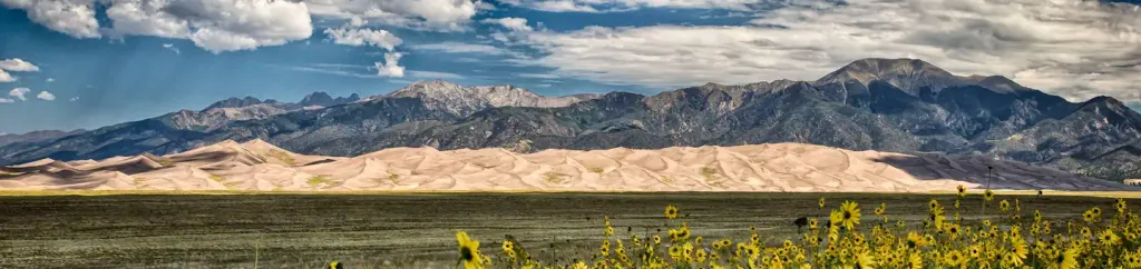 Pinon Flats CampgroundCampingPhoto: Recreation.gov (RIDB) / public domain9.2 mi
Source: Roamze catalog (indexable pages within 10 miles, PostGIS distance)
 South CrestoneMountain biking · ~47 min drivePhoto: Fredlyfish4, CC BY-SA 4.0 (via Wikimedia Commons)
 Horn Creek SpurMountain biking · ~48 min drivePhoto: Fredlyfish4, CC BY-SA 4.0 (via Wikimedia Commons)
- MaceyMountain biking · ~49 min drivePhoto: Fredlyfish4, CC BY-SA 4.0 (via Wikimedia Commons)
 Macey SpurMountain biking · ~46 min drivePhoto: Fredlyfish4, CC BY-SA 3.0 (via Wikimedia Commons)
- S. ZapataMountain biking · Next door
- Zapata Falls TrailMountain biking · ~3 min drive
- indian creek trailMountain biking · ~42 min drive
- Mountain Bike Trail near South Fork West Indian CreekMountain biking · ~44 min drive
- indian creek trailMountain biking · ~44 min drive
- North CrestoneMountain biking · ~51 min drive
Also worth it near here
 Zapata FallsWaterfall · ~3 min drivePhoto: XenonofArcticus (talk), CC BY-SA 3.0 (via Wikimedia Commons)
- Zapata Falls CampgroundCamping · ~3 min drivePhoto: Fredlyfish4, CC BY-SA 4.0 (via Wikimedia Commons)
 Ellingwood PointSummit · ~5 min drivePhoto: No machine-readable author provided. Meniscus~commonswiki assumed (based on copyright claims)., CC BY-SA 3.0 (via Wikimedia Commons)
Map and trail data © OpenStreetMap contributors
