Trail Riders
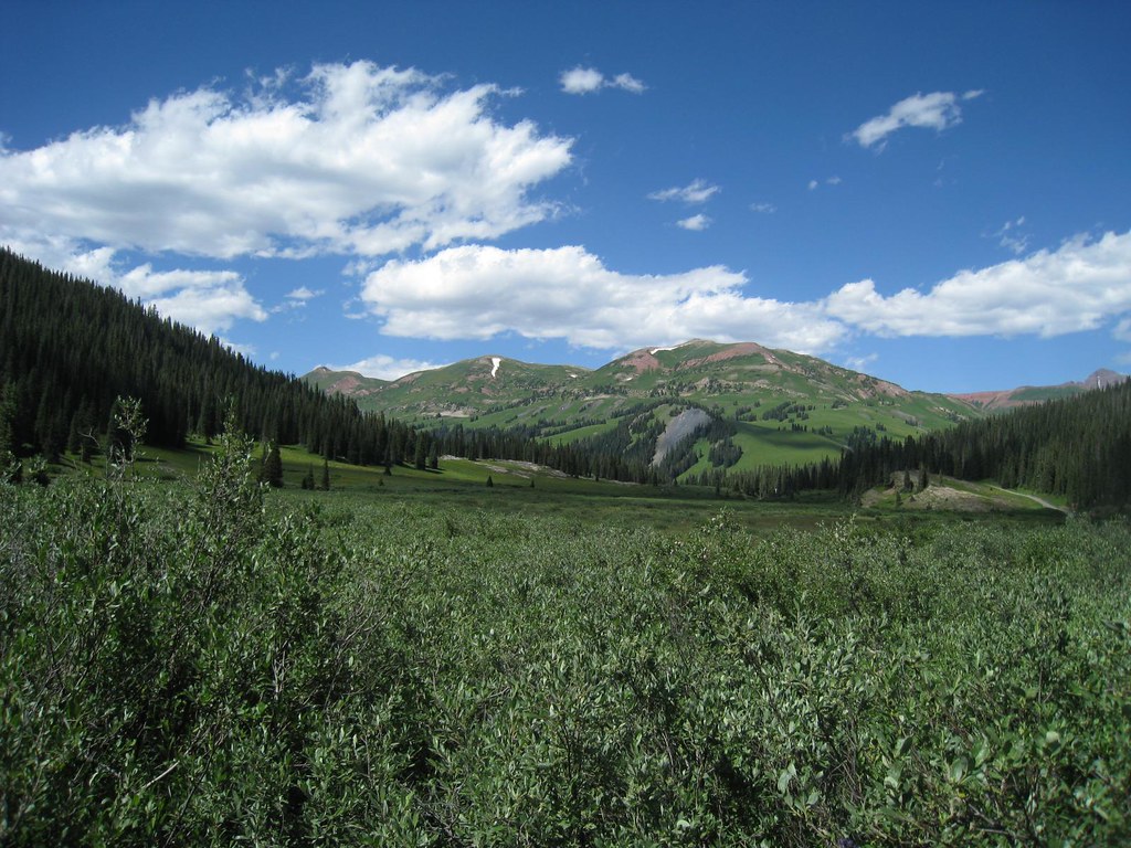 Photo: GSEC, CC BY 2.0 (via Flickr)
- 14.8 mi
- round trip
- 845 ft
- climb
- 11,346 ft
- high point
- Out and back
- route
Is Trail Riders open right now?
Alert in the area
The Forest Service lists 6 alerts for White River National Forest.
FSR 286, Radical Hill, is closed due to washouts and unsafe conditions
Agency alert covering White River National Forest · USFS · White River National Forest
Limited parking at Snowmass Creek Trailhead
Agency alert covering White River National Forest · USFS · White River National Forest
Grizzly Creek Trail Closure
Agency alert covering White River National Forest · Order 2026-02 · USFS · White River National Forest
Ruedi Marina Day Use area Dump Station is CLOSED
Agency alert covering White River National Forest · USFS · White River National Forest
Asbestos safety closure - Camp Hale
Agency alert covering White River National Forest · USFS · White River National Forest
As of · Source: USFS · White River National Forest. Agencies don't list every closure — check before you go.
Trail Riders is a 14.8-mile out-and-back hike in Colorado's White River National Forest, within the Sopris Ranger District. The trail rises from a low point of 9,687 feet to a high of 11,346 feet, with an elevation gain of 845 feet. It is a hard route, and the Forest Service manages the land. The trail is natural-surfaced and allows both horses and bikes, so it works for riders as well as hikers. The parking area is called Rustlers Gulch - Trail Riders, and the trail is open year-round. The trailhead sits right next to two campgrounds, GC 14 and GC 15, each about 0.3 miles away. Schofield Trail is 0.6 miles off, and the Bellview hike is about 2 miles away.
Go with a guide
- Mineral Belt Trail Guided WalkRoamze · $25 per person · 44 mi away
- Maroon Bells Guide and Outfitters14 mi away
Keep exploring — more trails worth the drive
 Photo: GSEC, CC BY 2.0 (via Flickr)
Schofield Trail
~1 min drive
2.94-mile out-and-back trail in Colorado with 1,024 ft gain and 11,355 ft max elevation.
 Photo: The Greater Southwestern Exploration Company from Long Beach, California, United States, CC BY 2.0 (via Wikimedia Commons)
Treasury Mountain
~3 min drive
Route to the summit of Treasury Mountain (13,386 ft) from Schofield Park Parking.
 Photo: Jeffrey Pang from Berkeley, CA, USA, CC BY 2.0 (via Wikimedia Commons)
Gothic Mountain Trail
~5 min drive
2.84-mile out-and-back hike in Colorado with 1,872 ft elevation gain and loss.
 Photo: Charlie DeTar, CC BY-SA 3.0 (via Wikimedia Commons)
Judd Falls
~8 min drive
1.08-mile out-and-back trail with 528 ft elevation gain and loss in Colorado.
 Photo: GSEC, CC BY 2.0 (via Flickr)
Yule Pass
~3 min drive
Yule Pass is a 4.68-mile out-and-back trail in Colorado with 442 ft of elevation gain.
Photo: Jeffrey Pang from Berkeley, CA, USA, CC BY 2.0 (via Wikimedia Commons)Precarious Peak
~5 min drive
Route to the summit of Precarious Peak (13,104 ft) from Rustler Gulch Trailhead.
 Photo: GSEC, CC BY 2.0 (via Flickr)
North Fork Crystal River
~9 min drive
16.58-mile out-and-back trail on North Fork Crystal River in Colorado.
 Photo: KimonBerlin, CC BY-SA 2.0 (via Wikimedia Commons)
Trail near Pyramid Peak
~11 min drive
0.38-mile out-and-back trail near Pyramid Peak in Colorado.
 Photo: kalestews, CC BY 2.0 (via Flickr)
Willow Lake
~12 min drive
4.61-mile out-and-back trail to Willow Lake in Colorado, 750 ft gain.
Photo: The Greater Southwestern Exploration Company from Long Beach, California, United States, CC BY 2.0 (via Wikimedia Commons)Hagerman Peak
~8 min drive
Route to the summit of Hagerman Peak (13,816 ft) from Geneva Lake Trailhead (Lead King Basin).
Also worth it near here
 Photo: James St. John, CC BY 2.0 (via Wikimedia Commons)
Campsites GC 13
~3 min drive
Photo: Jeffrey Pang from Berkeley, CA, USA, CC BY 2.0 (via Wikimedia Commons)Washington Gulch Trail
~5 min drive
CLIMB
Crested Butte
~5 min drive
 Photo: Jonathan Fox, CC BY-SA 2.0 (via Wikimedia Commons)
Purple Mountain
~6 min drive
