Winiger Ridge
Campground
Campground · 0.9 mi from the trail
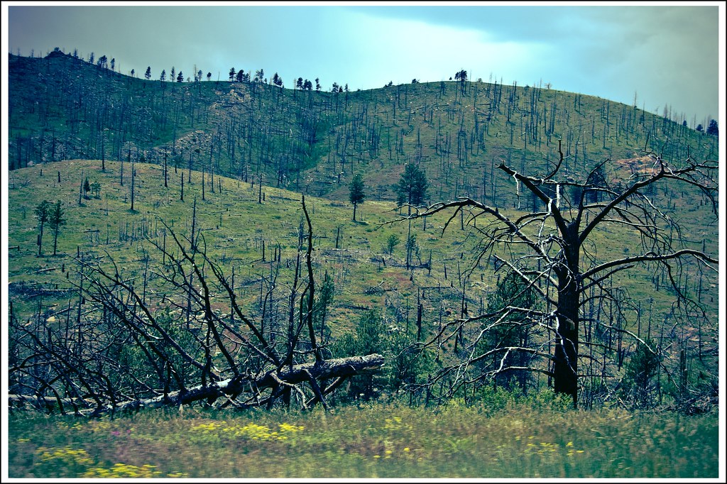
 Photo: Josh Gross — CC BY 2.0 (via Flickr)
Alert in the area
The Forest Service lists 3 alerts for Arapaho and Roosevelt National Forests.
Fire Restrictions
Agency alert covering Arapaho and Roosevelt National Forests · USFS · Arapaho and Roosevelt National Forests
Caribou Road Closure Order
Agency alert covering Boulder Ranger District · Order 02-10-01-26-04 · USFS · Boulder Ranger District
Raptor Nesting Area Closure - Boulder Ranger District
Agency alert covering Boulder Ranger District · Order 02-10-01-26-06 · USFS · Boulder Ranger District
As of · Source: USFS · Arapaho and Roosevelt National Forests. Agencies don't list every closure — check before you go.
Inlet Trail is a short hike in the Boulder Ranger District of the Arapaho and Roosevelt National Forests in Colorado, on Forest Service land. The route covers 1.2 miles and is rated easy, with about 300 feet of climbing over the full trip. Summer is the most comfortable time to go. Typical averages from a nearby weather station at Gross Reservoir show July highs around 79°F with lows near 50°F, while September cools to highs around 70°F. Winiger Ridge campground sits less than a mile away. Gross Reservoir, a climbing area, and Fisherman's Access Trail are both about 1.4 miles off, and South Boulder Creek offers paddling about 2 miles away.
Winiger Ridge
Campground
Last Stand Tavern
Pub
 If it rainsMatt Golon, CC BY-SA 3.0 · Wikimedia Commons
Places © OpenStreetMap contributors · Photos: Matt Golon, CC BY-SA 3.0 (commons)
More in Idaho SpringsNot on Roamze yet. Their page has how to reach them.
 Fisherman's Access TrailHikingPhoto: Jerry Huddleston from Hampton, Minnesota, US, CC BY 2.0 (via Wikimedia Commons)1.4 miDale's TrailHikingPhoto: Jerry Huddleston from Hampton, Minnesota, US, CC BY 2.0 (via Wikimedia Commons)1.5 mi
 South Boulder CreekCanoeingPhoto: Jeffrey Beall, CC BY 3.0 (via Wikimedia Commons)2 mi
 Boulder CreekCanoeingPhoto: Susan from Alameda, CA, USA, CC BY 2.0 (via Wikimedia Commons)6.1 mi
Source: Roamze catalog (indexable pages within 10 miles, PostGIS distance)
Fisherman's Access TrailHiking · ~2 min drivePhoto: Jerry Huddleston from Hampton, Minnesota, US, CC BY 2.0 (via Wikimedia Commons) Walker Ranch LoopHiking · ~5 min drivePhoto: Tony Webster — CC BY 2.0 (via Flickr)
 Bear Peak West Ridge TrailHiking · ~7 min drivePhoto: Stepan Mazurov, CC BY-SA 2.0 (via Flickr)Dale's TrailHiking · ~3 min drivePhoto: Jerry Huddleston from Hampton, Minnesota, US, CC BY 2.0 (via Wikimedia Commons)Green Bear TrailHiking · ~7 min drivePhoto: Stepan Mazurov, CC BY-SA 2.0 (via Flickr)
 Josie Heath TrailHiking · ~4 min drivePhoto: jefbrr, CC BY 2.0 (via Flickr)
 Bear Peak TrailHiking · ~8 min drivePhoto: michaelwm25, CC BY 3.0 (via Wikimedia Commons)
 Eldorado Canyon TrailHiking · ~5 min drivePhoto: andrusdevelopment, CC BY 2.0 (via Flickr)Bear CanyonHiking · ~8 min drivePhoto: michaelwm25, CC BY 3.0 (via Wikimedia Commons)Winiger Ridge TrailHiking · ~6 min drivePhoto: Tony Webster — CC BY 2.0 (via Flickr)
Best months: May–September. Best months have typical highs of 55–85 °F, lows of 30 °F or warmer (32 °F where the station doesn't record snow), at most one snowy day and no more than 12 wet days.
Jan
39° / 17°
5 wet
Feb
40° / 17°
5 wet
Mar
47° / 22°
6 wet
Apr
52° / 27°
8 wet
May
61° / 35°
10 wet
Jun
73° / 44°
9 wet
Jul
79° / 50°
10 wet
Aug
77° / 48°
11 wet
Sep
70° / 41°
8 wet
Oct
57° / 31°
6 wet
Nov
47° / 24°
5 wet
Dec
40° / 17°
5 wet
Typical high / low (°F) and days with rain or snow, 1991–2020. Measured at Gross Rsvr, CO, 1.2 mi away at 7,970 ft. We don't have this place's elevation, so higher spots nearby can run cooler. This station doesn't record snowfall. Source: NOAA NCEI U.S. Climate Normals 1991–2020.
Map and trail data © OpenStreetMap contributors
