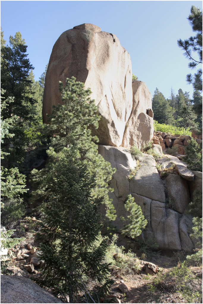
Gog and Magog Rocks Trail
 Photo: markbyzewski, CC BY 2.0 (via Flickr)
- 1.3 mi
- round trip
- 2,564 ft
- climb
- 8,658 ft
- high point
- Out and back
- route
- May–Jun, Sep
- best months
Is Gog and Magog Rocks Trail open right now?
Alert in the area
The Forest Service lists 11 alerts for Pike and San Isabel National Forests.
FSR 286, Radical Hill, is closed due to washouts and unsafe conditions
Agency alert covering Pike and San Isabel National Forests · USFS · Pike and San Isabel National Forests
Interlaken Hotel Tree Hazards
Agency alert covering Pike and San Isabel National Forests · USFS · Pike and San Isabel National Forests
Sharpe Fire Update
Agency alert covering Pike and San Isabel National Forests · USFS · Pike and San Isabel National Forests
Turquoise Lake Road (County Road 4) Closure
Agency alert covering Pike and San Isabel National Forests · USFS · Pike and San Isabel National Forests
Waldo Canyon Burn Area Closure
Agency alert covering Pikes Peak Ranger District · Order 02-12-09-24-07 · USFS · Pikes Peak Ranger District
As of · Source: USFS · Pike and San Isabel National Forests. Agencies don't list every closure — check before you go.
Gog and Magog Rocks Trail is a 2.64-mile out-and-back route in Colorado with 2,564 feet of elevation gain. The trail reaches a maximum elevation of 8,658 feet.
Local outfitters
- Broadmoor Outfitters7 mi away
- Gold Belt Tour Scenic and Historic Byway21 mi away
Not on Roamze yet. Their page has how to reach them.
- Gog and Magog Rocks TrailHiking · Next doorPhoto: markbyzewski, CC BY 2.0 (via Flickr)
 Pikes PeakHiking · ~2 min drivePhoto: davidwilson1949 — CC BY 2.0 (via Flickr)
 Intemann TrailHiking · ~4 min drivePhoto: eschipul, CC BY 2.0 (via Flickr)
- Eagle Mountain TrailHiking · ~2 min drive
 Eagles NestHiking · ~1 min drivePhoto: markbyzewski, CC BY 2.0 (via Flickr)
- Waldo CanyonHiking · ~4 min drive
 Intemann TrailHiking · ~5 min drivePhoto: CaroleHenson, CC BY-SA 3.0 (via Wikimedia Commons)
- Barr TrailHiking · ~2 min drive
 High School TrailHiking · ~4 min drivePhoto: jjes84, CC BY 2.0 (via Flickr)
 Lake MoraineHiking · ~5 min drivePhoto: Frans-Banja Mulder, CC BY 3.0 (via Wikimedia Commons)
Best time to visit Gog and Magog Rocks Trail
Best months: May–June and September. Best months have typical highs of 55–85 °F, lows of 30 °F or warmer (32 °F where the station doesn't record snow), at most one snowy day and no more than 12 wet days.
Jan
39° / 13°
5 wet
Feb
39° / 14°
6 wet
Mar
45° / 20°
7 wet
Apr
50° / 26°
8 wet
May
59° / 33°
10 wet
Jun
70° / 42°
11 wet
Jul
74° / 46°
16 wet
Aug
72° / 45°
16 wet
Sep
66° / 39°
9 wet
Oct
56° / 30°
6 wet
Nov
46° / 19°
5 wet
Dec
39° / 13°
5 wet
Typical high / low (°F) and days with rain or snow, 1991–2020. Measured at Ruxton Park, CO, 1.3 mi away at 9,060 ft. This station doesn't record snowfall. Source: NOAA NCEI U.S. Climate Normals 1991–2020.

Map and trail data © OpenStreetMap contributors
